 Travelling the troubled but beautiful Thailand/Myanmar (Burma) border over the last 40 years
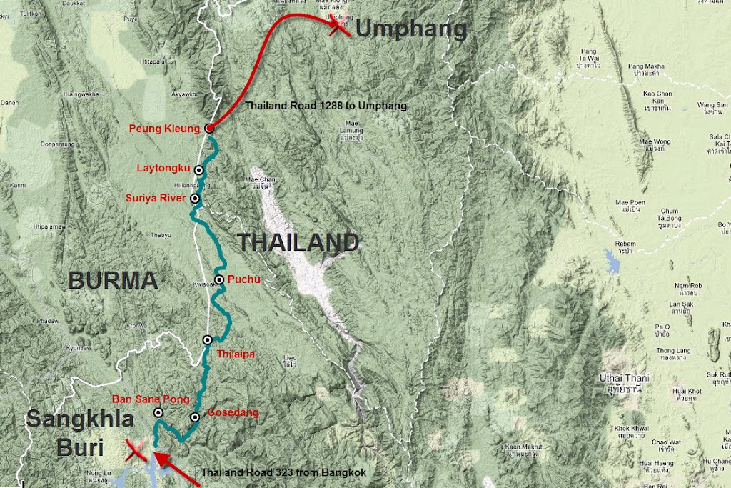
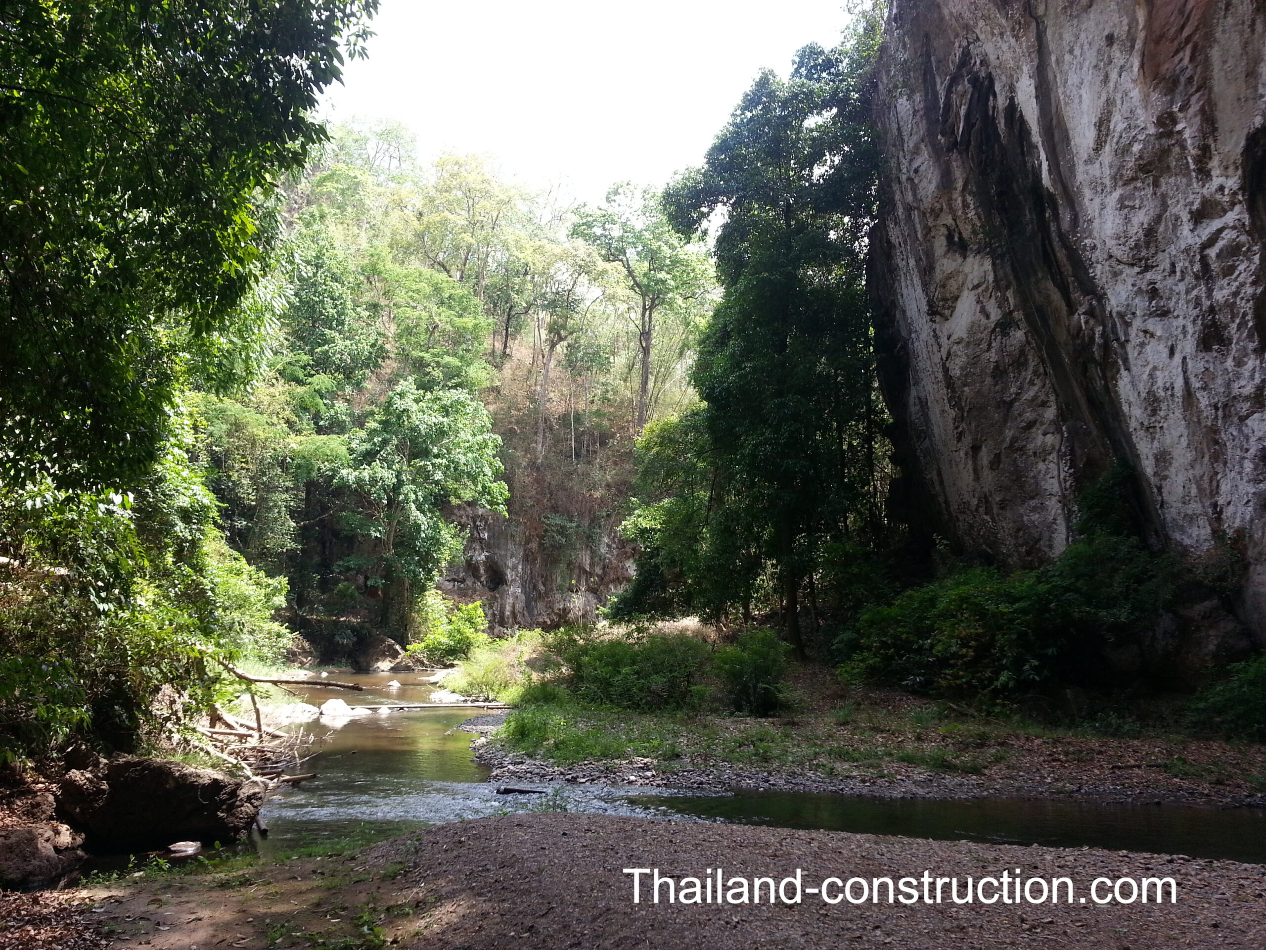
In a recent article ‘Who are the farlang YouTubers producing quality videos on Bangkok and Thailand?’, I referred to Karl’s Thailand YouTube videos showing his gruelling one-week trek back in 2018, through jungle terrain in the most remote corner of Thailand, from Sangkhlaburi in Kanchanaburi Province north towards Umphang in Tak Province – a route known as “The Missing Link” – where there are no roads, no 7-Elevens, and zero cell service. To drive between these two points would take a 900 km detour, but Karl and his mate decided to do it the hard way: on foot through the dense rainforest of the Western Forest Complex.
I thoroughly enjoyed Karl’s two-part video, and it jogged a long-forgotten memory, that somewhere in my house, I had a book written long ago about trekking a much longer journey along the Thai/Myanmar (Burma) border area from Chiang Dao (north of Chiang Mai) south to Umphang and down to Three Pagodas Pass (in Kanchanaburi province); in fact the journey was made by “motorbike, truck, bus, boat, elephant, and on foot” in dangerous border areas, which back then had very few roads (Thailand later built roads in to these border areas for quick response security).
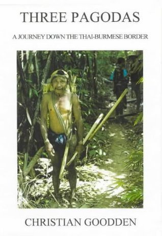
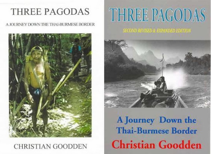
‘Three Pagodas – A journey down the Thai-Burmese Border’ by Englishman Christian Goodden
Sure enough, after a search of my house, I found that I did indeed have such a book that I’d read nearly 30 years ago: ‘Three Pagodas – A journey down the Thai-Burmese Border’ by Englishman Christian Goodden (Jungle Books (Halesworth) ISBN 0-9527383-0-9).
Author Christian, and his Thai wife Nittaya, first published the book in 1996. The back of the book refers as follows:
“Based on travels of the author and his Thai wife in northern Thailand over 6 years. Three Pagodas is an account of a remarkable 700-km journey through the mountainous jungle of the Thai-Burmese border, from Chiang Dao (in the northern Thailand province of Chiang Mai) to the Three Pagodas Pass (in the central Thailand province of Kanchanaburi). Starting where the guidebooks leave off, the book describes what it is like to make one’s way through this remote troubled terrain, inhabited by insurgent guerrilla groups, warlords, heroin traffickers, migrant hill tribes, and rare minority peoples.
With an eye for the telling minutiae of travel and the poetry of the moment, the author provides a snapshot of the way of life of these peoples, recording the impact on them of the far-reaching changes sweeping the Kingdom (of Thailand) in the 1990s. Here the reader rubs shoulders with Chinese KMT refugees, bizarre “long-neck” women, the vanishing Lawa tribe, a jungle demigod and the last Wa king, or visits mysterious “Spirit Well”, Karen rebel HQ in Burma, and “Death Highway”…
Three Pagodas culminates in a 2-week trailblazing adventure through 200 kms of unmapped jungle from Um Pang to the celebrated Three Pagodas. Written in an evocative anecdotal style and enlivened by the often absurd – humour of the situation, the text is backed up by personally researched maps, background cultural and historical detail, and stunning photos. For armchair traveller and traveller on the ground alike, this unique book is likely to remain the definitive account of a complex and fascinating region for years to come.”
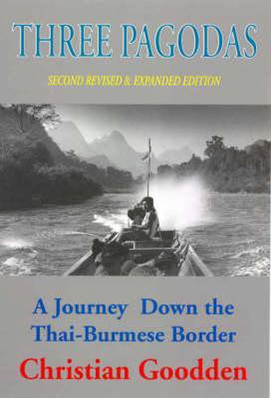
There is a “second revised & expanded edition preserves the original text, but updates the story and politico-cultural position chapter-by-chapter in a series of postscripts, at the same time adding much new material. Redoing the journey wherever possible, the author took fresh photographs, actualized the maps, and gathered travel information for readers wishing to retrace parts of the expedition.”
The author’s journey included: Kae Noi – Wiang Haeng & Piang Luang; Wiang Haeng – Pai – Mae Hong Son; Mae Hong Son – Mae Or & Nai Nai Soi; Mae Hong Son – Mae La Oop – Mae Sariang – Manerplaw – Ban Ta Song Yang – Mae Salid – Mae Sot – Wa Lae – Umphang – Lae Tong Ku – Three Pagodas Pass.
Karl’s videos inspired me to reread and thoroughly enjoy the Three Pagodas book – I honestly couldn’t put it down.
Although there’s been many changes along the route the author travelled, with, more roads built, more and bigger villages, villages which could only be reached by foot are now accessible by motorbike and/or car, wars have been fought in ever changing areas, ‘no go’ opium production areas are now accessible, the route has likely not changed greatly since the author trekked it.
I would definitely encourage you to track down a copy of this excellent book.
A bit of background on Umphang and Three Pagodas
Umphang lies in the remote mountain forests of northern Thailand and is home to people of mainly Karen origin. The few tourists who visit are drawn by one of Asia’s largest and most beautiful waterfalls, Thi Lor Su, declared part of a World Heritage Site by Unesco in 1999.
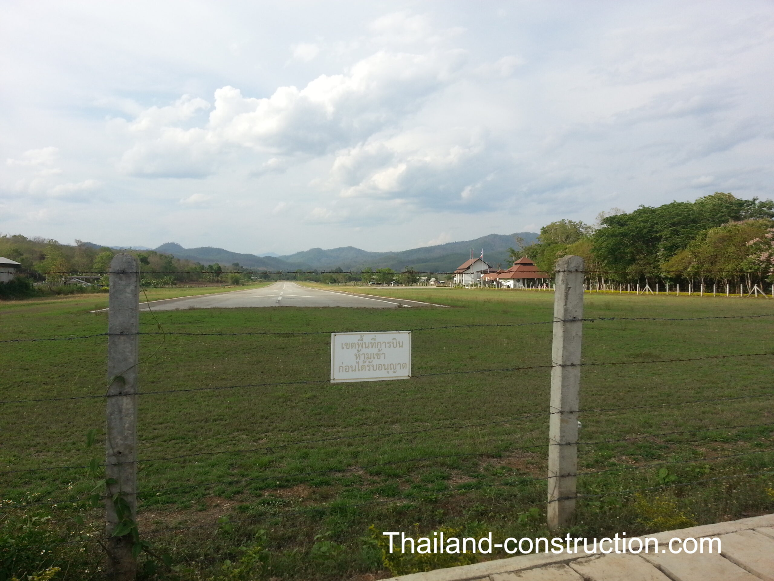
Historically, the journey to Umphang from Mae Sot was done by elephant and meant spending several nights in the forest. It wasn’t until the mid-1970s that Highway 1090 connected Mae Sot to the remote town of Umphang on the Burma border. Highway 1090, 164 km in total, contains 1,219 curves. The drive from Mae Sot to Umphang takes from three to four hours. The drive from Bangkok to Umphang takes about 12 hours.
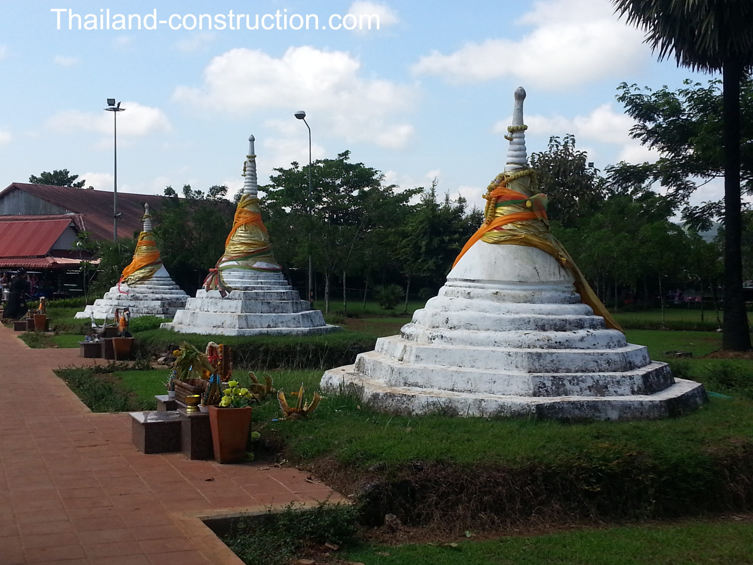
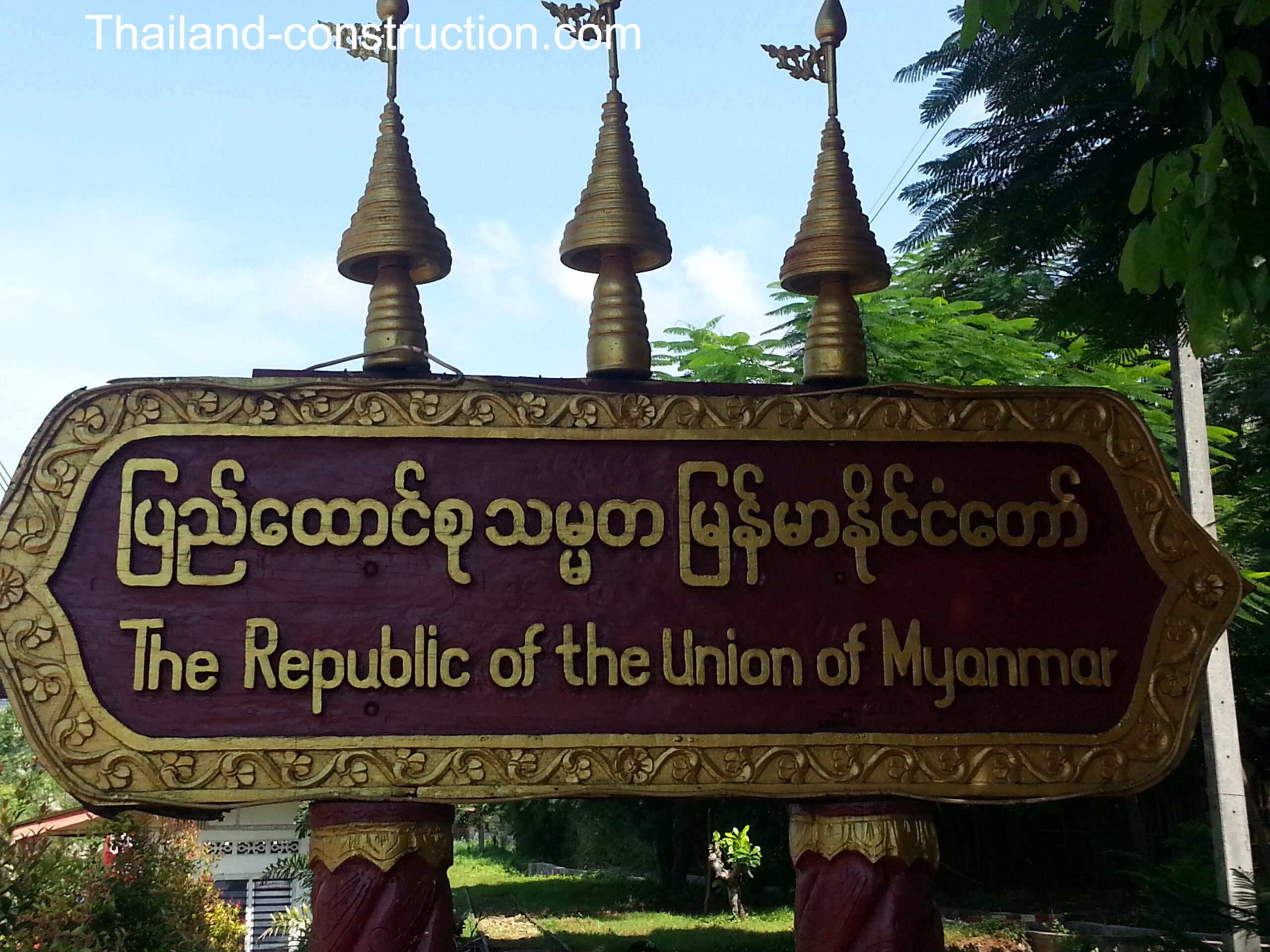
Three Pagodas or Three Pagodas Pass (Phra Chedi Sam Ong พระเจดีย์สามองค์ in Thai) is a pass in the Tenasserim Hills, right on the border between Thailand and Myanmar (Burma). The pass is named after three small, crumbling stupas or chedis which were probably built at the end of Ayutthaya period as a symbol of peace. The pagodas are now on the Thai side of the border in the village of Phra Chedi Sam Ong.
The pass has been the main land route into western Thailand since ancient times. It is one of the few passes in the Tenasserim Hills between the two countries, and during the Ayutthaya period in Thai history (14th–18th centuries), the pass was the main invasion route for the Burmese, but at times was also used against them by Siamese armies.
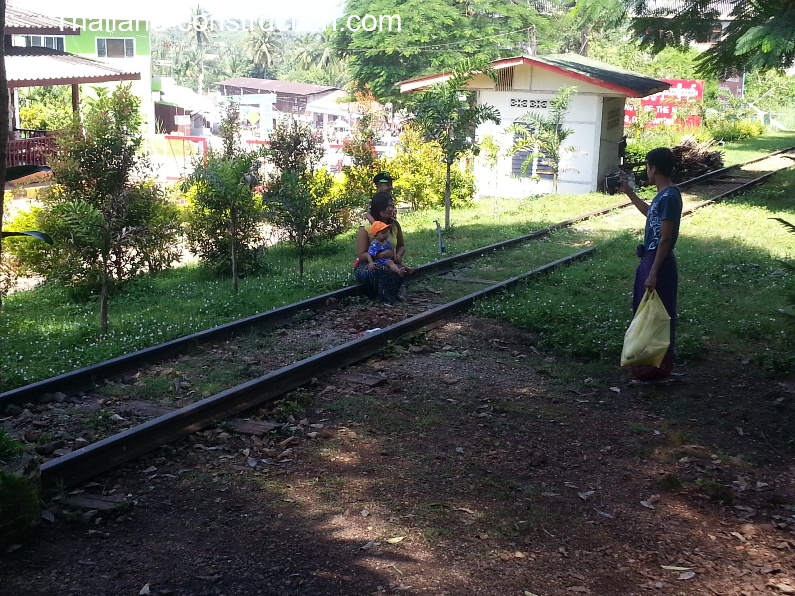
During World War II, Japan built the infamous ‘Death Railway’, which ran from Nong Pla Duk Junction Station in Ratchaburi to Thanbyuzayat through the pass. The section from Nong Pla Duk Junction Station in Ratchaburi to Nam Tok Station in Kanchanaburi, is still being used. The section from Nam Tok Station to the Myanmar border at Three Pagodas was removed, with a section submerged under Vajiralongkorn reservoir .
The region is home to several hill tribes, including Karens and Mons, who are unable or unwilling to obtain citizenship from either country. Separatist armies have repeatedly tried to seize the pass from Myanmar, with the Mons in effective control until 1990, when Burmese troops regained it. There is still occasional fighting in the area.
Three Pagodas Pass is popular with tourists, who are allowed to obtain a one-day visa from the Thai side to visit Payathonsu, the town just across the border, whenever the border is open. The drive from Bangkok to Three Pagodas takes about +5 hours.
Thailand / Myanmar (Burma) Border in the late 1980s / early 1990s
It was a very different time when the Three Pagodas book was written in the 6-year period of the late 1980s / early 1990s to now.
On 18 June 1989 Burma changed its name to Myanmar, but it is as much a troubled country now as it was back then.
Back then, all along the border there were war zones being fought between the Myanmar forces and multiple warring factions including, to name just a few: Karen National Liberation Army (KNLA), Karen National Union (KNU), National Democratic Front (NDF), Shan United Army (SUA), Shan United Revolutionary Army (SURA), Wa National Army (WNU). Different areas were settled by different ‘tribes’, including Shan, Karen, Padaung, KMT, Lisu, Lahu, Hmong, and Lawa.
The author and his wife had to travel through many dangerous trouble zones, including one zone where killings had taken place just days before.
Even now in 2026 there is intense fighting between Myanmar military forces (Tatmadaw) and ethnic armed organizations, particularly the Karen National Union (KNU) along the Thai-Myanmar border. This has caused significant instability near border districts like Mae Sot and Sop Moei in Tak and Mae Hong Son provinces.
As there was no internet back then for the author to research the journey, and only a few books to glean information from, it must have been very difficult to plan the journey and to know what to expect as he travelled along the border.
That border journey nowadays
The Sangkhlaburi – Umphang journey that took the author two weeks to trek in the early 1990s due the problems encountered and dangers on route, has in recent decades, with more and better permanent roads, become a 6-7 day trek as shown in Karl’s Thailand recent videos.
It can also be done in two days by motorbike; the route is only do-able during the dry season from middle of December through to May due to the numerous river and stream crossings, and the route follows the river bed in a few sections. There are several reports of this journey on the excellent rideasia.net website.

The infamous Golden Triangle opium production
In the 1950s–1970s, Northern Thailand was a major part of the infamous Golden Triangle opium production, cultivated extensively by ethnic hill tribes (Hmong, Akha, Lisu, Lahu, Yao). Only in the 1990s were Thai authorities successful in eradicating the poppy fields from the mountains in North Thailand.
The Golden Triangle had been one of the largest opium-producing areas of the world since the 1950s. Most of the world’s heroin came from the Golden Triangle until the early 21st century when opium production in Afghanistan increased. Myanmar was the world’s second-largest source of opium after Afghanistan up to 2022, producing some 25% of the world’s opium. In 2023, Myanmar became the world’s largest producer of opium after an estimated 1,080 tons of the drug was produced, according to a United Nations Office on Drugs and Crime report.
It therefore has to be considered that these border areas were still opium growing areas for cash income when the author and wife travelled through these border areas, were guarded by armed guards or militia, and as such were very dangerous areas for foreigners to enter.
My visits to the Thailand/Myanmar (Burma) border areas since 1989
When I bought the ‘Three Pagodas – A journey down the Thai-Burmese Border’ book back in the 1990s, having never visited any of the places the author passed through and refers to, I enjoyed the book but it didn’t resonate with me. In later years I travelled to some of the areas.
Finally making it to Three Pagodas
In June 1989 I arrived for my first visit to Thailand, backpacking my way to work in Australia.
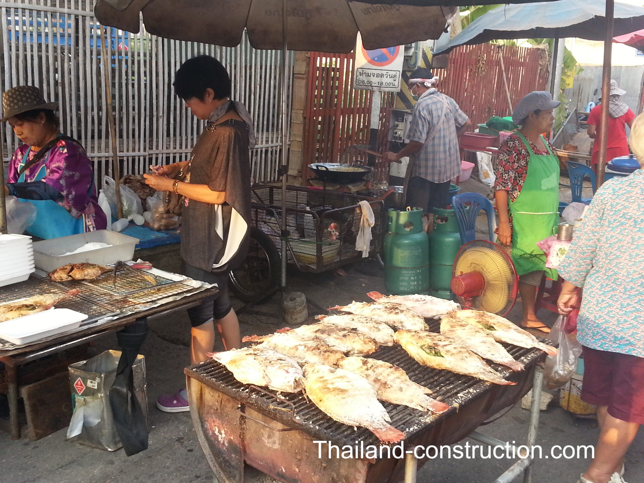
I stayed in Kanchanaburi town, on the river bank, in a cheap backpacker’s guest house. One day, I got talking to a Thai couple over breakfast, who said they were doing a daytrip (230 km 3.5-hour journey, each way) to Three Pagodas and would I like to join them. The Lonely Planet Thailand, third edition January 1989 describes Three Pagodas as “It’s an untame place that TAT (Tourism Thailand) and the Thai government would rather you forgot about…The pagodas themselves are rather small but it is the ‘wild west atmosphere’ that draws a few intrepid travellers. The Burmese side is controlled by Karen National Union and Three Pagodas is one of several ‘toll gates’ along the Thai-Burmese border where the KNU collects a 5% tax on all merchandise which passes. They use the funds to finance armed resistance against the Burmese government…”; I couldn’t possibly turn down an invitation to visit the ‘wild west atmosphere’!
The road back then wasn’t so good, with the last stretch from Thong Pha Phum to Sangkhlaburi and Three Pagodas being described by Lonely Planet as “mostly laterite and dust (or mud, if you’re foolish enough to go there during the rainy season)”, and after close to 4 hours we arrived in a suspiciously quiet Three Pagodas, parked the car, got out, and were promptly advised by Thai soldiers that there was fighting going on just over the border in Myanmar, it wasn’t safe, so please get back in the car and leave. We left. And that 5 minutes folks, was my very short introduction to Three Pagodas: I saw nothing!
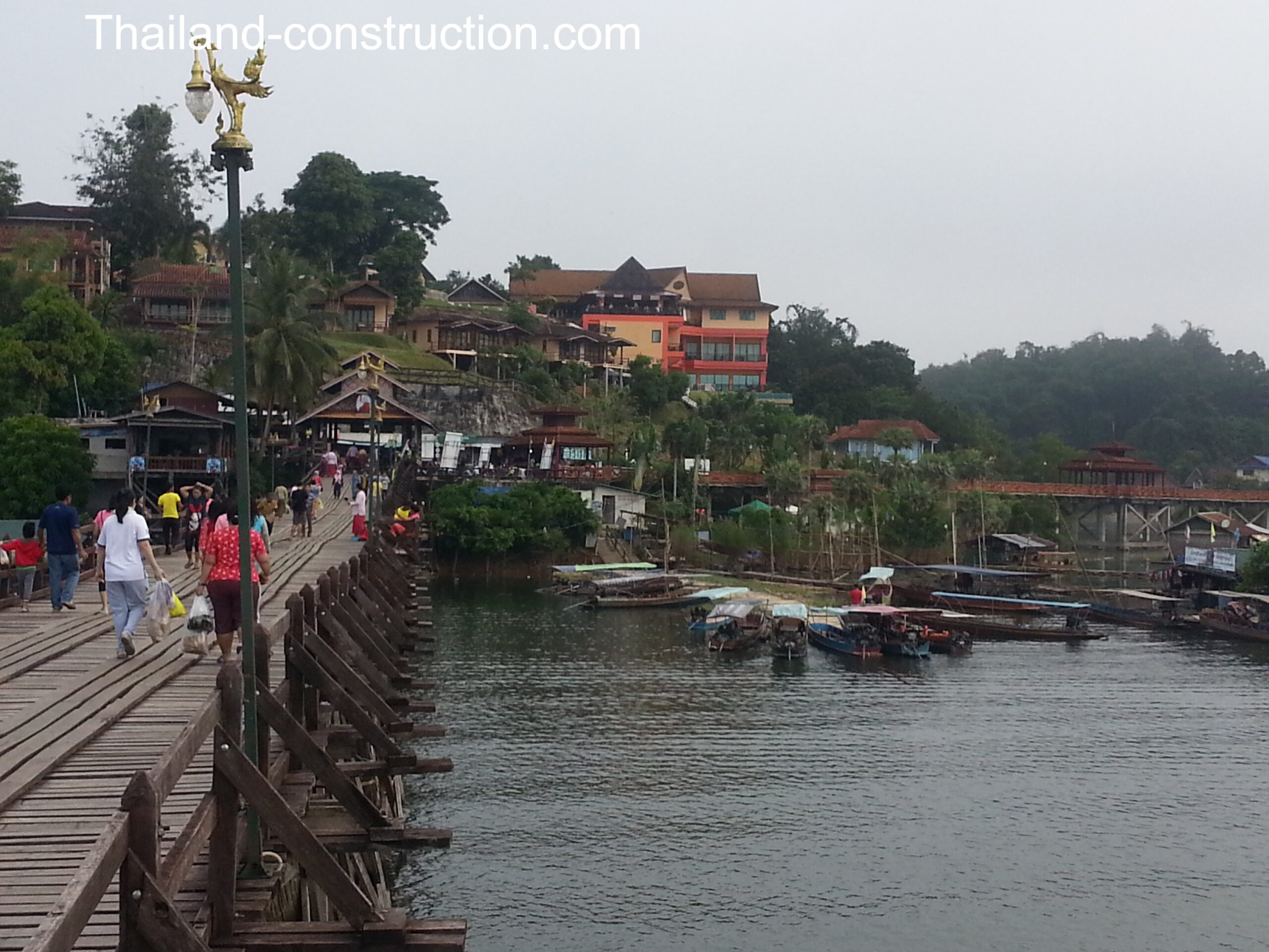
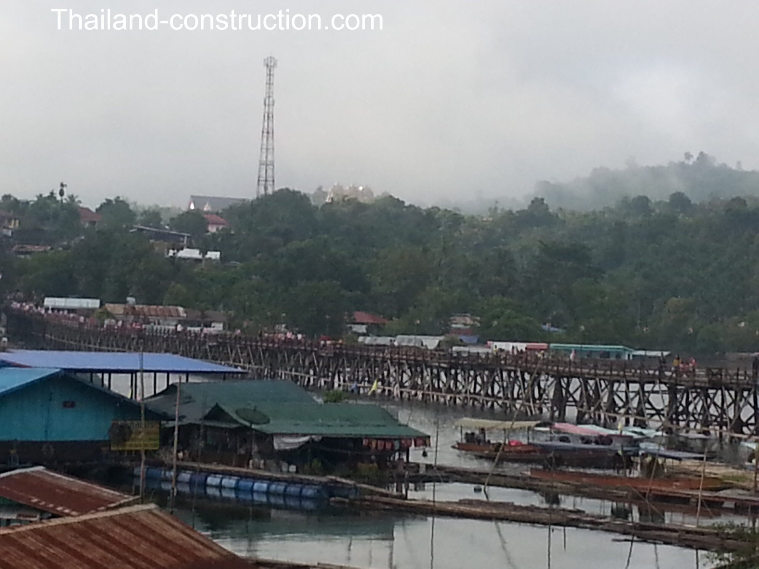
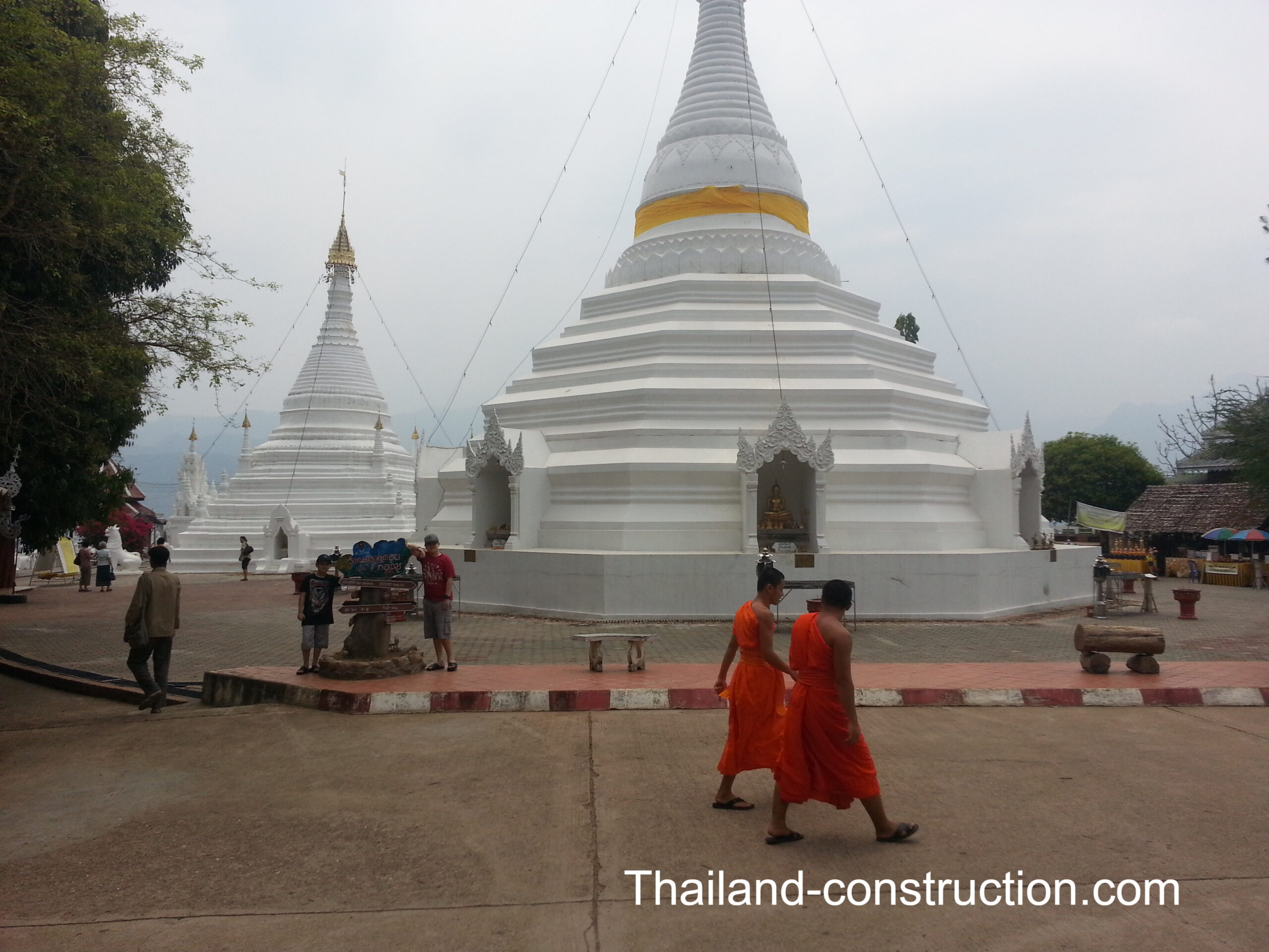
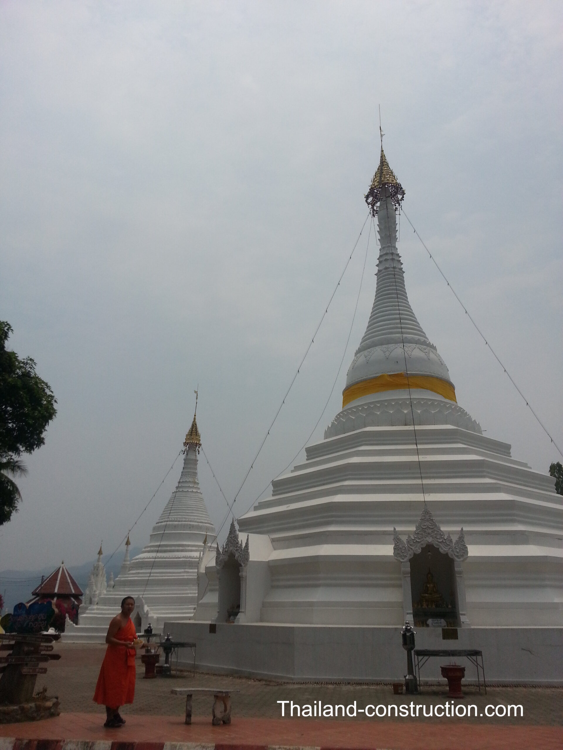
It would be 29 years later, in 2018, having long since settled in Thailand and now with wife and kids, that I finally got to visit AND SEE the Three Pagodas, as we travelled for a family holiday to the wonderful town of Sangkhlaburi on the banks of the Vajiralongkorn reservoir – I had finally made it to visit Three Pagodas.
Doing an extended Mae Hong Son loop in 2014
In 2014 I took my family on a driving tour of the extended version of the famous Mae Hong Son Loop. Our version was Bangkok – Nakhon Sawan – Sukhothai/Si Satchanalai/Uttaradit – Tak – Mae Sot – Mae Sariang – Mae Hong Son – Pai – Chiang Mai – Lampang – Phrae – Sukhothai – Bangkok (with Mae Sot – Mae Sariang – Mae Hong Son – Pai – Chiang Mai being the extended Mae Hong Son loop section), meaning we passed through a lot of the same towns, cities and roads referred to in the ‘Three Pagodas – A journey down the Thai-Burmese Border’ book.
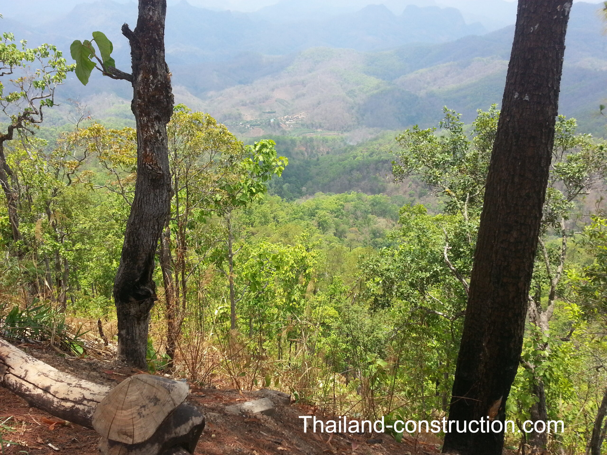
The main impression we took away from the trip, is the Thailand/Myanmar border area has a different feeling (or vibe as the young folk say these days) to anywhere else in Thailand. You often don’t feel you are in Thailand. A great deal of the people you encounter are not Thai, don’t speak Thai. It has a Wild West feeling but seems safe if you stay in Thailand: to cross in to Myanmar, as some of the border paths do, is not something to be recommended.
Points of interest along the route at that time, though I expect there have been many changes in the years since, were:
Mae Sot –
Mae Sot (แม่สอด), 87 km from the city of Tak and 492 km from Bangkok, a major border crossing / trading town with Myanmar, with a substantial population of Burmese migrants and refugees, and has that slightly ‘wild west’ feel about it. Probably the biggest town along the Thai / Myanmar border. It is a main gateway between Thailand and Myanmar, and as a result, it has gained notoriety for its trade in gems and teak, as well as black market services such as human trafficking and illicit drugs.
Hotel choice back in 2014 wasn’t great. We stayed at Centara Life Hotel Mae Sot. There seems to be lots of hotels to choose from nowadays.
Mae Sot is the start of the road north along the border to Chiang Mai (640 km +12 hour journey) and all towns in between, and also the start of the road south to Umphang (160 km 4 hour journey).
Mae La Temporary Shelter Area –
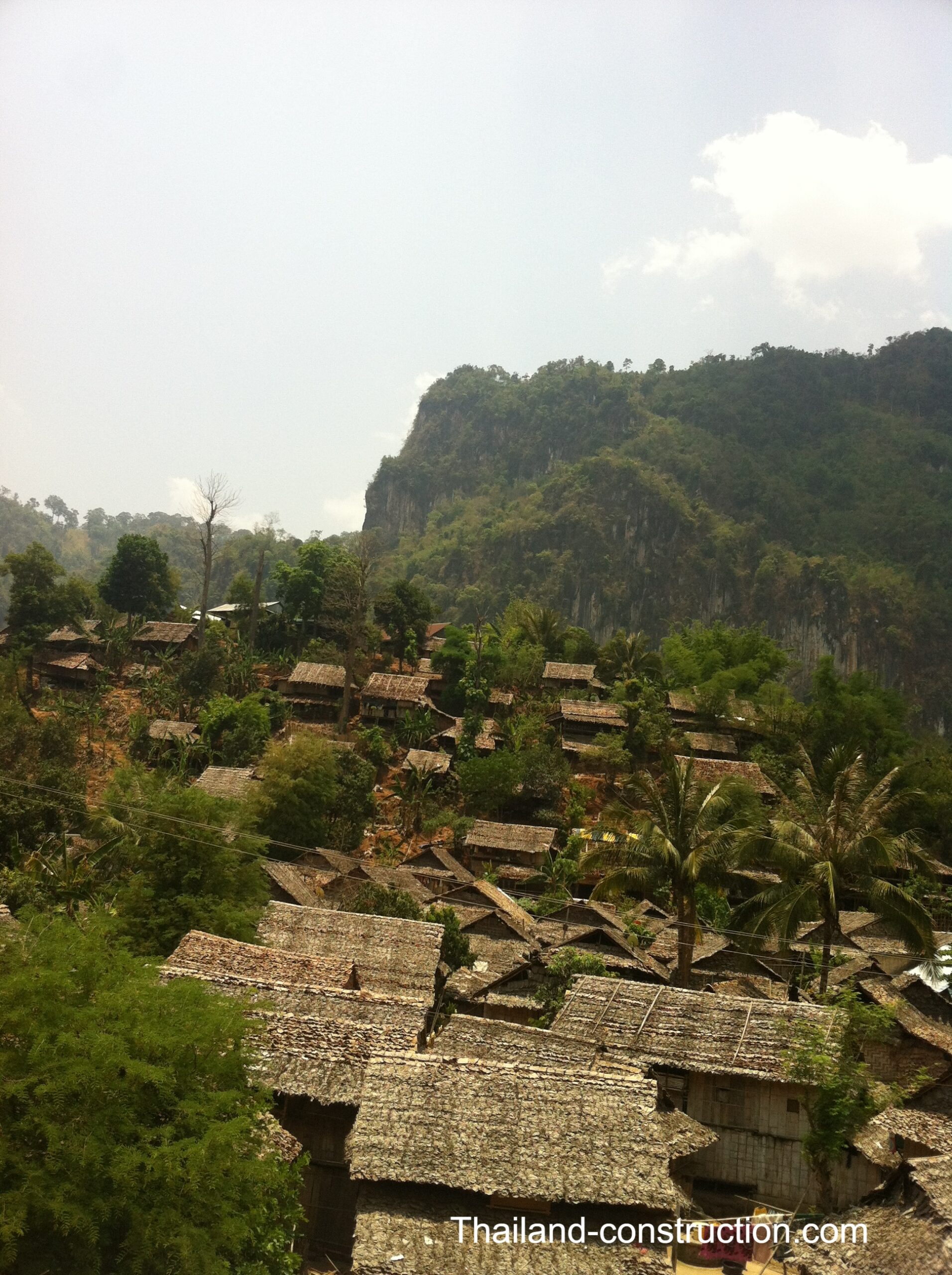
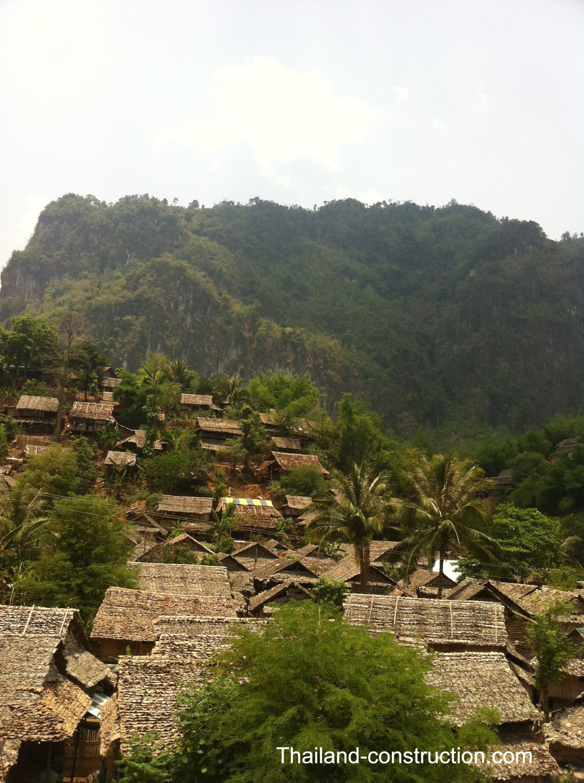
An hour after leaving Mae Sot travelling north, you pass Mae La Temporary Shelter Area. It “is a significant humanitarian facility located in Tha Song Yang District, Tak Province, Thailand. Established in 1984, it has become the largest temporary shelter on the Thai-Myanmar border, primarily housing Karen refugees fleeing armed conflict. The shelter is divided into three zones and is divided into sections, with Mae La being the largest. It serves as a center for educational and community development activities and is administered by the Ministry of Interior. The shelter is monitored by a Thai Ranger Unit and has a Camp Committee for governance, supported by the Karen Refugee Committee and UNHCR”. It takes quite a few minutes to drive past the camps at the side of the road, and it sure left a lasting impression on me.
Mae Sariang –
For a long distance, the road north out of Mae Sot follows the Moei river, which forms the Thai/Myanmar border, and passes through stunning countryside. Where the road finally leaves the river behind, around Ban Tha Song Yang village, and heads east towards Mae Sariang, back in 2014 they were doing extensive road works, and after we crept through the roadworks, route 105 headed in to dense jungle terrain, gps signal was lost, and I was convinced that I could not possibly still be on the main road north – I was.
Four hours after leaving Mae Sot, and after traversing route 105’s hundreds of twists and turns, we came to the very pleasant town of Mae Sariang. The town sits at a junction with Route 108 to Chiang Mai.
Mae Sariang (แม่สะเรียง) is a small town and district (amphoe) on the narrow valley along Yuam River in Mae Hong Son province. The areas around Mae Sariang are mountainous and forested; flat terrain that suits population or agriculture is scarce. The local population of Mae Sariang is of mixed origin.
Mae Sariang is one of those towns to just chill and potter around for a couple of days, taking in the sights of the markets, the people, and the hills around.
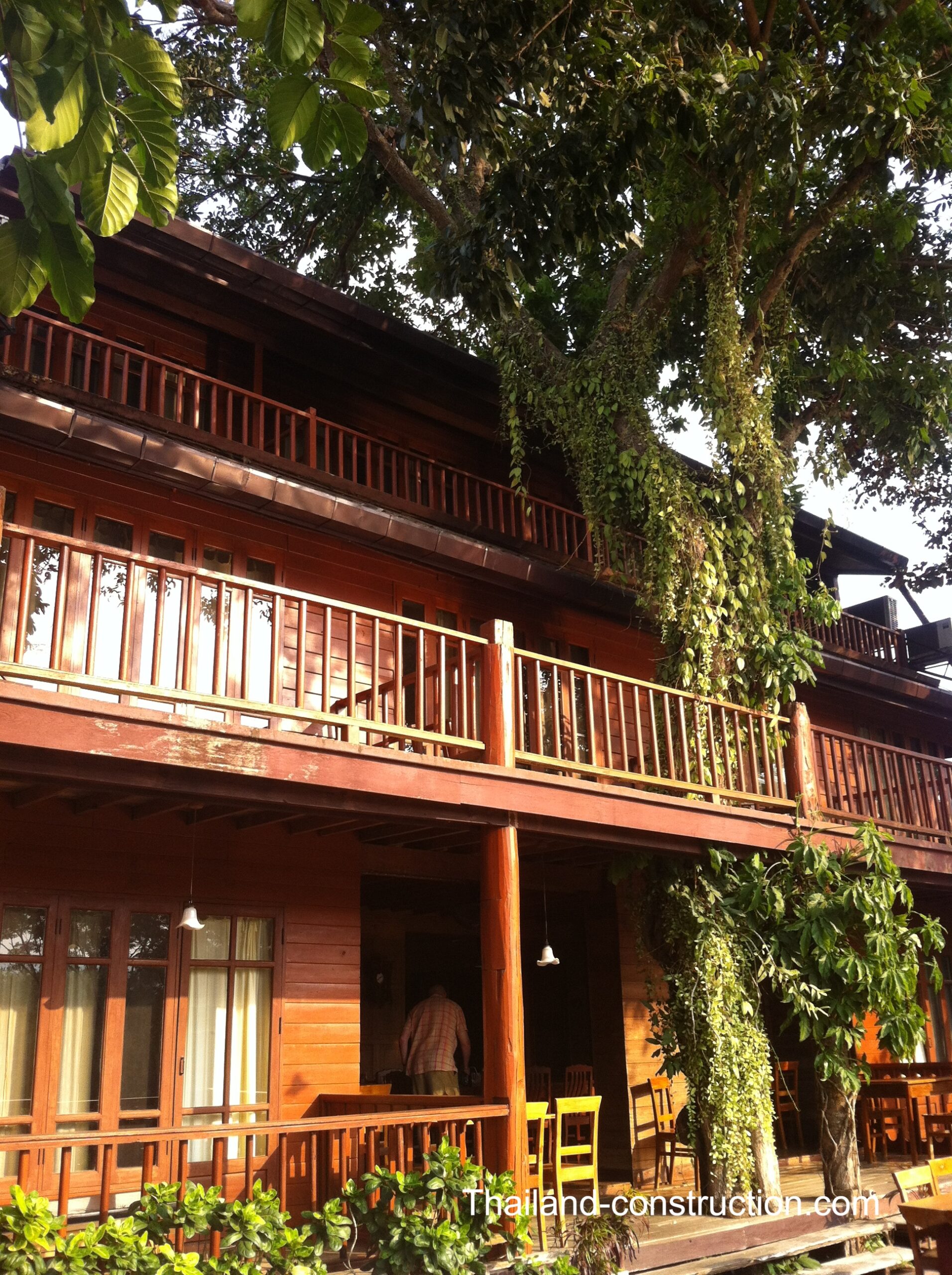
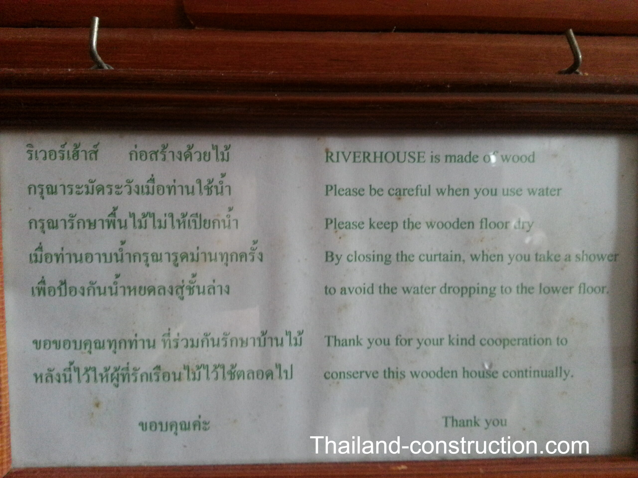
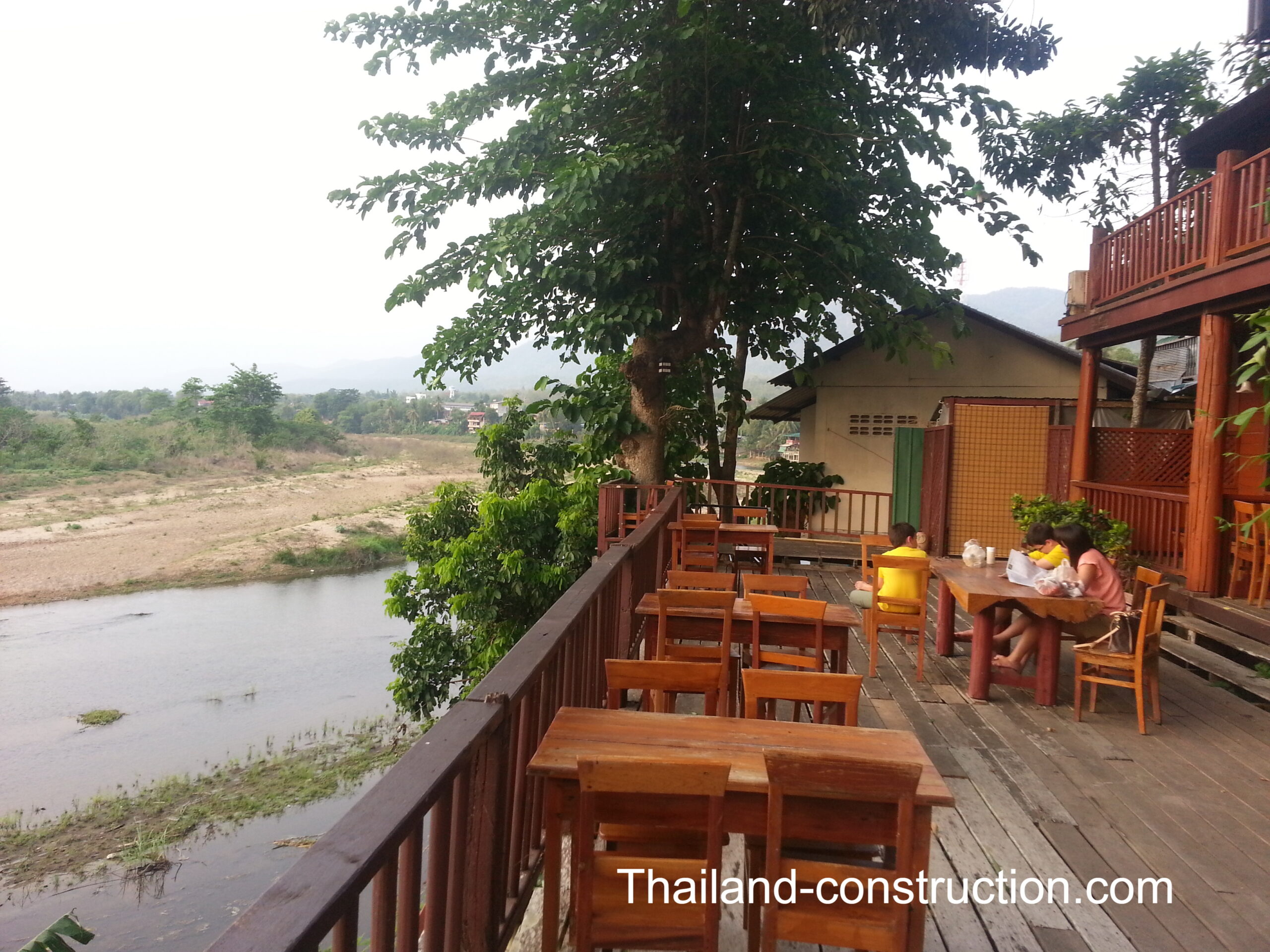
We stayed at the well-known The Teak House (Riverhouse Hotel) on the river bank. A place to sit for hours having coffee on the balcony overlooking the river, and watch the buffalos wallowing in the waters. The building is made of teak and creaks and cracks as you walk about.
Mae Sariang is one of those places visited, that I regret not staying a few more days, but unfortunately work commitments back in Bangkok wouldn’t allow it on this tour; hopefully I will return one day.
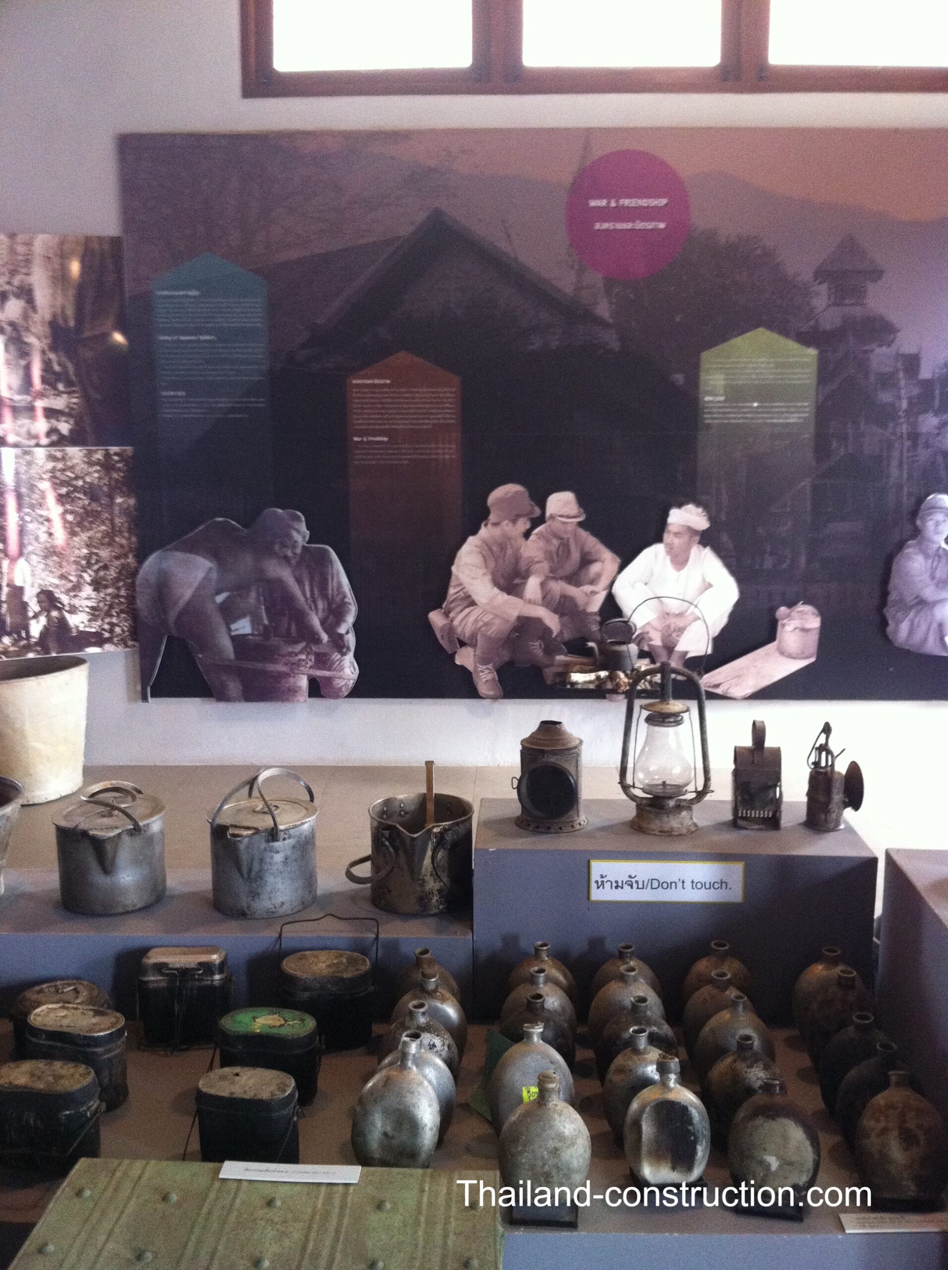
Khun Yuam –
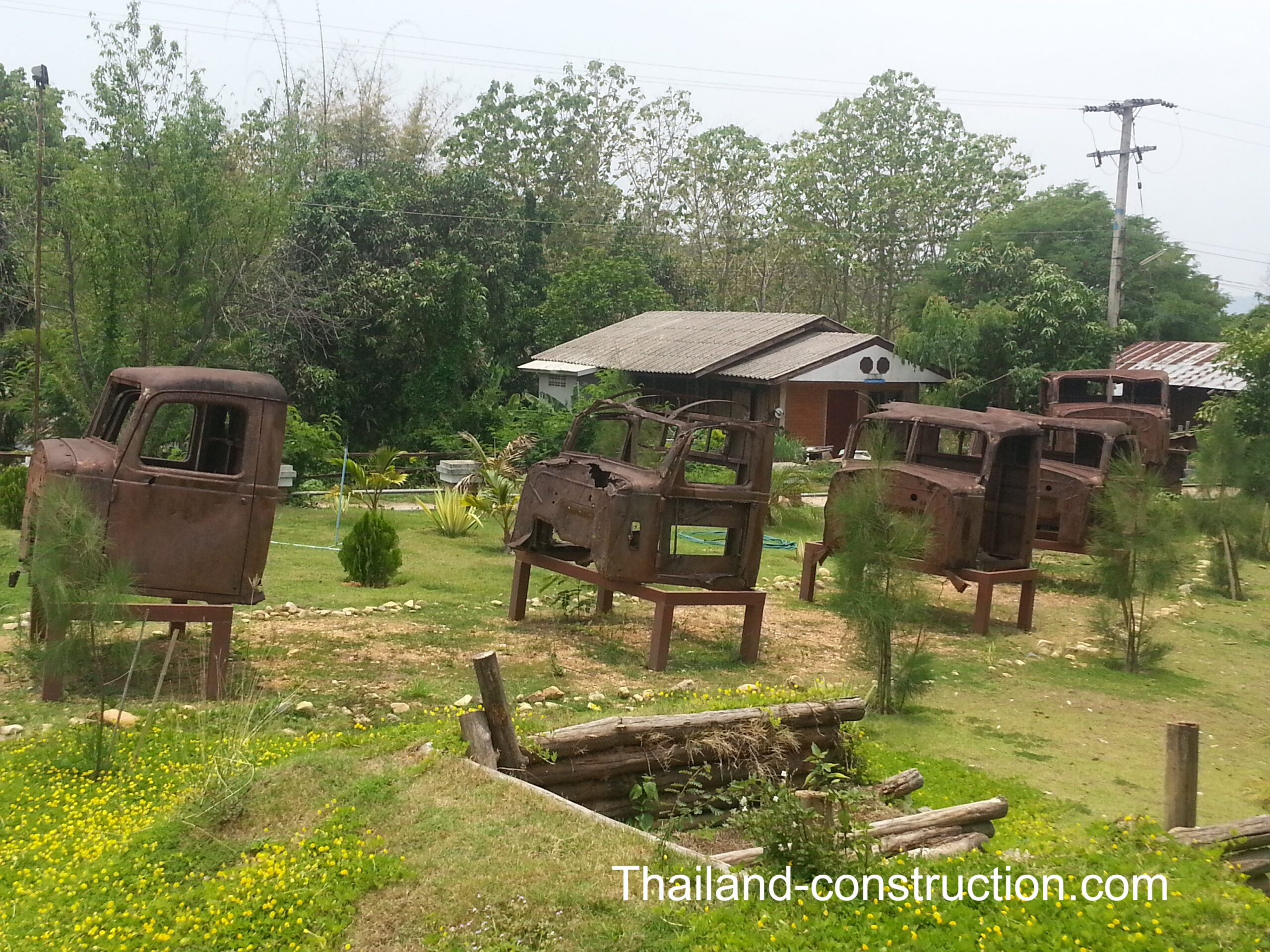
Khun Yuam (ขุนยวม) was one of the most strategic points for Thailand and Japan during the Second World War (WWII), 67 km’s south of Mae Hong Son, and is home to the Thai-Japan Friendship Memorial Hall Khun Yuam. Opened in 1996, it was built at Wat Muay which was the assembly place and makeshift hospital for some 7,000 injured Japanese soldiers following the end of WWII and the historic defeat.
As referred to in Travelfish: “Khun Yuam was one of the Japanese army’s most important bases in Thailand, as a forward supply and communications centre during their Burma campaign. It was also something of an R&R centre and housed the largest military hospital in the country. Consequentially, many Japanese soldiers died and were buried here—many under what is now Highway 108. The Imperial army hacked out roads and bridges right across northwest Thailand and the only reason it’s not as famous today as Kanchanaburi and the Bridge on the River Kwai is that local coolies were employed as workers, since it wasn’t really practical to transport any Allied prisoners this far. The museum today receives financial assistance from Japan, sees many Japanese visitors and has a similar significance for the Japanese as the Hellfire Pass Museum in Sai Yok does for Australians or British”
Mae Hong Son –
Ninety minutes and 70 km north from Khun Yuam is the delightful town of Mae Hong Son.
Mae Hong Son (แม่ฮ่องสอน), is a town and capital of Mae Hong Son Province. It is in the Shan Hills, along the banks of the River Pai. Mae Hong Son is 883 kilometres north of Bangkok and 251 kilometres northwest of Chiang Mai.
As a result of the Anglo-Siamese Boundary Commission of 1892-93 Mae Hong Son district was ceded by Burma to Siam (Thailand).
Second in size along the border to Mae Sot, Mae Hong Son serviced by the Mae Hong Son Airport (though there appear to be no flights currently).
The town has some tourist infrastructure, including many guesthouses and several internet cafes, and is a popular jumping-off point for tours to visit hill tribe villages, caves, and waterfalls in the area.
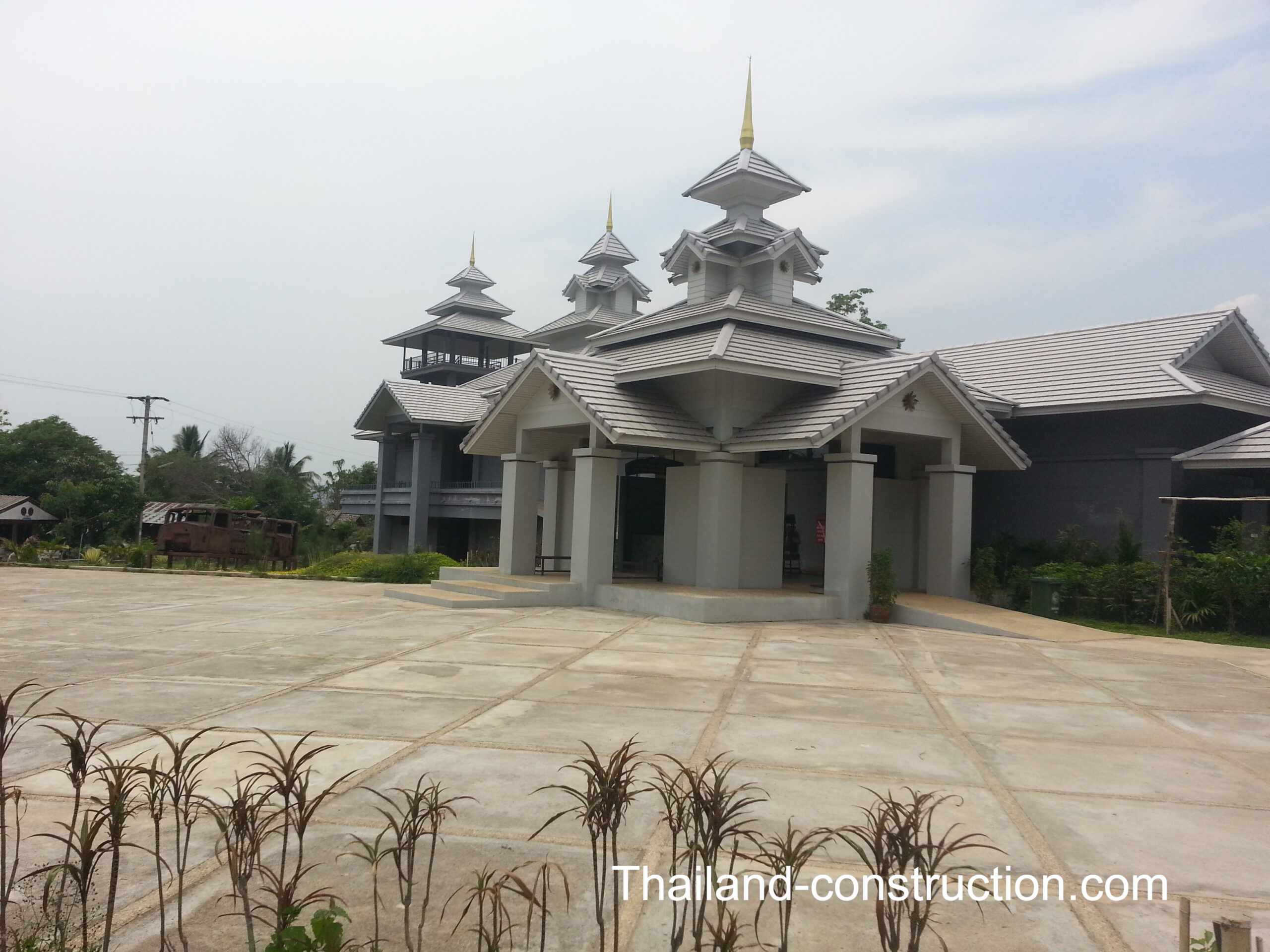
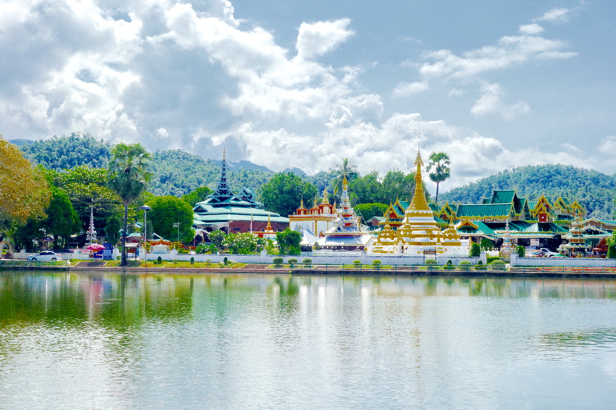
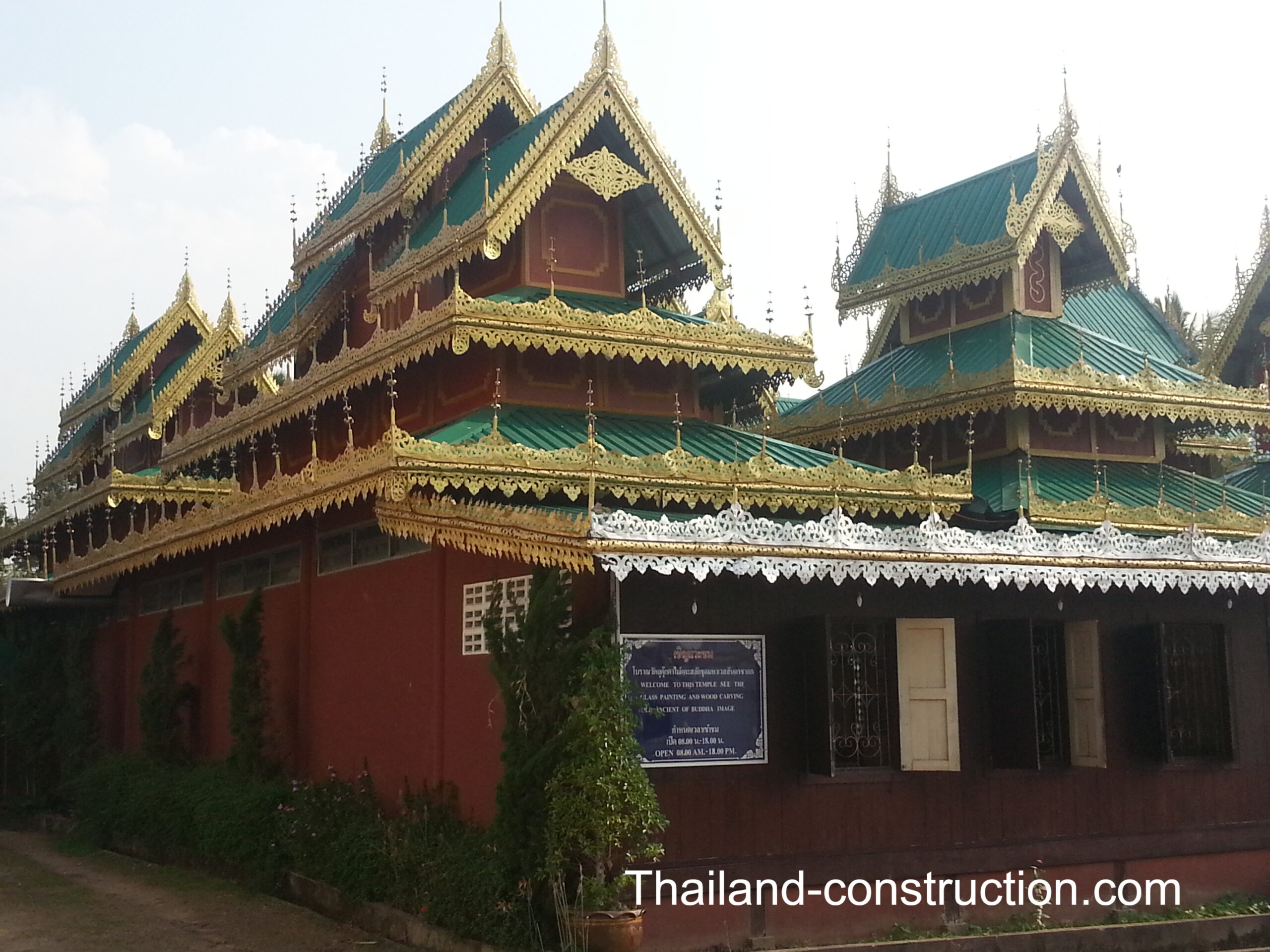
In the centre of town is Chong Kham Lake, with the very scenic Wat Chong Kham or Wat Jong Kham วัดจองคำพระอารามหลวง and Wat Chong Klang or Wat Jong Klang วัดจองกลาง sitting side-by-side on its banks, and Mae Hong Son Walking Street close by. Maehongsonthailand.com refers to Wat Jong Kham and Wat Jong Klang as: “widely regarded as the spiritual and cultural epicenter of Mae Hong Son town, frequently referred to as “twin” or “sibling” temples due to their shared grounds. Their picturesque location on the southern bank of Nong Chong Kham Lake forms a signature image of Mae Hong Son, with their reflections shimmering upon the water, creating an “awe-inspiring” and “beautiful” visual spectacle”. Wat Chong Kham was built in 1827 and a sign outside the wat refers to being the first temple in Mae Hong Son province. The temple is so called because the temple’s pillars are decorated with gold leaf, which was originally a silver plate.
Perched on top of a nearby hill and looking down on the town is Wat Phra That Doi Kong Mu วัดพระธาตุดอยกองมู. You can walk or drive up; it’s worth it.
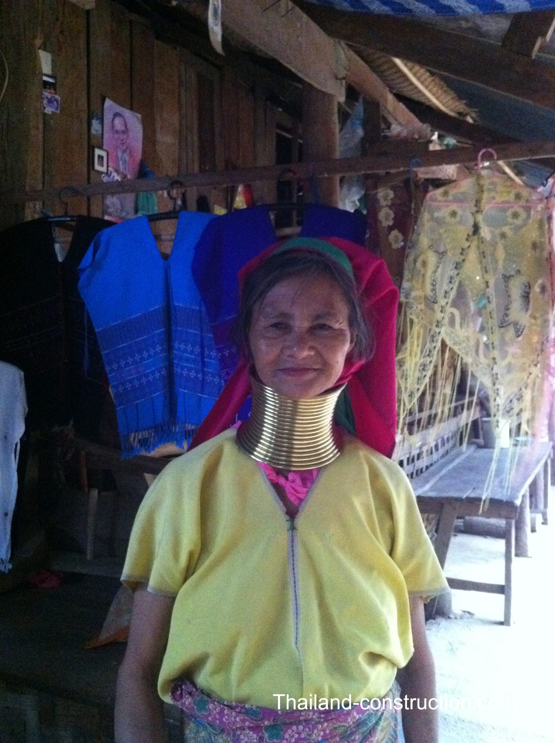
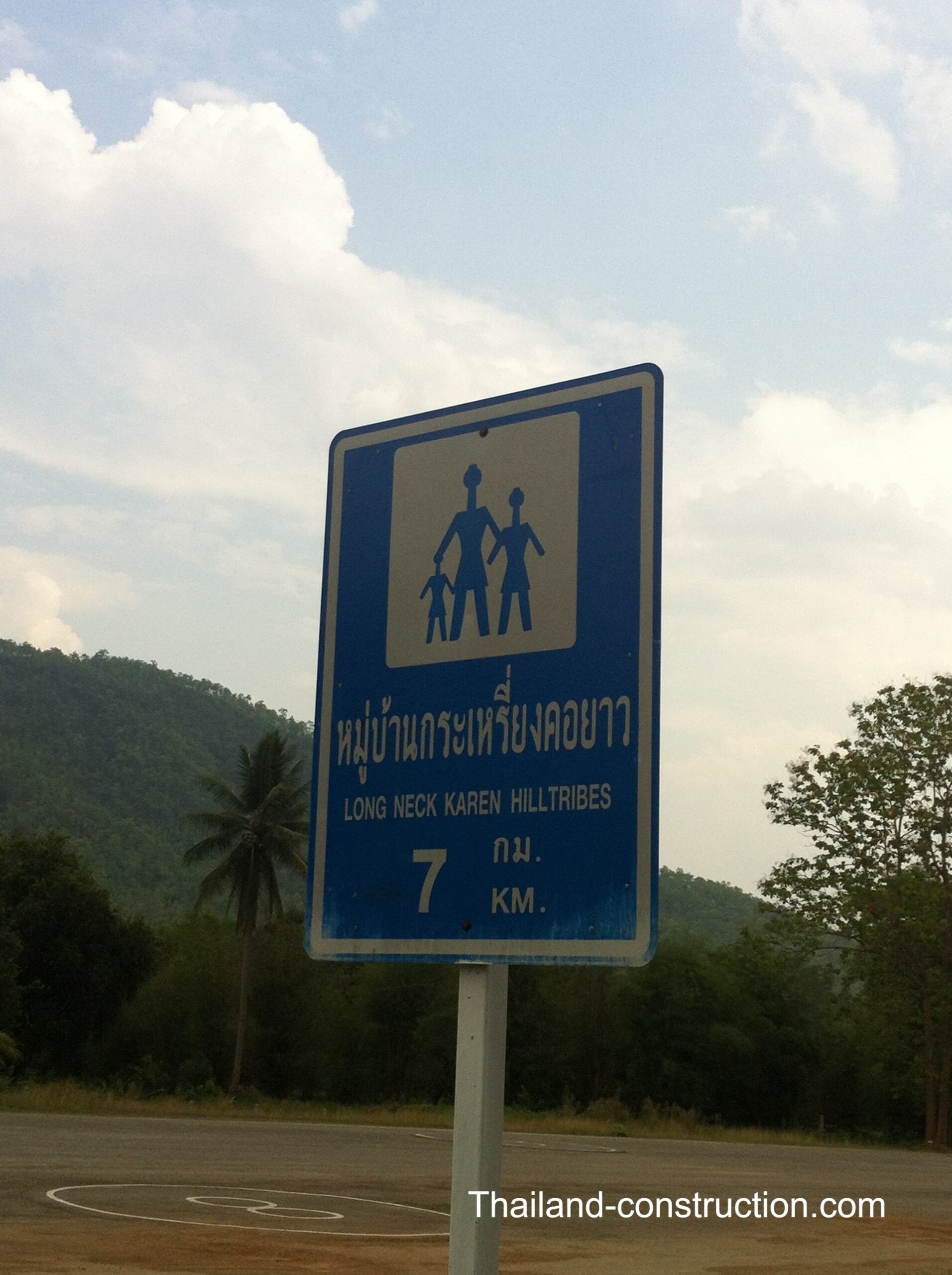
Back in 2014 we drove the 20 minutes on highway 1250 in to the hills to Huay Sua Thao: Kayan (long neck) village. I was interested to see that the village is still there on google maps.
Padaung (Yan Pa Doung) is a Shan term for the Kayan Lahwi (the group in which women wear brass neck rings). The Kayan object to being called Padaung.
I was a little uneasy about going gawping at these people – but I appreciate that having visitors come see them in their village and selling their handicrafts is their only way to survive in their temporary Thai home – so I sat outside while my wife and sons went in and visited the women. They came out very happy to have met the women and chatted to some of the younger women / girls in Thai, so my loss.
In Mae Hong Son we stayed at the classic Imperial Mae Hong Son Hotel อิมพีเรียลแม่ฮ่องสอน.
Between Mae Hong Son and Pai –
Between Mae Hong Son and Pai there are a couple of places well worth visiting.
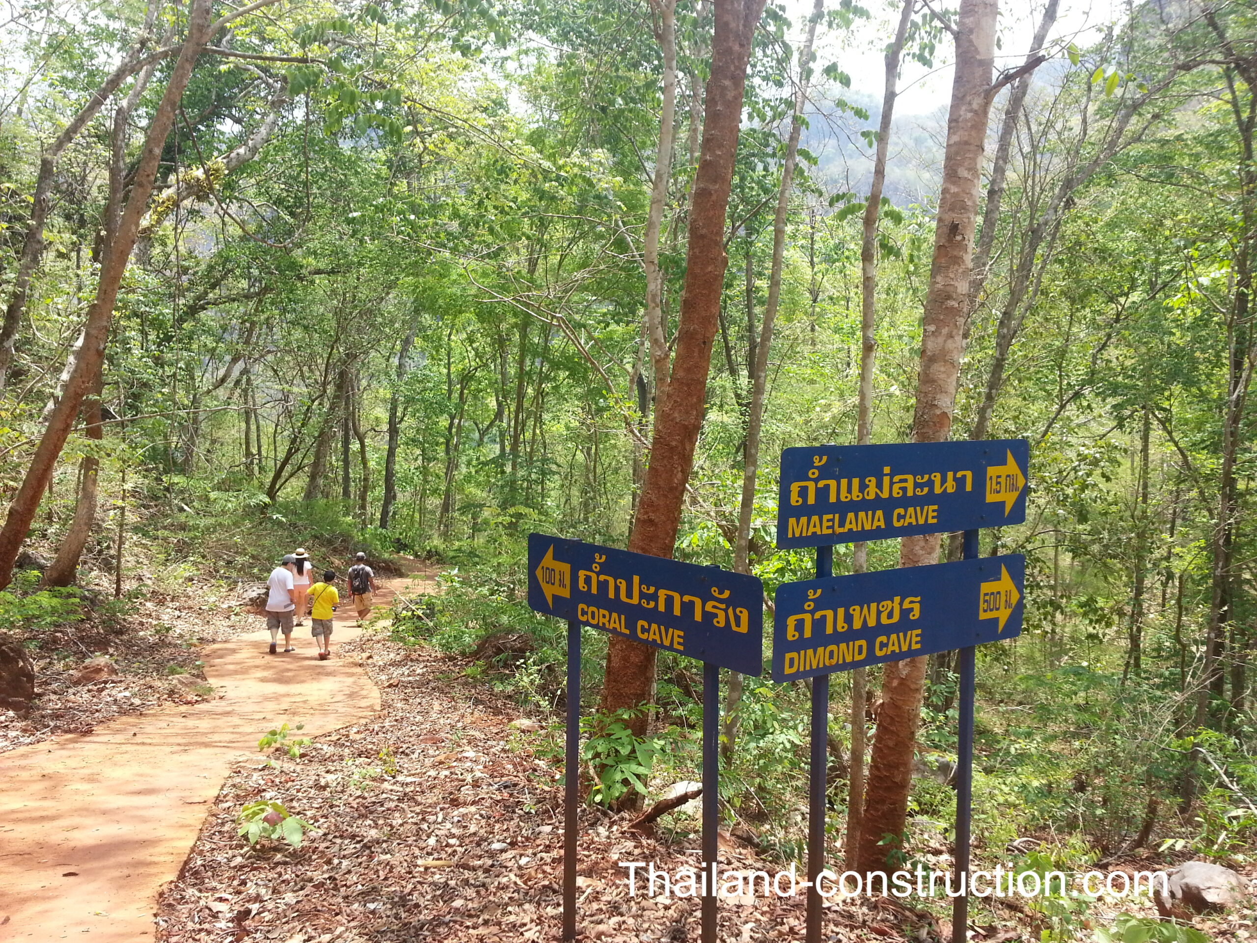
Diamond cave (and/or Coral cave and/or Maelana cave) in Pang Mapha. Driving north along route 1095, on the left side of the road, I spotted a sign for the caves and thought that’s a must go see. We turned off the highway and down the very small road and drove until we came across an army checkpoint (there’s lots of army/ranger checkpoints in the border region), they let us through and told us we needed to get a guide for the caves. The guide on his motorbike led our car down the steep switchback road to the caves. We chose Coral cave; a very large dark cave, which turned out to be worth visiting but it was the treacherous drive to and from the cave that lingers in my memory to this day.
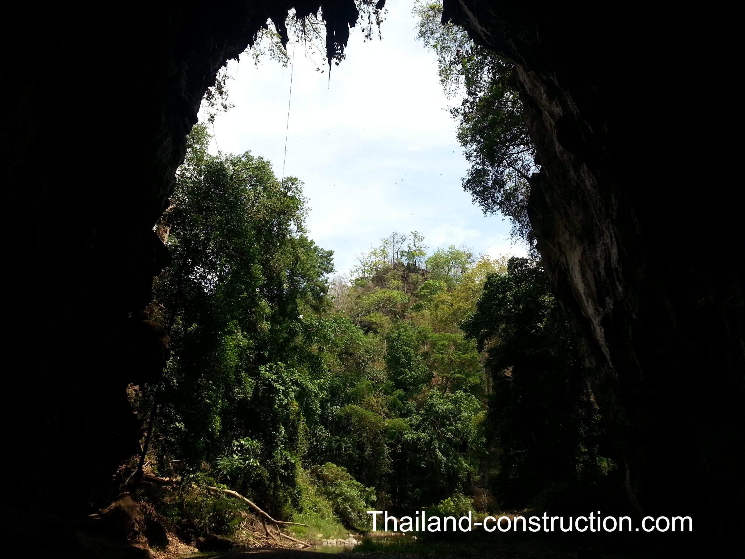
40 minutes drive north of Diamond cave is the amazing Tham Lod Cave, also known as Tham Lot Cave, “a stunning limestone cave located in the Pang Mapha district . This cave system stretches over 1,666 meters and is renowned for its impressive stalactites, stalagmites, and columns. The cave is a karst masterpiece where water and rock meet, forming majestic stalactites and stalagmites over millions of years. Visitors can explore the cave by bamboo raft, experiencing a journey through the heart of the mountain. The cave is also a rich archaeological site, inhabited as far back as 9,000 BC by the Hoabinhian culture—a Stone Age hunter-gatherer tribe”. Hire a guide with lanterns and bamboo raft and cruise along the river through the cave. A really magical place to visit.
Be sure also to visit Cave Lodge near to Tham Lot Cave for food and drinks or stay overnight – this place has been in business decades and makes for an interesting visit. Cave Lodge, “established in 1984, is the longest running guesthouse in Mae Hong Son province, catering to a wide range of guests from budget backpackers to travellers seeking some of the best bungalows in the Pang Mapha, Soppong, Tham Lod area”.
Pai –
2.5 hours 120 km drive north from Mae Hong Son is the backpacker’s paradise town of Pai (ปาย). It is also about 146 km northwest of Chiang Mai. It lies on the Pai River.
The road from Chiang Mai to Pai in the late 19th century took one week to travel. The settlement, then known as Ban Wiang Tai, developed into the modern town of Pai.
In 1943, Japan began several projects to create efficient troop and equipment transport routes between Thailand and Myanmar in support of their planned attacks on Imphal and Kohima, both in India. In addition to the so-called Death Railway through Kanchanaburi, this included improvement of the existing road from Chiang Mai to Pai as well as the patchwork of trails leading north to Mae Hong Son. The Japanese efforts to develop road networks were abandoned in early 1944, when it became evident that the improvements could not be completed in time for the scheduled attack on Imphal. The incomplete road did serve as an avenue of retreat for the Japanese after their disastrous defeat at Imphal and Kohima.
In 1967, the Thai government started developing the road leading from Chiang Mai via Pai to Mae Hong Son, known today as Route 1095, but didn’t finish paving it until the early- to mid-1990s.
Pai Airport, built in 1947, was paved in 2007. There have been no commercial flights to or from Pai since around 2017.
Wikipedia describes Pai as: “primarily thrives on tourism. Known among backpackers for its relaxed atmosphere, the town is full of cheap guesthouses, souvenir shops, and restaurants. Its surroundings include so-called “elephant camps”, waterfalls, hot springs, and hiking trails. As Pai lies in a valley, some tourists use it as a base for trekking and visiting hill tribes like Karen, Hmong, Lisu, and Lahu.
Pai has several 7-Elevens, a number of small- to medium-sized luxury resorts, live music clubs, and beer bars. While some locals hail this tourism boom as a new age of prosperity for Pai, others point to the loss of the town’s traditional customs and culture.
During the tourist high season of November through March, tourist numbers swell to the point that Pai experiences traffic jams as well as shortages of electricity, water, and gasoline”.
In Pai we stayed at The Quarter located a short walk away from walking street and next to Pai Hospital.
In 1989 when I first visited Thailand, a New Zealander I met while backpacking China prior to Thailand, was raving about the little paradise in the hills of Pai, and drew a little map for me of how to get there. It took me 25 years to make it to Pai but what a place.
Tourism in Thailand was in its relative infancy back in 1989 during my first visit here, but how things have changed in the intervening 37 years!
Looking back, one of the most fascinating aspects of both Goodden’s journey and my own travels is witnessing the transformation of the border over time. Roads have replaced jungle tracks, mobile phones have replaced isolation, and tourism has reached places that once seemed impossibly remote. Yet despite these changes, the mountains, forests and cultural diversity that define the Thai–Myanmar frontier remain remarkably intact.
The Thai–Myanmar border is far more than a line on a map. It is a region shaped by history, conflict, migration, trade and extraordinary natural beauty. Christian Goodden’s Three Pagodas captures a frontier world that was already disappearing when he travelled through it, while modern journeys reveal how much has changed since. Together, they tell the story of one of Southeast Asia’s most fascinating regions—a place where adventure, history and culture continue to meet along Thailand’s rugged western edge.
Google Translation:
การเดินทางสำรวจชายแดนไทย-เมียนมาร์ (พม่า) ที่เต็มไปด้วยปัญหาแต่ก็สวยงามมาตลอด 40 ปีที่ผ่านมา
ในบทความล่าสุดเรื่อง ‘ใครคือเหล่าชาวต่างชาติที่ทำวิดีโอคุณภาพเกี่ยวกับกรุงเทพฯ และประเทศไทย?’ ผมได้กล่าวถึงวิดีโอ YouTube ของ Karl เกี่ยวกับการเดินทางไกลสุดทรหดหนึ่งสัปดาห์ของเขาในปี 2018 ผ่านภูมิประเทศป่าทึบในมุมที่ห่างไกลที่สุดของประเทศไทย จากสังขละบุรี จังหวัดกาญจนบุรี มุ่งหน้าไปทางเหนือสู่เมืองอุมพาง จังหวัดตาก ซึ่งเป็นเส้นทางที่รู้จักกันในชื่อ “เส้นทางที่หายไป” (The Missing Link) ที่ไม่มีถนน ไม่มีร้านเซเว่นอีเลฟเว่น และไม่มีสัญญาณโทรศัพท์มือถือ การขับรถระหว่างสองจุดนี้จะต้องอ้อมไปไกลถึง 900 กิโลเมตร แต่ Karl และเพื่อนของเขาตัดสินใจเลือกเส้นทางที่ยากลำบากกว่านั้น นั่นคือการเดินเท้าผ่านป่าฝนหนาทึบของป่าตะวันตก
ฉันสนุกกับวิดีโอสองตอนของคาร์ลมาก และมันปลุกความทรงจำที่ลืมเลือนไปนานแล้ว ว่าที่บ้านฉันเคยมีหนังสือเล่มหนึ่งที่เขียนไว้เมื่อนานมาแล้ว เกี่ยวกับการเดินทางไกลมากตามแนวชายแดนไทย/เมียนมาร์ (พม่า) จากเชียงดาว (ทางเหนือของเชียงใหม่) ลงใต้ไปยังอุมพางและลงไปถึงด่านเจดีย์สามองค์ (ในจังหวัดกาญจนบุรี) ที่จริงแล้วการเดินทางนั้นใช้ “มอเตอร์ไซค์ รถบรรทุก รถบัส เรือ ช้าง และเดินเท้า” ในพื้นที่ชายแดนอันตราย ซึ่งในสมัยนั้นมีถนนน้อยมาก (ต่อมาประเทศไทยได้สร้างถนนเข้าไปในพื้นที่ชายแดนเหล่านี้เพื่อการตอบสนองด้านความปลอดภัยอย่างรวดเร็ว)
‘สามเจดีย์ – การเดินทางเลียบชายแดนไทย-พม่า’ โดย คริสเตียน กู๊ดเดน ชาวอังกฤษ
และแน่นอน หลังจากค้นหาในบ้านของฉัน ฉันก็พบว่าฉันมีหนังสือเล่มนั้นจริงๆ ที่ฉันเคยอ่านเมื่อเกือบ 30 ปีที่แล้ว: ‘สามเจดีย์ – การเดินทางเลียบชายแดนไทย-พม่า’ โดย คริสเตียน กู๊ดเดน ชาวอังกฤษ (สำนักพิมพ์จังเกิลบุ๊คส์ (เฮลส์เวิร์ธ) ISBN 0-9527383-0-9)
ผู้เขียน คริสเตียน และภรรยาชาวไทยของเขา นิตยา ได้ตีพิมพ์หนังสือเล่มนี้ครั้งแรกในปี 1996 ปกหลังของหนังสือระบุไว้ดังนี้:
“จากประสบการณ์การเดินทางของผู้เขียนและภรรยาชาวไทยในภาคเหนือของประเทศไทยเป็นเวลา 6 ปี หนังสือสามเจดีย์เป็นบันทึกการเดินทางอันน่าทึ่งระยะทาง 700 กิโลเมตร ผ่านป่าเขาบริเวณชายแดนไทย-พม่า จากเชียงดาว (ในจังหวัดเชียงใหม่ทางภาคเหนือของประเทศไทย) ไปยังด่านสามเจดีย์ (ในจังหวัดกาญจนบุรีทางภาคกลางของประเทศไทย) หนังสือเล่มนี้เริ่มต้นจากจุดที่หนังสือคู่มือท่องเที่ยวจบลง โดยบรรยายถึงประสบการณ์การเดินทางผ่านภูมิประเทศที่ห่างไกลและเต็มไปด้วยปัญหา ซึ่งเป็นที่อยู่อาศัยของกลุ่มกองโจร กองกำลังติดอาวุธ ผู้ค้ายาเสพติด ชนเผ่าบนเขาที่อพยพ และชนกลุ่มน้อยที่หายาก
ด้วยสายตาที่เฉียบคมในการสังเกตรายละเอียดเล็กๆ น้อยๆ ของการเดินทางและบทกวีแห่งช่วงเวลา ผู้เขียนได้นำเสนอภาพชีวิตความเป็นอยู่ของผู้คนเหล่านี้ บันทึกผลกระทบจากความเปลี่ยนแปลงครั้งใหญ่ที่เกิดขึ้นในราชอาณาจักร (ประเทศไทย) ทศวรรษ 1990 ผู้อ่านจะได้สัมผัสกับชีวิตที่ใกล้ชิดกับผู้ลี้ภัยชาวจีนจากพรรคก๊กมินตั๋ง หญิงสาวคอยาวแปลกประหลาด ชนเผ่าลาวาที่กำลังจะสูญหาย เทพเจ้าแห่งป่า และกษัตริย์องค์สุดท้ายของชนเผ่าวา หรือเยี่ยมชม “บ่อน้ำศักดิ์สิทธิ์” อันลึกลับ กองบัญชาการกบฏกะเหรี่ยงในพม่า และ “ทางหลวงแห่งความตาย”…
หนังสือ “สามเจดีย์” จบลงด้วยการผจญภัยบุกเบิกเส้นทาง 2 สัปดาห์ ผ่านป่าทึบที่ยังไม่เคยมีใครสำรวจมาก่อนกว่า 200 กิโลเมตร จากอุมปางไปยังสามเจดีย์อันเลื่องชื่อ เขียนด้วยสไตล์การเล่าเรื่องแบบเกร็ดเล็กเกร็ดน้อยที่ชวนให้ระลึกถึงอดีต และเติมชีวิตชีวาด้วยอารมณ์ขันที่มักจะดูไร้สาระของสถานการณ์ เนื้อหาได้รับการสนับสนุนด้วยแผนที่ที่ค้นคว้าด้วยตนเอง รายละเอียดทางวัฒนธรรมและประวัติศาสตร์ และภาพถ่ายที่สวยงาม สำหรับนักเดินทางที่อ่านหนังสืออยู่บ้านและนักเดินทางที่ลงพื้นที่จริง หนังสือที่ไม่เหมือนใครเล่มนี้มีแนวโน้มที่จะเป็นบันทึกที่สมบูรณ์ที่สุดของภูมิภาคที่ซับซ้อนและน่าหลงใหลนี้ไปอีกหลายปี”
มี “ฉบับปรับปรุงและขยายความครั้งที่สอง ซึ่งคงเนื้อหาเดิมไว้ แต่ปรับปรุงเรื่องราวและมุมมองทางการเมืองและวัฒนธรรมในแต่ละบทด้วยภาคผนวก พร้อมทั้งเพิ่มเนื้อหาใหม่ ๆ มากมาย ผู้เขียนได้เดินทางใหม่เท่าที่จะเป็นไปได้ ถ่ายภาพใหม่ ปรับปรุงแผนที่ และรวบรวมข้อมูลการเดินทางสำหรับผู้อ่านที่ต้องการย้อนรอยการเดินทางบางส่วน”
การเดินทางของผู้เขียนประกอบด้วย: แกน้อย – เวียงแหงและเปียงหลวง; เวียงแหง – ปาย – แม่ฮ่องสอน; แม่ฮ่องสอน – แม่อ้อและในในซอย; แม่ฮ่องสอน – แม่ลาอูป – แม่สะเรียง – มเณรพลอว์ – บ้านตาสงยาง – แม่สาลิด – แม่สอด – วาแล – อุมพัง – แลตองกู – ด่านเจดีย์สามองค์
วิดีโอของคาร์ลเป็นแรงบันดาลใจให้ฉันอ่านหนังสือเจดีย์สามองค์อีกครั้งและสนุกไปกับมันอย่างเต็มที่ – ฉันวางไม่ลงเลยจริง ๆ
แม้ว่าเส้นทางที่ผู้เขียนเดินทางจะมีการเปลี่ยนแปลงมากมาย ทั้งการสร้างถนนเพิ่มขึ้น หมู่บ้านที่ใหญ่ขึ้นและมากขึ้น หมู่บ้านที่เคยเข้าถึงได้ด้วยการเดินเท้าเท่านั้น ปัจจุบันสามารถเข้าถึงได้ด้วยรถจักรยานยนต์และ/หรือรถยนต์ สงครามได้เกิดขึ้นในพื้นที่ที่เปลี่ยนแปลงอยู่เสมอ พื้นที่ปลูกฝิ่นที่เคยเป็นเขตห้ามเข้า ปัจจุบันสามารถเข้าถึงได้แล้ว แต่เส้นทางนี้อาจไม่ได้เปลี่ยนแปลงไปมากนักนับตั้งแต่ที่ผู้เขียนได้เดินทางไป
ผมขอแนะนำอย่างยิ่งให้คุณหาหนังสือเล่มนี้มาอ่าน
ข้อมูลเบื้องต้นเกี่ยวกับอำเภออุมพางและเจดีย์สามองค์
อำเภออุมพางตั้งอยู่ในป่าเขาห่างไกลทางตอนเหนือของประเทศไทย และเป็นที่อยู่อาศัยของชาวกะเหรี่ยงเป็นส่วนใหญ่ นักท่องเที่ยวจำนวนน้อยที่มาเยือนนั้นถูกดึงดูดด้วยน้ำตกธิลอสุ ซึ่งเป็นหนึ่งในน้ำตกที่ใหญ่และสวยงามที่สุดในเอเชีย ซึ่งได้รับการประกาศให้เป็นมรดกโลกโดยยูเนสโกในปี 1999
ในอดีต การเดินทางจากแม่สอดไปยังอุมพางนั้นใช้ช้างเป็นพาหนะ และต้องพักค้างคืนในป่าหลายคืน จนกระทั่งช่วงกลางทศวรรษ 1970 ทางหลวงหมายเลข 1090 จึงเชื่อมต่อแม่สอดกับเมืองอุมพางที่ห่างไกลบนชายแดนพม่า ทางหลวงหมายเลข 1090 มีความยาว 164 กิโลเมตร และมีโค้งถึง 1,219 โค้ง การเดินทางจากแม่สอดไปยังอุมพางใช้เวลาประมาณ 3-4 ชั่วโมง ส่วนการเดินทางจากกรุงเทพฯ ไปยังอุมพางใช้เวลาประมาณ 12 ชั่วโมง
ช่องเขาเจดีย์สามองค์ (Phra Chedi Sam Ong) เป็นช่องเขาในเทือกเขาเทนาสเซริม บนชายแดนระหว่างไทยและเมียนมาร์ (พม่า) ช่องเขานี้ตั้งชื่อตามเจดีย์ขนาดเล็กสามองค์ที่ผุพัง ซึ่งคาดว่าสร้างขึ้นในช่วงปลายสมัยอยุธยาเพื่อเป็นสัญลักษณ์แห่งสันติภาพ ปัจจุบันเจดีย์เหล่านี้ตั้งอยู่ฝั่งไทยในหมู่บ้านพระเจดีย์สามองค์
ช่องเขานี้เป็นเส้นทางบกหลักเข้าสู่ภาคตะวันตกของประเทศไทยมาตั้งแต่สมัยโบราณ เป็นหนึ่งในไม่กี่ช่องเขาในเทือกเขาเทนาเสริมที่เชื่อมระหว่างสองประเทศ และในสมัยอยุธยา (ศตวรรษที่ 14-18) ช่องเขานี้เป็นเส้นทางหลักในการรุกรานของพม่า แต่บางครั้งก็ถูกใช้ต่อต้านพม่าโดยกองทัพสยามด้วย
ในช่วงสงครามโลกครั้งที่ 2 ญี่ปุ่นได้สร้างทางรถไฟสายมรณะอันเลื่องชื่อ ซึ่งวิ่งจากสถานีหนองปลาดุก จังหวัดราชบุรี ไปยังธันบิวซายัต ผ่านช่องเขานี้ ส่วนจากสถานีหนองปลาดุก จังหวัดราชบุรี ถึงสถานีน้ำตก จังหวัดกาญจนบุรี ยังคงใช้งานอยู่ ส่วนจากสถานีน้ำตกไปยังชายแดนพม่าที่เจดีย์สามองค์ถูกรื้อถอน โดยส่วนหนึ่งจมอยู่ใต้น้ำในอ่างเก็บน้ำวชิราลงกรณ์
ภูมิภาคนี้เป็นที่อยู่อาศัยของชนเผ่าบนเขาหลายเผ่า รวมถึงกะเหรี่ยงและมอญ ซึ่งไม่สามารถหรือไม่เต็มใจที่จะขอสัญชาติจากทั้งสองประเทศ กองทัพแบ่งแยกดินแดนพยายามยึดช่องเขาจากเมียนมาร์หลายครั้ง โดยชาวมอญควบคุมพื้นที่ได้อย่างมีประสิทธิภาพจนถึงปี 1990 เมื่อกองทัพพม่าได้ยึดคืนมา ปัจจุบันยังคงมีการสู้รบกันเป็นครั้งคราวในพื้นที่นี้
ช่องเขาเจดีย์สามองค์เป็นที่นิยมของนักท่องเที่ยว ซึ่งได้รับอนุญาตให้ขอวีซ่าหนึ่งวันจากฝั่งไทยเพื่อเยี่ยมชมเมืองพะยาธนสุ เมืองที่อยู่ฝั่งตรงข้ามชายแดน เมื่อใดก็ตามที่ชายแดนเปิด การเดินทางจากกรุงเทพฯ ไปยังช่องเขาเจดีย์สามองค์ใช้เวลาประมาณ 5 ชั่วโมงขึ้นไป
ชายแดนไทย/เมียนมาร์ (พม่า) ในช่วงปลายทศวรรษ 1980 / ต้นทศวรรษ 1990
เป็นช่วงเวลาที่แตกต่างกันมากเมื่อหนังสือเกี่ยวกับช่องเขาเจดีย์สามองค์ถูกเขียนขึ้นในช่วง 6 ปีระหว่างปลายทศวรรษ 1980 / ต้นทศวรรษ 1990 จนถึงปัจจุบัน
เมื่อวันที่ 18 มิถุนายน 1989 พม่าได้เปลี่ยนชื่อเป็นเมียนมาร์ แต่ปัจจุบันก็ยังคงเป็นประเทศที่มีปัญหาไม่ต่างจากในอดีต
ในอดีต ตลอดแนวชายแดนมีเขตสงครามที่กองกำลังเมียนมาร์และกลุ่มติดอาวุธหลายฝ่ายต่อสู้กัน ซึ่งรวมถึง กองทัพปลดปล่อยแห่งชาติกะเหรี่ยง (KNLA), สหภาพแห่งชาติกะเหรี่ยง (KNU), แนวร่วมประชาธิปไตยแห่งชาติ (NDF), กองทัพสหรัฐฉาน (SUA), กองทัพสหรัฐปฏิวัติฉาน (SURA), กองทัพแห่งชาติวา (WNU) เป็นต้น แต่ละพื้นที่มีชนเผ่าต่างๆ อาศัยอยู่ เช่น ฉาน กะเหรี่ยง ปะดอง ก๊กมินตั๋ง ลีซู ลาหู ม้ง และลาวา
ผู้เขียนและภรรยาต้องเดินทางผ่านเขตอันตรายหลายแห่ง รวมถึงเขตที่มีการสังหารหมู่เกิดขึ้นเมื่อไม่กี่วันก่อน
แม้กระทั่งในปัจจุบันปี 2026 ก็ยังมีการสู้รบอย่างดุเดือดระหว่างกองทัพเมียนมาร์ (ทัตมาดอว์) และกลุ่มติดอาวุธชาติพันธุ์ โดยเฉพาะสหภาพแห่งชาติกะเหรี่ยง (KNU) ตามแนวชายแดนไทย-เมียนมาร์ ซึ่งก่อให้เกิดความไม่มั่นคงอย่างมากในบริเวณใกล้เคียงชายแดน เช่น แม่สอดและสบเมย ในจังหวัดตากและแม่ฮ่องสอน
เนื่องจากในสมัยนั้นยังไม่มีอินเทอร์เน็ตให้ผู้เขียนค้นคว้าข้อมูล และมีเพียงหนังสือไม่กี่เล่มที่ใช้เป็นแหล่งข้อมูล การวางแผนการเดินทางและการรู้ว่าจะเกิดอะไรขึ้นบ้างระหว่างการเดินทางเลียบชายแดนจึงเป็นเรื่องยากมาก
การเดินทางเลียบชายแดนในปัจจุบัน
การเดินทางจากสังขละบุรีไปยังอุมพาง ที่ผู้เขียนใช้เวลาเดินเท้าสองสัปดาห์ในช่วงต้นทศวรรษ 1990 เนื่องจากปัญหาและอันตรายที่พบเจอระหว่างทาง ในปัจจุบัน ด้วยถนนที่แข็งแรงและดีขึ้นกว่าเดิม การเดินทางจึงใช้เวลาเพียง 6-7 วัน ดังที่แสดงในวิดีโอของ Karl เกี่ยวกับประเทศไทยเมื่อเร็วๆ นี้
นอกจากนี้ยังสามารถเดินทางได้ภายในสองวันด้วยมอเตอร์ไซค์ เส้นทางนี้เหมาะสำหรับช่วงฤดูแล้งตั้งแต่กลางเดือนธันวาคมถึงเดือนพฤษภาคมเท่านั้น เนื่องจากมีแม่น้ำและลำธารให้ข้ามหลายแห่ง และเส้นทางบางส่วนก็เลียบไปตามลำน้ำ มีรายงานการเดินทางนี้หลายฉบับในเว็บไซต์ rideasia.net ที่ยอดเยี่ยม
การผลิตฝิ่นในสามเหลี่ยมทองคำอันเลื่องชื่อ
ในช่วงทศวรรษ 1950-1970 ภาคเหนือของประเทศไทยเป็นส่วนสำคัญของการผลิตฝิ่นในสามเหลี่ยมทองคำอันเลื่องชื่อ ซึ่งมีการเพาะปลูกอย่างกว้างขวางโดยชนเผ่าบนเขา (ม้ง อาข่า ลีซู ลาหู เยา) จนกระทั่งทศวรรษ 1990 ทางการไทยจึงประสบความสำเร็จในการกำจัดไร่ฝิ่นออกจากภูเขาในภาคเหนือของประเทศไทย
สามเหลี่ยมทองคำเคยเป็นหนึ่งในพื้นที่ผลิตฝิ่นที่ใหญ่ที่สุดในโลกมาตั้งแต่ทศวรรษ 1950 เฮโรอีนส่วนใหญ่ของโลกมาจากสามเหลี่ยมทองคำจนกระทั่งต้นศตวรรษที่ 21 เมื่อการผลิตฝิ่นในอัฟกานิสถานเพิ่มขึ้น เมียนมาร์เป็นแหล่งผลิตฝิ่นที่ใหญ่เป็นอันดับสองของโลก รองจากอัฟกานิสถานจนถึงปี 2022 โดยผลิตฝิ่นได้ประมาณ 25% ของโลก ในปี 2023 เมียนมาร์กลายเป็นผู้ผลิตฝิ่นรายใหญ่ที่สุดของโลก หลังจากมีการผลิตยาเสพติดชนิดนี้ประมาณ 1,080 ตัน ตามรายงานของสำนักงานว่าด้วยยาเสพติดและอาชญากรรมแห่งสหประชาชาติ
ดังนั้นจึงต้องพิจารณาว่าพื้นที่ชายแดนเหล่านี้ยังคงเป็นพื้นที่ปลูกฝิ่นเพื่อหารรายได้เมื่อผู้เขียนและภรรยาเดินทางผ่านพื้นที่ชายแดนเหล่านี้ มีทหารหรือกองกำลังติดอาวุธคอยคุ้มกัน และเป็นพื้นที่อันตรายมากสำหรับชาวต่างชาติที่จะเข้าไป
การเดินทางไปเยือนพื้นที่ชายแดนไทย-เมียนมาร์ (พม่า) ของผมตั้งแต่ปี 1989
เมื่อผมซื้อหนังสือ ‘สามเจดีย์ – การเดินทางเลียบชายแดนไทย-พม่า’ ในช่วงปี 1990 โดยที่ผมไม่เคยไปเยือนสถานที่ใดๆ ที่ผู้เขียนเดินทางผ่านและกล่าวถึงมาก่อน ผมสนุกกับหนังสือเล่มนั้น แต่ก็ไม่ได้รู้สึกประทับใจอะไรมากนัก ต่อมาผมได้เดินทางไปยังบางพื้นที่เหล่านั้น
ในที่สุดก็ได้ไปเยือนสามเจดีย์
ในเดือนมิถุนายน ปี 1989 ผมเดินทางมาถึงประเทศไทยเป็นครั้งแรก ในฐานะนักท่องเที่ยวแบ็คแพ็คเพื่อไปทำงานที่ออสเตรเลีย
ผมพักอยู่ที่เมืองกาญจนบุรี ริมฝั่งแม่น้ำ ในเกสต์เฮาส์ราคาประหยัดสำหรับนักท่องเที่ยวแบ็คแพ็ค วันหนึ่ง ผมได้คุยกับคู่สามีภรรยาชาวไทยคู่หนึ่งระหว่างทานอาหารเช้า พวกเขาบอกว่ากำลังจะไปเที่ยวสามเจดีย์แบบไปเช้าเย็นกลับ (ระยะทาง 230 กิโลเมตร ใช้เวลาเดินทาง 3.5 ชั่วโมงต่อเที่ยว) และถามว่าผมอยากไปกับพวกเขาไหม หนังสือ Lonely Planet Thailand ฉบับที่ 3 มกราคม 1989 บรรยายถึงเจดีย์สามองค์ว่า “เป็นสถานที่ที่ดุร้ายซึ่งการท่องเที่ยวแห่งประเทศไทย (TAT) และรัฐบาลไทยอยากให้คุณลืมไปเสีย…เจดีย์เองนั้นค่อนข้างเล็ก แต่เป็น ‘บรรยากาศแบบตะวันตกป่าเถื่อน’ ที่ดึงดูดนักท่องเที่ยวผู้กล้าหาญจำนวนไม่น้อย ฝั่งพม่าอยู่ภายใต้การควบคุมของสหภาพแห่งชาติกะเหรี่ยง และเจดีย์สามองค์เป็นหนึ่งใน ‘ด่านเก็บภาษี’ หลายแห่งตามแนวชายแดนไทย-พม่า ที่สหภาพแห่งชาติกะเหรี่ยงเก็บภาษี 5% จากสินค้าทั้งหมดที่ผ่านเข้ามา พวกเขาใช้เงินเหล่านั้นเพื่อสนับสนุนการต่อต้านรัฐบาลพม่าด้วยอาวุธ…” ผมคงปฏิเสธคำเชิญให้ไปเยี่ยมชม ‘บรรยากาศแบบตะวันตกป่าเถื่อน’ นั้นไม่ได้หรอก!
ถนนในตอนนั้นไม่ค่อยดีนัก โดยเฉพาะช่วงสุดท้ายจากทองผาภูมิไปสังขละบุรีและเจดีย์สามองค์นั้น Lonely Planet บรรยายไว้ว่า “ส่วนใหญ่เป็นดินลูกรังและฝุ่น (หรือโคลน ถ้าคุณโง่พอที่จะไปที่นั่นในช่วงฤดูฝน)” และหลังจากขับรถมาเกือบ 4 ชั่วโมง เราก็มาถึงเจดีย์สามองค์ที่เงียบสงัดผิดปกติ จอดรถแล้วลงจากรถ ทหารไทยก็รีบมาบอกทันทีว่ามีการสู้รบเกิดขึ้นที่ชายแดนพม่า ไม่ปลอดภัย ขอให้ขึ้นรถแล้วรีบกลับไป เราก็เลยรีบกลับไป และนั่นก็เป็น 5 นาทีแรกที่ผมได้ไปเยือนเจดีย์สามองค์: ผมไม่เห็นอะไรเลย!
อีก 29 ปีต่อมา ในปี 2018 หลังจากที่ผมมาลงหลักปักฐานในประเทศไทย มีภรรยาและลูกๆ แล้ว ในที่สุดผมก็ได้ไปเยี่ยมชมและเห็นเจดีย์สามองค์ ในระหว่างที่เราเดินทางไปเที่ยวพักผ่อนกับครอบครัวที่เมืองสังขละบุรีอันงดงามริมฝั่งอ่างเก็บน้ำวชิราลงกรณ์ ผมได้ไปเยี่ยมชมเจดีย์สามองค์เสียที
การเดินทางท่องเที่ยวแบบวนรอบแม่ฮ่องสอนในปี 2014
ในปี 2014 ผมพาครอบครัวไปเที่ยวแบบขับรถเที่ยวในเส้นทางวนรอบแม่ฮ่องสอนอันโด่งดัง เส้นทางการเดินทางของเราคือ กรุงเทพฯ – นครสวรรค์ – สุโขทัย/ศรีสัชนาลัย/อุตรดิตถ์ – ตาก – แม่สอด – แม่สะเรียง – แม่ฮ่องสอน – ปาย – เชียงใหม่ – ลำปาง – แพร่ – สุโขทัย – กรุงเทพฯ (โดยเส้นทาง แม่สอด – แม่สะเรียง – แม่ฮ่องสอน – ปาย – เชียงใหม่ เป็นเส้นทางวนรอบแม่ฮ่องสอนที่ยาวกว่า) ซึ่งหมายความว่าเราได้ผ่านเมืองและถนนหลายสายที่เหมือนกับที่กล่าวถึงในหนังสือ ‘สามเจดีย์ – การเดินทางเลียบชายแดนไทย-พม่า’
ความประทับใจหลักที่เราได้รับจากการเดินทางครั้งนี้คือ บริเวณชายแดนไทย-พม่า มีความรู้สึก (หรือบรรยากาศอย่างที่คนรุ่นใหม่พูดกัน) แตกต่างจากที่อื่นๆ ในประเทศไทย คุณมักจะไม่รู้สึกว่าตัวเองอยู่ในประเทศไทย ผู้คนจำนวนมากที่คุณพบเจอไม่ใช่คนไทย และไม่ได้พูดภาษาไทย มันให้ความรู้สึกเหมือนดินแดนตะวันตกที่ป่าเถื่อน แต่ดูเหมือนจะปลอดภัยหากคุณอยู่ในประเทศไทย การข้ามไปยังพม่าอย่างที่บางเส้นทางชายแดนทำนั้น ไม่แนะนำให้ทำ
จุดที่น่าสนใจตามเส้นทางในเวลานั้น แม้ว่าฉันคาดว่าหลายสิ่งหลายอย่างได้เปลี่ยนแปลงไปแล้วในช่วงหลายปีที่ผ่านมา ได้แก่:
แม่สอด –
แม่สอด (Mae Sot) อยู่ห่างจากเมืองตาก 87 กิโลเมตร และห่างจากกรุงเทพฯ 492 กิโลเมตร เป็นด่านชายแดน/เมืองค้าขายที่สำคัญกับเมียนมาร์ มีประชากรผู้อพยพและผู้ลี้ภัยชาวพม่าจำนวนมาก และมีบรรยากาศแบบ ‘ตะวันตกป่าเถื่อน’ เล็กน้อย น่าจะเป็นเมืองที่ใหญ่ที่สุดตามแนวชายแดนไทย/เมียนมาร์ เป็นประตูหลักระหว่างไทยและเมียนมาร์ และด้วยเหตุนี้จึงมีชื่อเสียงในด้านการค้าอัญมณีและไม้สัก รวมถึงบริการตลาดมืด เช่น การค้ามนุษย์และยาเสพติดผิดกฎหมาย
ตัวเลือกโรงแรมในปี 2014 ไม่ค่อยดีนัก เราพักที่โรงแรมเซ็นทารา ไลฟ์ แม่สอด ปัจจุบันดูเหมือนจะมีโรงแรมให้เลือกมากมาย
แม่สอดเป็นจุดเริ่มต้นของถนนที่มุ่งหน้าไปทางเหนือเลียบชายแดนไปยังเชียงใหม่ (640 กม. ใช้เวลาเดินทาง 12 ชั่วโมง) และเมืองต่างๆ ระหว่างทาง และยังเป็นจุดเริ่มต้นของถนนที่มุ่งหน้าไปทางใต้ไปยังอุมพาง (160 กม. ใช้เวลาเดินทาง 4 ชั่วโมง)
ที่พักพิงชั่วคราวแม่ลา –
หนึ่งชั่วโมงหลังจากออกจากแม่สอดเดินทางไปทางเหนือ คุณจะผ่านที่พักพิงชั่วคราวแม่ลา ซึ่งเป็น “สถานที่พักพิงเพื่อมนุษยธรรมที่สำคัญ ตั้งอยู่ในอำเภอท่าสองยาง จังหวัดตาก ประเทศไทย ก่อตั้งขึ้นในปี 1984 และได้กลายเป็นที่พักพิงชั่วคราวที่ใหญ่ที่สุดบนชายแดนไทย-เมียนมาร์ โดยส่วนใหญ่เป็นที่พักพิงของผู้ลี้ภัยชาวกะเหรี่ยงที่หนีความขัดแย้งทางอาวุธ ที่พักพิงแบ่งออกเป็นสามโซนและแบ่งเป็นส่วนๆ โดยแม่ลาเป็นส่วนที่ใหญ่ที่สุด ทำหน้าที่เป็นศูนย์กลางสำหรับกิจกรรมด้านการศึกษาและการพัฒนาชุมชน และบริหารงานโดยกระทรวงมหาดไทย ที่พักพิงได้รับการดูแลโดยหน่วยพิทักษ์ชายแดนของไทย และมีคณะกรรมการค่ายเพื่อการปกครอง โดยได้รับการสนับสนุนจากคณะกรรมการผู้ลี้ภัยชาวกะเหรี่ยงและ UNHCR” ใช้เวลาขับรถนานพอสมควรกว่าจะผ่านค่ายพักแรมข้างทาง และมันก็สร้างความประทับใจให้ฉันอย่างมาก
แม่สะเรียง –
ถนนจากแม่สอดไปทางเหนือเป็นระยะทางไกลเลียบแม่น้ำเมี่ย ซึ่งเป็นพรมแดนไทย-เมียนมาร์ และผ่านชนบทที่สวยงามตระการตา เมื่อถนนแยกจากแม่น้ำ บริเวณหมู่บ้านบ้านท่าสองยาง และมุ่งหน้าไปทางตะวันออกสู่แม่สะเรียง ในปี 2014 มีการก่อสร้างถนนอย่างกว้างขวาง และหลังจากที่เราค่อยๆ ขับผ่านบริเวณก่อสร้าง ถนนหมายเลข 105 ก็เข้าสู่ป่าทึบ สัญญาณ GPS หายไป และฉันก็มั่นใจว่าฉันไม่น่าจะยังอยู่บนถนนสายหลักไปทางเหนือแล้ว – แต่ฉันก็อยู่
สี่ชั่วโมงหลังจากออกจากแม่สอด และหลังจากขับรถผ่านทางโค้งหลายร้อยโค้งของถนนหมายเลข 105 เราก็มาถึงเมืองแม่สะเรียงที่น่ารื่นรมย์ เมืองนี้ตั้งอยู่ตรงทางแยกกับถนนหมายเลข 108 ไปเชียงใหม่
แม่สะเรียง (Mae Sariang) เป็นเมืองและอำเภอเล็กๆ ตั้งอยู่บนหุบเขาแคบๆ ริมแม่น้ำยวม ในจังหวัดแม่ฮ่องสอน บริเวณรอบๆ แม่สะเรียงเป็นภูเขาและป่าไม้ พื้นที่ราบที่เหมาะสำหรับการตั้งถิ่นฐานหรือทำการเกษตรมีน้อย ประชากรท้องถิ่นของแม่สะเรียงมีเชื้อชาติผสม
แม่สะเรียงเป็นหนึ่งในเมืองที่เหมาะสำหรับการพักผ่อนและเดินเล่นชมเมืองสักสองสามวัน ดื่มด่ำกับบรรยากาศของตลาด ผู้คน และเนินเขาโดยรอบ
เราพักที่โรงแรมไม้สักชื่อดัง The Teak House (Riverhouse Hotel) ริมฝั่งแม่น้ำ เป็นสถานที่ที่เหมาะสำหรับการนั่งจิบกาแฟบนระเบียงชมวิวแม่น้ำ และดูควายเล่นน้ำ ตัวอาคารทำจากไม้สักและมีเสียงเอี๊ยดอ๊าดเมื่อเดินไปมา
แม่สะเรียงเป็นหนึ่งในสถานที่ที่เคยไปเยือนแล้วเสียดายที่ไม่ได้อยู่ต่ออีกสองสามวัน แต่ติดภาระงานที่กรุงเทพฯ หวังว่าสักวันจะได้กลับมาอีก
ขุนยวม –
ขุนยวมเป็นหนึ่งในจุดยุทธศาสตร์สำคัญที่สุดระหว่างไทยและญี่ปุ่นในช่วงสงครามโลกครั้งที่สอง ตั้งอยู่ห่างจากแม่ฮ่องสอนไปทางใต้ 67 กิโลเมตร และเป็นที่ตั้งของอนุสรณ์สถานมิตรภาพไทย-ญี่ปุ่นขุนยวม เปิดทำการในปี 1996 สร้างขึ้นที่วัดมวย ซึ่งเป็นสถานที่รวมพลและโรงพยาบาลชั่วคราวสำหรับทหารญี่ปุ่นที่ได้รับบาดเจ็บประมาณ 7,000 นาย หลังสิ้นสุดสงครามโลกครั้งที่สองและความพ่ายแพ้ครั้งประวัติศาสตร์
ตามที่อ้างอิงใน Travelfish: “ขุนยวมเป็นหนึ่งในฐานทัพที่สำคัญที่สุดของกองทัพญี่ปุ่นในประเทศไทย ทำหน้าที่เป็นศูนย์ส่งกำลังบำรุงและสื่อสารแนวหน้าในระหว่างการรุกรานพม่า นอกจากนี้ยังเป็นศูนย์พักผ่อนหย่อนใจและเป็นที่ตั้งของโรงพยาบาลทหารที่ใหญ่ที่สุดในประเทศ ด้วยเหตุนี้ ทหารญี่ปุ่นจำนวนมากจึงเสียชีวิตและถูกฝังอยู่ที่นี่ โดยหลายคนถูกฝังอยู่ใต้สิ่งที่ปัจจุบันคือทางหลวงหมายเลข 108 กองทัพจักรวรรดิได้สร้างถนนและสะพานข้ามภาคตะวันตกเฉียงเหนือของประเทศไทย และเหตุผลเดียวที่ทำให้ที่นี่ไม่โด่งดังเท่ากาญจนบุรีและสะพานข้ามแม่น้ำแควในปัจจุบันก็คือ มีการจ้างแรงงานท้องถิ่นมาทำงาน เนื่องจากไม่สะดวกที่จะขนส่งเชลยศึกฝ่ายสัมพันธมิตรมาไกลถึงที่นี่ พิพิธภัณฑ์ในปัจจุบันได้รับการสนับสนุนทางการเงินจากญี่ปุ่น มีผู้เข้าชมชาวญี่ปุ่นจำนวนมาก และมีความสำคัญต่อชาวญี่ปุ่นเช่นเดียวกับพิพิธภัณฑ์ช่องเขาเฮลไฟร์ในไทรโยคสำหรับชาวออสเตรเลียหรือชาวอังกฤษ”
แม่ฮ่องสอน –
ห่างจากขุนยวมไปทางเหนือ 90 นาทีและ 70 กิโลเมตร คือเมืองแม่ฮ่องสอนที่น่ารัก
แม่ฮ่องสอน เป็นเมืองและเมืองหลวงของจังหวัดแม่ฮ่องสอน ตั้งอยู่ในเทือกเขาฉาน ริมฝั่งแม่น้ำปาย แม่ฮ่องสอนอยู่ห่างจากกรุงเทพฯ ไปทางเหนือ 883 กิโลเมตร และห่างจากเชียงใหม่ไปทางตะวันตกเฉียงเหนือ 251 กิโลเมตร
จากการกำหนดเขตแดนระหว่างอังกฤษและสยามในปี 1892-1893 อำเภอแม่ฮ่องสอนถูกยกให้แก่สยาม (ประเทศไทย)
แม่ฮ่องสอนมีขนาดใหญ่เป็นอันดับสองรองจากแม่สอด มีสนามบินแม่ฮ่องสอน (แม้ว่าปัจจุบันจะไม่มีเที่ยวบิน)
เมืองนี้มีโครงสร้างพื้นฐานด้านการท่องเที่ยวอยู่บ้าง เช่น เกสต์เฮาส์และร้านอินเทอร์เน็ตคาเฟ่หลายแห่ง และเป็นจุดเริ่มต้นยอดนิยมสำหรับการท่องเที่ยวไปยังหมู่บ้านชาวเขา ถ้ำ และน้ำตกในบริเวณใกล้เคียง
ใจกลางเมืองคือทะเลสาบชองคำ ซึ่งมีวัดชองคำ หรือวัดจงคำหลวง และวัดจงกลาง หรือวัดจงกลาง ตั้งอยู่เคียงข้างกันริมฝั่งทะเลสาบ และอยู่ใกล้กับถนนคนเดินแม่ฮ่องสอน เว็บไซต์ Maehongsonthailand.com กล่าวถึงวัดจงคำและวัดจงกลางว่า “ได้รับการยกย่องอย่างกว้างขวางว่าเป็นศูนย์กลางทางจิตวิญญาณและวัฒนธรรมของเมืองแม่ฮ่องสอน มักถูกเรียกว่าวัด “แฝด” หรือ “พี่น้อง” เนื่องจากตั้งอยู่ในบริเวณเดียวกัน ทำเลที่ตั้งอันงดงามบนฝั่งใต้ของทะเลสาบหนองชองคำเป็นภาพอันเป็นเอกลักษณ์ของแม่ฮ่องสอน โดยเงาสะท้อนของวัดบนผืนน้ำสร้างภาพที่ “น่าเกรงขาม” และ “สวยงาม” วัดชองคำสร้างขึ้นในปี 1827 และป้ายด้านนอกวัดระบุว่าเป็นวัดแรกในจังหวัดแม่ฮ่องสอน วัดนี้ได้ชื่อเช่นนั้นเพราะเสาของวัดประดับด้วยแผ่นทองคำเปลว ซึ่งเดิมเป็นแผ่นเงิน
วัดพระธาตุดอยคงมู ตั้งอยู่บนยอดเขาใกล้ๆ มองลงมาเห็นตัวเมือง สามารถเดินหรือขับรถขึ้นไปได้ คุ้มค่าแก่การไปชม
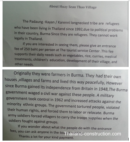
ย้อนกลับไปในปี 2014 เราขับรถไปตามทางหลวงหมายเลข 1250 ประมาณ 20 นาที เข้าไปในหมู่บ้านห้วยเสือเถา: หมู่บ้านกะเหรี่ยง (คอยาว) ผมสนใจที่จะเห็นว่าหมู่บ้านนี้ยังคงปรากฏอยู่บน Google Maps
ปาดอง (ยันปาดอง) เป็นคำในภาษาฉานที่ใช้เรียกกะเหรี่ยงลาห์วี (กลุ่มที่ผู้หญิงสวมห่วงทองเหลืองที่คอ) ชาวกะเหรี่ยงไม่ชอบให้ถูกเรียกว่าปาดอง
ผมรู้สึกไม่ค่อยสบายใจที่จะไปจ้องมองผู้คนเหล่านี้ แต่ผมเข้าใจว่าการที่มีนักท่องเที่ยวมาเยี่ยมชมหมู่บ้านของพวกเขา และการขายหัตถกรรมเป็นวิธีเดียวที่พวกเขาจะอยู่รอดได้ในบ้านชั่วคราวในประเทศไทย ดังนั้นผมจึงนั่งอยู่ข้างนอกขณะที่ภรรยาและลูกชายเข้าไปเยี่ยมผู้หญิง พวกเขาออกมาอย่างมีความสุขที่ได้พบกับผู้หญิงและพูดคุยกับผู้หญิง/เด็กสาวบางคนเป็นภาษาไทย ดังนั้นผมจึงพลาดโอกาสนั้นไป
ที่แม่ฮ่องสอน เราพักที่โรงแรมอิมพีเรียล แม่ฮ่องสอน ซึ่งเป็นโรงแรมคลาสสิก
ระหว่างแม่ฮ่องสอนและปาย –
ระหว่างแม่ฮ่องสอนและปาย มีสถานที่ท่องเที่ยวที่น่าสนใจอยู่สองสามแห่ง
ถ้ำเพชร (และ/หรือ ถ้ำปะการัง และ/หรือ ถ้ำมาเอลานา) ในปางมะพ่า ขณะขับรถไปทางเหนือตามเส้นทางหมายเลข 1095 ทางด้านซ้ายมือ ฉันเห็นป้ายบอกทางไปถ้ำ และคิดว่าต้องไปดูให้ได้ เราเลี้ยวออกจากทางหลวงและขับไปตามถนนเล็กๆ จนกระทั่งเจอจุดตรวจของทหาร (มีจุดตรวจของทหาร/เจ้าหน้าที่พิทักษ์ป่ามากมายในบริเวณชายแดน) พวกเขาให้เราผ่านไปและบอกว่าเราต้องหาไกด์นำทางไปถ้ำ ไกด์ขี่มอเตอร์ไซค์นำรถของเราลงไปตามถนนคดเคี้ยวลาดชันไปยังถ้ำ เราเลือกไปถ้ำปะการัง ซึ่งเป็นถ้ำขนาดใหญ่และมืดมาก แต่สิ่งที่ติดอยู่ในความทรงจำของฉันจนถึงทุกวันนี้คือการขับรถไปและกลับจากถ้ำที่อันตรายมาก
ห่างจากถ้ำไดมอนด์ไปทางเหนือประมาณ 40 นาที จะพบกับถ้ำลอดอันน่าทึ่ง หรือที่รู้จักกันในชื่อถ้ำธรรมลอด “ถ้ำหินปูนที่สวยงามตั้งอยู่ในอำเภอพังมะพ่า ระบบถ้ำนี้ทอดยาวกว่า 1,666 เมตร และมีชื่อเสียงในด้านหินงอก หินย้อย และเสาหินที่น่าประทับใจ ถ้ำแห่งนี้เป็นผลงานชิ้นเอกของภูมิประเทศแบบคาร์สต์ ที่ซึ่งน้ำและหินมาบรรจบกัน ก่อให้เกิดหินงอกและหินย้อยอันงดงามนับล้านปี นักท่องเที่ยวสามารถสำรวจถ้ำได้โดยล่องแพไม้ไผ่ สัมผัสประสบการณ์การเดินทางผ่านใจกลางภูเขา ถ้ำแห่งนี้ยังเป็นแหล่งโบราณคดีที่สำคัญ มีผู้คนอาศัยอยู่ตั้งแต่ 9,000 ปีก่อนคริสตกาล โดยวัฒนธรรมโฮบินห์ ซึ่งเป็นชนเผ่าล่าสัตว์ในยุคหิน” จ้างไกด์พร้อมโคมไฟและแพไม้ไผ่ แล้วล่องไปตามแม่น้ำผ่านถ้ำ เป็นสถานที่ที่วิเศษมากที่ควรค่าแก่การไปเยือน
อย่าลืมแวะไปที่ Cave Lodge ใกล้กับถ้ำธรรมลอดเพื่อรับประทานอาหารและเครื่องดื่ม หรือพักค้างคืน – ที่นี่เปิดให้บริการมานานหลายทศวรรษและน่าสนใจมาก Cave Lodge “ก่อตั้งขึ้นในปี 1984 เป็นเกสต์เฮาส์ที่เปิดให้บริการยาวนานที่สุดในจังหวัดแม่ฮ่องสอน ให้บริการแขกหลากหลายกลุ่ม ตั้งแต่แบ็คแพ็คเกอร์งบประหยัดไปจนถึงนักเดินทางที่มองหาบังกะโลที่ดีที่สุดในพื้นที่ปางมะภา สพง และถ้ำลอด”
ปาย –
ขับรถ 2.5 ชั่วโมง 120 กิโลเมตรไปทางเหนือจากแม่ฮ่องสอน คือเมืองสวรรค์ของแบ็คแพ็คเกอร์อย่างปาย (Pai) และอยู่ห่างจากเชียงใหม่ไปทางตะวันตกเฉียงเหนือประมาณ 146 กิโลเมตร ตั้งอยู่ริมแม่น้ำปาย
ในปลายศตวรรษที่ 19 การเดินทางจากเชียงใหม่ไปปายใช้เวลาหนึ่งสัปดาห์ ชุมชนในสมัยนั้นรู้จักกันในชื่อบ้านเวียงใต้ ได้พัฒนาเป็นเมืองปายในปัจจุบัน
ในปี ค.ศ. 1943 ญี่ปุ่นเริ่มโครงการหลายโครงการเพื่อสร้างเส้นทางการขนส่งทหารและยุทโธปกรณ์ที่มีประสิทธิภาพระหว่างประเทศไทยและเมียนมาร์ เพื่อสนับสนุนการโจมตีที่วางแผนไว้ที่อิมพาลและโคฮิมา ซึ่งทั้งสองแห่งอยู่ในอินเดีย นอกเหนือจากทางรถไฟสายมรณะที่ผ่านกาญจนบุรีแล้ว โครงการนี้ยังรวมถึงการปรับปรุงถนนที่มีอยู่จากเชียงใหม่ไปยังปาย ตลอดจนเส้นทางที่เชื่อมต่อกันเป็นหย่อมๆ ที่มุ่งหน้าไปทางเหนือสู่แม่ฮ่องสอน ความพยายามของญี่ปุ่นในการพัฒนาเครือข่ายถนนถูกยกเลิกในช่วงต้นปี ค.ศ. 1944 เมื่อเห็นได้ชัดว่าการปรับปรุงไม่สามารถแล้วเสร็จทันเวลาสำหรับการโจมตีอิมพาลที่กำหนดไว้ ถนนที่สร้างไม่เสร็จนี้ได้ทำหน้าที่เป็นเส้นทางถอยทัพของญี่ปุ่นหลังจากความพ่ายแพ้อย่างยับเยินที่อิมพาลและโคฮิมา
ในปี 1967 รัฐบาลไทยเริ่มพัฒนาถนนที่เชื่อมจากเชียงใหม่ผ่านปายไปยังแม่ฮ่องสอน ซึ่งปัจจุบันรู้จักกันในชื่อทางหลวงหมายเลข 1095 แต่การก่อสร้างถนนยังไม่แล้วเสร็จจนกระทั่งช่วงต้นถึงกลางทศวรรษ 1990
สนามบินปาย สร้างขึ้นในปี 1947 และปูพื้นใหม่ในปี 2007 ไม่มีเที่ยวบินพาณิชย์เข้าหรือออกจากปายตั้งแต่ประมาณปี 2017 เป็นต้นมา
วิกิพีเดียอธิบายปายว่า: “เมืองนี้เจริญรุ่งเรืองหลักๆ ด้วยการท่องเที่ยว เป็นที่รู้จักในหมู่นักท่องเที่ยวแบ็กแพ็กเกอร์ในเรื่องบรรยากาศที่ผ่อนคลาย เมืองนี้เต็มไปด้วยเกสต์เฮาส์ราคาประหยัด ร้านขายของที่ระลึก และร้านอาหาร บริเวณโดยรอบประกอบด้วยสิ่งที่เรียกว่า “ค่ายช้าง” น้ำตก น้ำพุร้อน และเส้นทางเดินป่า เนื่องจากปายตั้งอยู่ในหุบเขา นักท่องเที่ยวบางส่วนจึงใช้เป็นฐานสำหรับการเดินป่าและเยี่ยมชมชนเผ่าบนเขา เช่น กะเหรี่ยง ม้ง ลีซู และลาหู”
ปายมีร้านเซเว่นอีเลฟเว่นหลายแห่ง รีสอร์ทหรูขนาดเล็กถึงขนาดกลางหลายแห่ง คลับดนตรีสด และบาร์เบียร์ ในขณะที่ชาวบ้านบางคนยกย่องการบูมของการท่องเที่ยวนี้ว่าเป็นยุคแห่งความเจริญรุ่งเรืองใหม่ของปาย แต่คนอื่นๆ ชี้ให้เห็นถึงการสูญเสียขนบธรรมเนียมและวัฒนธรรมดั้งเดิมของเมือง
ในช่วงฤดูท่องเที่ยวสูงสุดตั้งแต่เดือนพฤศจิกายนถึงมีนาคม จำนวนนักท่องเที่ยวเพิ่มขึ้นจนทำให้ปายประสบปัญหาการจราจรติดขัด ปัญหารถติด รวมถึงการขาดแคลนไฟฟ้า น้ำ และน้ำมันเชื้อเพลิง”
ที่ปาย เราพักที่เดอะควอเตอร์ ซึ่งอยู่ไม่ไกลจากถนนคนเดินและอยู่ติดกับโรงพยาบาลปาย
ในปี 1989 ตอนที่ฉันมาเที่ยวประเทศไทยครั้งแรก เพื่อนชาวนิวซีแลนด์ที่ฉันเจอระหว่างแบ็คแพ็คเที่ยวจีนก่อนมาไทย เล่าถึงปาย สวรรค์เล็กๆ บนเนินเขาแห่งนี้อย่างตื่นเต้น และวาดแผนที่เล็กๆ ให้ฉันดูว่าไปที่นั่นได้อย่างไร ฉันใช้เวลา 25 ปีถึงจะได้ไปปาย แต่ที่นั่นช่างเป็นสถานที่ที่ยอดเยี่ยมจริงๆ
การท่องเที่ยวในประเทศไทยยังอยู่ในช่วงเริ่มต้นเมื่อปี 1989 ตอนที่ฉันมาเที่ยวครั้งแรก แต่สิ่งต่างๆ เปลี่ยนไปมากแค่ไหนใน 37 ปีที่ผ่านมา!
เมื่อมองย้อนกลับไป หนึ่งในแง่มุมที่น่าสนใจที่สุดของการเดินทางของกูดเดนและการเดินทางของผมเอง คือการได้เห็นการเปลี่ยนแปลงของพรมแดนเมื่อเวลาผ่านไป ถนนเข้ามาแทนที่เส้นทางในป่า โทรศัพท์มือถือเข้ามาแทนที่ความโดดเดี่ยว และการท่องเที่ยวได้เข้าถึงสถานที่ที่ครั้งหนึ่งเคยดูเหมือนห่างไกลอย่างเหลือเชื่อ แต่ถึงแม้จะมีการเปลี่ยนแปลงเหล่านี้ ภูเขา ป่าไม้ และความหลากหลายทางวัฒนธรรมที่กำหนดพรมแดนไทย-เมียนมาร์ยังคงอยู่ครบถ้วนอย่างน่าทึ่ง
พรมแดนไทย-เมียนมาร์เป็นมากกว่าเส้นบนแผนที่ มันเป็นภูมิภาคที่หล่อหลอมโดยประวัติศาสตร์ ความขัดแย้ง การอพยพ การค้า และความงามทางธรรมชาติที่พิเศษ หนังสือ Three Pagodas ของคริสเตียน กูดเดน บันทึกโลกแห่งพรมแดนที่กำลังหายไปแล้วเมื่อเขาเดินทางผ่าน ในขณะที่การเดินทางในยุคปัจจุบันเผยให้เห็นว่ามีการเปลี่ยนแปลงไปมากเพียงใดนับตั้งแต่นั้นมา ทั้งหมดนี้ร่วมกันบอกเล่าเรื่องราวของหนึ่งในภูมิภาคที่น่าหลงใหลที่สุดของเอเชียตะวันออกเฉียงใต้ สถานที่ที่การผจญภัย ประวัติศาสตร์ และวัฒนธรรมยังคงมาบรรจบกันตามแนวชายฝั่งตะวันตกที่ขรุขระของประเทศไทย