 The 7 km queue to Koh Chang’s ferries; and will the planned bridge to the mainland be good or bad for the island’s future?
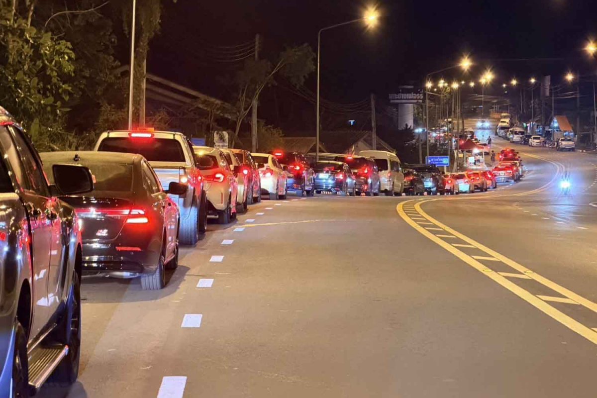
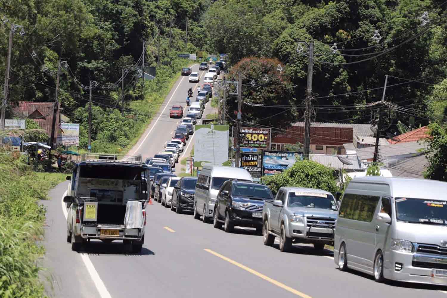
For the recent Friday 1st of May 2026 Labour Day holiday, the Bangkok Post reported “Tourists pack Koh Chang on long holiday – Queues for ferries on Trat mainland stretch up to 7km on Friday night”. The article went on to say that tourists had been flocking to Koh Chang to enjoy the four-day holiday weekend (Monday 4th of May 2026 being the ‘Coronation Day’ national holiday), resulting in unusually long queues waiting for ferries at the Ao Thammachat pier in Laem Ngop district, which stretched for as long as seven kilometres on Friday. The last ferry to Koh Chang left the pier at midnight. Some tourists waited more than six hours to get across.
The tourists that had crossed to Koh Chang on Friday could then expect to suffer massive queues on Sunday or Monday to cross back to the mainland.
Having personally experienced the long queues to cross to and from Koh Chang on normal weekends, I learnt long ago it is not wise to venture to Koh Chang on Thai National holidays.
What and where is Koh Chang?
Wikitravel.org describes Koh Chang or Ko Chang (เกาะช้าง) as:
“an island in Trat Province, Eastern Thailand. Ko Chang is Thailand’s third largest island (Phuket is largest, Ko Samui is 2nd largest), and the biggest in Eastern Thailand. With about 5,000 permanent residents the island is not heavily populated, but tourism (and development) has increased dramatically over the last few years. Despite this, tourism is nowhere near at the levels of Phuket and Samui, and as such, the island offers a much better experience for anyone willing to make the effort to get there…
Ko Chang is the largest island in the Ko Chang Archipelago. The name means Elephant Island (Chang = elephant), named for the elephant shape of its headland, although elephants are not indigenous to the island.
The only way onto the island is by Ferry…”
Normally you see the name of the island written in English as Koh Chang or Ko Chang. Koh or Ko is the transliteration in to English language of the Thai word for island. Non-Thais usually incorrectly pronounce Koh or Ko like ‘Coe’ as in Sebastian Coe the runner, or like ‘Co-‘ as in co-habit, but it should actually be pronounced more like ‘Go’ as in ‘Bo-ttle’.
The Ferry situation to Koh Chang
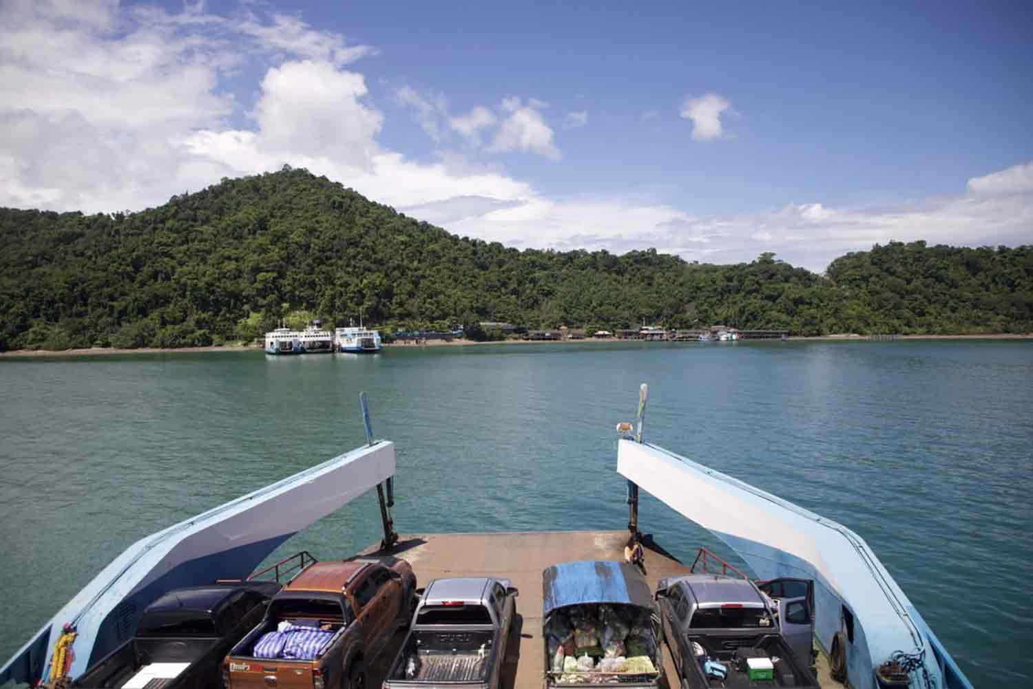
Local website explorekohchang.com refers to “Koh Chang ferries are supplied by just one company, Ferry Koh Chang. The drive-on/drive-off service takes foot passengers, 2-wheel and 4-wheel vehicles and microbuses but large tour buses cannot travel onto the island. The Koh Chang ferries run every day of the year as scheduled, with only the very occasional cancellation due to high waves…Ferry Koh Chang leaves from Ao Thammachat Pier on the mainland to arrive at Ao Sapparot Pier on the north east coast of Koh Chang. Ferry Koh Chang operates several different sized boats, with the smallest taking 25 minutes and the larger ones around 35 minutes.”.
In addition to Koh Chang ferries, there used to be Trat Ferry (formerly Centrepoint Ferry) but they suspended their services in July 2024. They have not resumed and it’s reported unlikely that they will in the near future.
I am not aware of the residents of Koh Chang receiving any beneficial or preferential treatment when crossing to and from the mainland. No jumping to the front of the queue. No resident only queues. No discounted ferry rates.
When the weather is good, which is most of the time in Thailand, it is a lovely 30–40 minutes crossing time to and from the island. On board, there is a refreshments area, toilets and plenty of seating spaces upstairs.
Unfortunately at peak times, such as Thai national holidays, the ferries cannot meet the increased demand resulting in lengthy queues and long waits.
Will a bridge from the mainland to Koh Chang solve the problem?
All transportation of people and vehicles to the island is by ferry. It obviously doesn’t help the situation that there is currently only one ferry company instead of the usual two companies plying the route. So, could another company or more ferries help? The ferry runs on a regular schedule, with only so many ferries, so the ups and downs of demand will be hard to manage, resulting in periods of not so busy, busy and absolutely busy.
Phuket is currently the only major Thai island permanently connected to the mainland by bridges (Sarasin and Thepkasattri bridges linking Phuket Island to the mainland at Phang Nga, with a total length of 660 m).
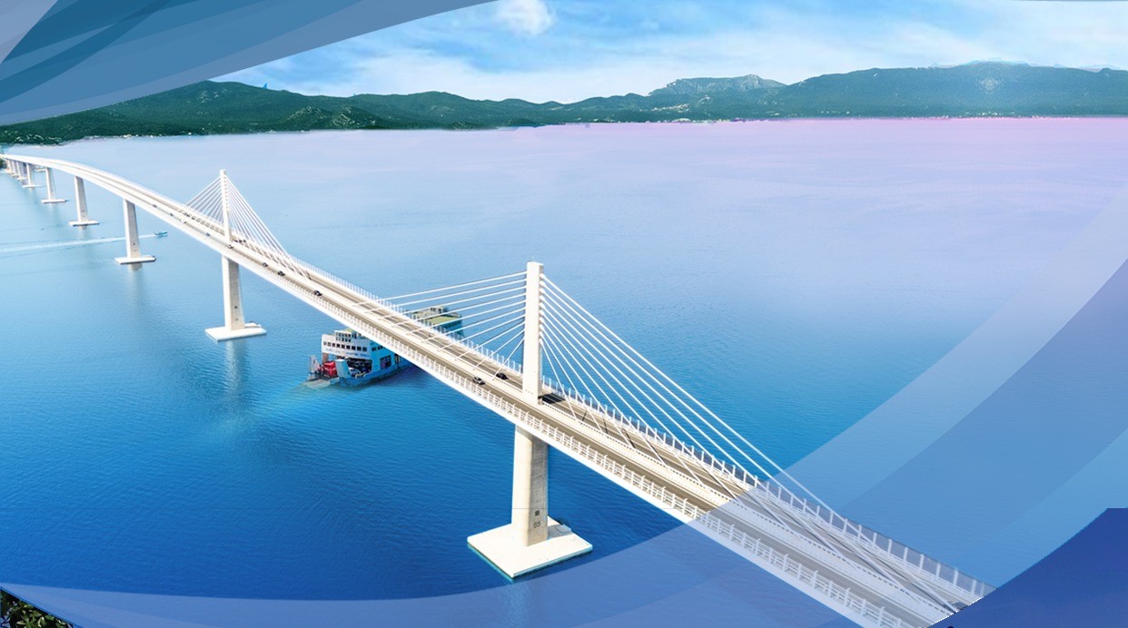
There is a major project underway to build a 37.41 kilometre, Bht55 billion cable-stayed bridge connecting Koh Samui to the mainland at Khanom District in Nakhon Si Thammarat, expected to open by 2034.
Thailand-construction.com has carried many news articles on this Koh Chang bridge issue over the years (search the site for ‘Koh Chang’ or ‘Ko Chang’), but as there is an excellent summary of the long-running ‘should there be a bridge?’ and if yes ‘where should the bridge connect the mainland and the island’ scenario by the equally long-running but brilliant iamkohchang.com website, we have pulled out below the main points from their summary:
- the overwhelming consensus amongst local residents (and large business owners) on the island is that they want a bridge. When residents of the island, and also Laem Ngop on the mainland, were surveyed, over 95% of the total wanted a bridge. Amongst locals on the island the figure was 98% in favour of a bridge.
- If it was up to expats and most Western tourists who currently visit the island, then a bridge wouldn’t be built as the character of the island will undoubtedly change. However, no amount of foreigners whining or getting upset on social media is going to change things. A non-scientific Facebook poll from 2020 showed a very strong anti-bridge sentiment amongst expats and foreign tourists.
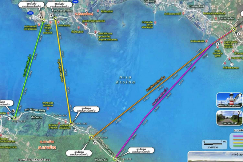
- Of the four route options considered, the 5.9 km long ‘Route 3’ was confirmed as the definite choice of location for the bridge. This is due to a combination of short distance, least disruption to local communities and least effect of the natural environment. The bridge would begin at Ao Thammachat Lang, a small fishing community on the mainland near Ao Thammachat pier. On Koh Chang the bridge would join the island at a point just north of Amber Sands Beach Resort.
- In May 2026, the Expressway Authority of Thailand (EXAT) plan to hold more rounds of public consultation meetings. These will summarize the feasibility study results which cover engineering, economic, financial, and environmental impacts of the bridge. Then, in late 2026 or early 2027, discussions will be held with utility agencies to jointly plan the infrastructure and how to integrate it with the expressway to enhance safety and reduce future costs. The design will hopefully then be finalised. It is expected that the project will be submitted to the Cabinet for approval in 2028. If approved, the project timeline will see land acquisition begin in 2029. Then construction starts in 2030, and services open in 2034 (This is a 1-year delay from the original plan).
- The bridge design across the sea will be divided into two sections. With most bridge span lengths of 50-60 meters, with box girder and balanced girder bridge structures. Plus, one longer span of approximately 200 meters, which allows larger ships to pass underneath. This will be either an extradosed or balanced cantilever bridge design.
In summary, a proposed 5.7-kilometre bridge is under discussion to connect the mainland to Koh Chang.
Will the character / composition of the island change if the bridge goes ahead? Will the bridge affect the number of tourists to the island?
Anyone who has spent any time on Koh Chang will know that it is a relatively small island. It has an area covering approximately 212 square kilometres, 70% of Koh Chang is covered in rainforests, mountains and beaches. The highest peak on the island is Khao Salak Phet, rising from the ground at 743 meters.
There are two main roads on Ko Chang, running the length of the east and west coasts – they do not connect so it is not possible to drive around the island. Both roads start at Ao Sapparot in the north of the island, near the ferry piers, one goes to the right to the west coast and the other goes left to the east coast.
The East coast faces the mainland and the road here is relatively flat. This coast is not as pretty as the west coast and therefore not so many resorts or tourists on the east coast. Koh Chang’s hospital is on the east coast. The east coast has no large supermarkets.
The most popular areas are on the West coast of Ko Chang. White Sand beach has always been the most popular on the island (and is where tourism started) and so attracts the highest number of tourists. The road on this coast is steep and mountainous in areas. The island has large supermarkets such as Makro, Big C and Lotus’s; they are all on the west coast.
Koh Chang can therefore be considered a bit lopsided, with almost everything appealing to tourists on the west coast, and not so much of appeal on the east side where the bridge if constructed will be.
A bridge, and with it ease of access to the island, will bring more tourists, particularly Thais. Bangkok (Bangna) to the ferry point currently takes around 4.5 hours to drive – according to Google Maps. With no ferry to contend with, and being able to drive straight on to the island, the island will likely be swamped with the weekend crowd from the huge Bangkok-to-Trat catchment area.
Traffic jams on the island, especially on the tricky mountainous west coast roads, will be inevitable.
Development areas on the island are minimal.
The local residents will no doubt love it. Large tour buses would be able to drive on to the island. They’ll be more tourists. More opportunity to increase incomes. Easy access to the hospitals, schools, etc., on the mainland. But they will have to put up with crowded roads, more people, and regular crowds. With a bridge, the local residents effectively become mainland residents.
There will be change, but not necessarily for the good. Be careful what you wish for.
Having visited Koh Chang off and on since the early 1990s, do I see myself visiting Koh Chang by bridge? Definitely at least once to see how it is, but the quiet appeal of Koh Chang’s beautiful beaches and the laidback vibe of the island itself will be lost with the hordes of visiting tourists – similar to modern day Pattaya, Hua Hin, Khao Yai, etc., which have all changed beyond recognition over recent decades – and as such is unlikely to appeal to me. The more difficult a place is to visit, often the enjoyment factor and appeal is higher, and Koh Chang and Koh Samui in the south of Thailand are about to become easy places to visit.
The growth of Koh Chang since the 1970s
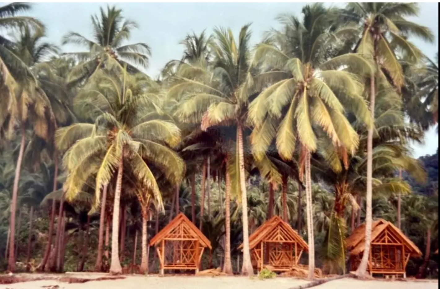
Tourists first began traveling to Koh Chang in the mid-1970s, when Western backpackers discovered the island and arrived via local fishing boats. It remained an underdeveloped, “untouched” destination with simple bamboo huts, particularly around White Sand Beach and Lonely Beach, until tourism infrastructure (roads and ferries) expanded in the 1990s.
- 1970s: First backpackers arrived on the island, drawn by its remote nature.
- 1980s: Koh Chang became a quiet, adventurous backpacker destination with basic bungalow accommodation.
- 1990s-2000s: The construction of roads connecting main beaches brought major tourist development and accessibility.
- 2000s: The island became a significant tourism destination, heavily promoted for further development
Tourist arrivals to Thailand grew to 39.92 million visitors in 2019 – marking the highest number of international tourists Thailand has ever received. However back in the late 1980s, Thailand was receiving a meagre 3-4 million tourists.
In 1988, Thailand experienced a significant surge in tourism, often cited as a key year in its tourism revolution. 1988 was part of the “Visit Thailand Year” campaign (1987-1988), which catapulted the country into a major international tourist destination, and drove international tourist arrivals to over 4 million. However significantly for Koh Chang, in late October 1988, an Irish and Welsh young woman were murdered on Koh Chang, while trekking to meet their partners at a resort. The women were shot by robbers, likely during a robbery attempt where they resisted. Two young local men were captured after a 13-day manhunt, confessed to the killings, and were sentenced to life imprisonment. This sad incident was a major blow to Koh Chang’s slowly growing popularity amongst the foreign back-packing community and visits to Koh Chang dipped.
In 1989, the year I first visited Thailand – on my way from Beijing’s Tiananmen Square protests to work in Sydney – Thailand welcomed approximately 4.81 million international tourist arrivals.
In 1991, the year I moved to work and settle in Thailand, Thailand experienced a decline in international tourist arrivals, with numbers falling to approximately 5.1 million.
Back then, there just weren’t that many tourists in Thailand, and hardly any discovering Koh Chang.
Wikitravel.org refers to the “discovery” of the island as a tourist destination since 2000 has brought on a large amount of rapid development…This sudden tourism boom however, has been fraught with controversy concerning land use, etc. The government is trying to “develop” it from a backpackers’ paradise to a top-level destination, and construction work is going on throughout the island, with basic huts torn down to make way for fancy resorts…”
Sometime, probably in 1992 or 1993, I made my first visit to Koh Chang.
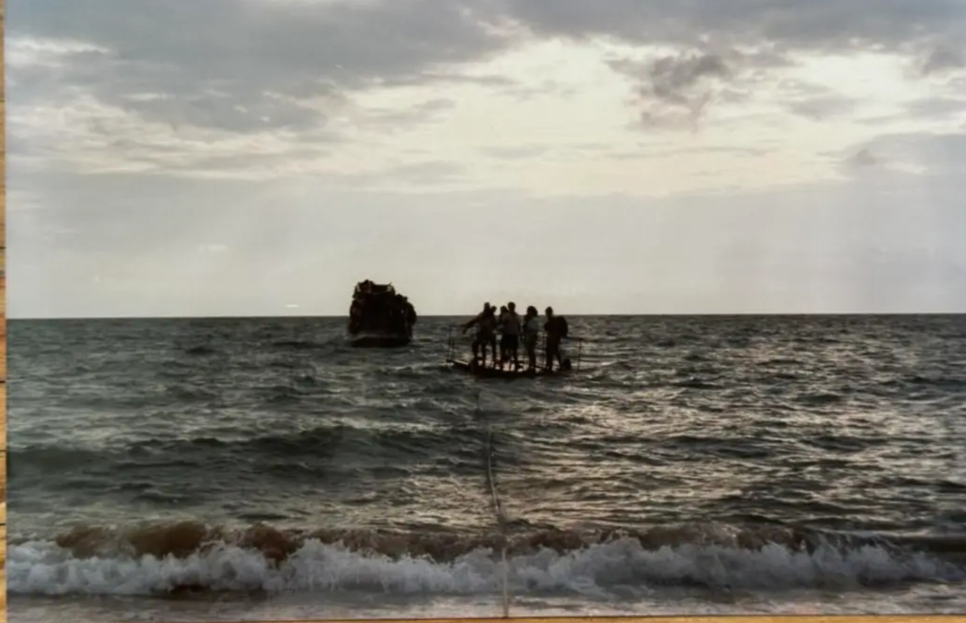
Back then the route from Bangkok was to take a coach ride from Ekkamai bus station, eventually arriving at the pier opposite Koh Chang. Then take a very small fishing boat – like they use nowadays to catch squid – to the far side of Koh Chang, to White Sand beach, where the boat would manoeuvre as close as possible to the beach and some of the backpackers on the beach would push out/swim out a floating raft to the boat for the new arrivals to clamber on to, and people on the beach would pull the rope attached to the raft to bring you to shore – hard to believe but true (see the image of the raft I found on Facebook).
Back then there were no paved roads on the island.
There were no fancy resorts, just small bungalows next to the beach made from the local materials. There was no electricity on the island – power was from oil generators between 6am and 6pm (I could be wrong; I have seen others referring to 9pm to 9am). During the night, oil tilley lamps/lanterns were provided to each bungalow. No electricity meant no fan/no aircon and meant you woke up covered in sweat, but roll out of bed and straight in the sea just metres away, followed by the cold-water bucket shower, you were ready for your banana pancake breakfast. Food ordered was whatever the bungalow owner had in the fridge that day – choices minimal. Behind the beach tree line, it was jungle. Days were spent on or around the beach, walking, swimming, exploring, meeting people and talking, reading, etc – no internet, it was a smaller world. Great times.
Second and third visit to Koh Chang a few years later, the floating raft had been replaced by a man in a wrap-around pakama, shirtless, with mahogany-coloured skin from days in the sun, who would spot the fishing boat arriving with fresh backpackers, and would zip out to bring them to shore with his long-tailed boat. I believe the road up and over the twisting hills from the ferry point at Ao Sapparot Pier to White Sand Beach was under construction.
Fourth visit, the road was open. Now a crossing on the large ferry followed by a ride in a pickup to White Sand Beach. The vibe had completely changed. Now there were Thais making the journey, and they were majority of the tourist crowd.
In recent times, I would take our car over on the ferry and the wife, sons and I would stay in one of the luxury houses in Siam Royal View in Klongson, near to Koh Chang’s only golf course (a 9/18 hole pitch and putt par 3 golf course). A far cry from arriving with a backpack on a floating raft!
Things have definitely changed over the years from being a backpacker island with no roads, power or much else, to being on the verge of being connected permanently and becoming part of the mainland. The coming of the bridge will undoubtedly change the Koh Chang we love to visit – but for better, or for worse?
Whether the proposed bridge is ultimately built or not, Koh Chang stands at a crossroads in its history. Over the past fifty years it has evolved from a remote backpacker hideaway reached by fishing boats and floating rafts into one of Thailand’s most popular island destinations, while still retaining much of the natural beauty and relaxed atmosphere that first attracted visitors. For local residents, a bridge promises easier access, economic opportunity and improved links to the mainland. For many long-time visitors, however, it raises concerns about overdevelopment, traffic congestion and the loss of the island’s unique character. Change is inevitable, as it has been throughout Koh Chang’s history, but the challenge will be finding the right balance between progress and preservation. Whatever the future holds, those who have known and loved Koh Chang over the years can only hope that the island’s forests, beaches, landscapes and laid-back spirit remain at the heart of what makes it such a special place.
Google Translation:
คิวรอเรือข้ามฟากเกาะช้างยาวถึง 7 กิโลเมตร และสะพานที่วางแผนสร้างเชื่อมไปยังแผ่นดินใหญ่จะเป็นผลดีหรือผลเสียต่ออนาคตของเกาะ?
เมื่อวันศุกร์ที่ 1 พฤษภาคม 2569 ซึ่งเป็นวันหยุดวันแรงงานที่ผ่านมา หนังสือพิมพ์บางกอกโพสต์รายงานว่า “นักท่องเที่ยวแห่กันไปเกาะช้างช่วงวันหยุดยาว – คิวรอเรือข้ามฟากที่แผ่นดินใหญ่จังหวัดตราดยาวถึง 7 กิโลเมตรในคืนวันศุกร์” บทความดังกล่าวระบุต่อไปว่า นักท่องเที่ยวจำนวนมากแห่กันไปเกาะช้างเพื่อพักผ่อนในช่วงวันหยุดยาว 4 วัน (วันจันทร์ที่ 4 พฤษภาคม 2569 เป็นวันหยุดราชการวันเฉลิมพระเกียรติ) ส่งผลให้มีคิวรอเรือข้ามฟากที่ท่าเรืออ่าวธรรมชาติ อำเภอแหลมงอบ ยาวผิดปกติถึง 7 กิโลเมตรในวันศุกร์ เรือข้ามฟากเที่ยวสุดท้ายไปเกาะช้างออกจากท่าเรือเวลาเที่ยงคืน นักท่องเที่ยวบางคนต้องรอมากกว่า 6 ชั่วโมงเพื่อข้ามฝั่ง
นักท่องเที่ยวที่ข้ามไปเกาะช้างในวันศุกร์ก็อาจต้องเผชิญกับคิวยาวเหยียดในวันอาทิตย์หรือวันจันทร์เพื่อข้ามกลับไปยังแผ่นดินใหญ่
จากประสบการณ์ส่วนตัวที่เคยเจอคิวยาวเหยียดเพื่อข้ามไปและกลับจากเกาะช้างในวันหยุดสุดสัปดาห์ปกติ ทำให้ฉันเรียนรู้มานานแล้วว่าไม่ควรไปเกาะช้างในช่วงวันหยุดนักขัตฤกษ์ของไทย
เกาะช้างคืออะไรและอยู่ที่ไหน?
เว็บไซต์ Wikitravel.org อธิบายเกาะช้าง (Koh Chang หรือ Ko Chang) ไว้ดังนี้:
“เกาะในจังหวัดตราด ทางภาคตะวันออกของประเทศไทย เกาะช้างเป็นเกาะที่ใหญ่เป็นอันดับสามของประเทศไทย (ภูเก็ตใหญ่ที่สุด เกาะสมุยใหญ่เป็นอันดับสอง) และใหญ่ที่สุดในภาคตะวันออกของประเทศไทย มีประชากรอาศัยอยู่ถาวรประมาณ 5,000 คน ซึ่งถือว่าไม่หนาแน่นมากนัก แต่การท่องเที่ยว (และการพัฒนา) เพิ่มขึ้นอย่างมากในช่วงไม่กี่ปีที่ผ่านมา ถึงกระนั้น การท่องเที่ยวก็ยังไม่มากเท่ากับภูเก็ตและเกาะสมุย ดังนั้น เกาะแห่งนี้จึงมอบประสบการณ์ที่ดีกว่ามากสำหรับผู้ที่เต็มใจที่จะพยายามเดินทางไปที่นั่น…
เกาะช้างเป็นเกาะที่ใหญ่ที่สุดในหมู่เกาะช้าง ชื่อนี้มีความหมายว่า เกาะช้าง (ช้าง = ช้าง) ตั้งชื่อตามรูปทรงของแหลมที่คล้ายช้าง แม้ว่าช้างจะไม่ใช่สัตว์พื้นเมืองของเกาะก็ตาม
วิธีเดียวที่จะขึ้นเกาะได้คือโดยเรือเฟอร์รี่…”
โดยปกติแล้ว คุณจะเห็นชื่อเกาะเขียนเป็นภาษาอังกฤษว่า Koh Chang หรือ Ko Chang คำว่า Koh หรือ Ko เป็นการถอดเสียงภาษาไทยเป็นภาษาอังกฤษจากคำว่าเกาะ” ชาวต่างชาติมักออกเสียง โค หรือ โก ผิด โดยออกเสียงเหมือน ‘โค’ ในชื่อ เซบาสเตียน โค นักวิ่ง หรือเหมือน ‘โค-‘ ในคำว่า co-habit แต่ที่จริงควรออกเสียงเหมือน ‘โก’ ในคำว่า ‘ขวด’ มากกว่า
ชาวบ้านและนักท่องเที่ยวที่เดินทางระหว่างแผ่นดินใหญ่ของจังหวัดตราดและเกาะช้างต้องเดินทางโดยเรือเฟอร์รี่ ซึ่งใช้เวลา 30-45 นาที (ภาพโดย จักรฤทธิ์ เววกไลหง)
สถานการณ์เรือเฟอร์รี่ไปเกาะช้าง
เว็บไซต์ท้องถิ่น explorekohchang.com ระบุว่า “เรือเฟอร์รี่ไปเกาะช้างให้บริการโดยบริษัทเดียว คือ Ferry Koh Chang บริการแบบขับรถขึ้น/ลงได้เอง รับผู้โดยสารที่เดินเท้า รถจักรยานยนต์ รถยนต์ และรถไมโครบัส แต่รถทัวร์ขนาดใหญ่ไม่สามารถขึ้นเกาะได้ เรือเฟอร์รี่ไปเกาะช้างให้บริการทุกวันตลอดทั้งปีตามตารางเวลา โดยมีการยกเลิกบ้างเป็นครั้งคราวเนื่องจากคลื่นสูง… เรือเฟอร์รี่ Koh Chang ออกจากท่าเรืออ่าวธรรมชาติบนแผ่นดินใหญ่ไปยังท่าเรืออ่าวสะพโรททางชายฝั่งตะวันออกเฉียงเหนือของเกาะช้าง Ferry Koh Chang ให้บริการเรือหลายขนาด โดยเรือขนาดเล็กใช้เวลา 25 นาที และเรือขนาดใหญ่ใช้เวลาประมาณ 35 นาที”
นอกจากเรือข้ามฟากเกาะช้างแล้ว ก่อนหน้านี้เคยมีเรือข้ามฟากตราด (เดิมชื่อ Centrepoint Ferry) แต่ได้ระงับบริการไปตั้งแต่เดือนกรกฎาคม 2567 และยังไม่ได้กลับมาให้บริการอีก และมีรายงานว่าไม่น่าจะกลับมาให้บริการในอนาคตอันใกล้นี้
ดิฉันไม่ทราบว่าผู้อยู่อาศัยบนเกาะช้างได้รับสิทธิพิเศษหรือการดูแลเป็นพิเศษใดๆ ในการเดินทางข้ามไปมาระหว่างเกาะกับแผ่นดินใหญ่ ไม่มีการแซงคิว ไม่มีช่องทางพิเศษสำหรับผู้อยู่อาศัย ไม่มีส่วนลดค่าโดยสาร
เมื่ออากาศดี ซึ่งส่วนใหญ่ในประเทศไทยก็เป็นเช่นนั้น การเดินทางข้ามไปมาระหว่างเกาะใช้เวลาประมาณ 30-40 นาที บนเรือมีพื้นที่จำหน่ายเครื่องดื่ม ห้องน้ำ และที่นั่งมากมายบนชั้นบน
น่าเสียดายที่ในช่วงเวลาที่มีผู้ใช้บริการมาก เช่น วันหยุดนักขัตฤกษ์ เรือข้ามฟากไม่สามารถรองรับความต้องการที่เพิ่มขึ้นได้ ส่งผลให้มีคิวยาวและต้องรอนาน
แผนที่ที่จัดทำโดยการทางด่วนแห่งประเทศไทยแสดงเส้นทางเลือก 4 เส้นทางสำหรับสะพานที่วางแผนไว้ไปยังเกาะช้างในจังหวัดตราด
สะพานจากแผ่นดินใหญ่ไปยังเกาะช้างจะแก้ปัญหาได้หรือไม่?
การขนส่งผู้คนและยานพาหนะทั้งหมดไปยังเกาะใช้เรือข้ามฟาก ซึ่งเห็นได้ชัดว่าสถานการณ์แย่ลงเพราะปัจจุบันมีบริษัทเรือข้ามฟากเพียงบริษัทเดียว แทนที่จะเป็นสองบริษัทตามปกติ ดังนั้น การเพิ่มบริษัทหรือจำนวนเรือข้ามฟากจะช่วยได้หรือไม่? เรือข้ามฟากวิ่งตามตารางเวลาปกติ แต่มีจำนวนเรือจำกัด ดังนั้นความผันผวนของความต้องการจึงจัดการได้ยาก ส่งผลให้มีช่วงเวลาที่ไม่ค่อยมีผู้โดยสาร ช่วงเวลาที่มีผู้โดยสารมาก และช่วงเวลาที่มีผู้โดยสารหนาแน่นมาก
ปัจจุบันเกาะภูเก็ตเป็นเกาะหลักของไทยเพียงเกาะเดียวที่เชื่อมต่อกับแผ่นดินใหญ่ด้วยสะพานอย่างถาวร (สะพานสารสินและสะพานเทพกษัตริย์เชื่อมเกาะภูเก็ตกับแผ่นดินใหญ่ที่พังงา มีความยาวรวม 660 เมตร)
ขณะนี้มีโครงการก่อสร้างสะพานแขวนขนาดใหญ่ความยาว 37.41 กิโลเมตร มูลค่า 55,000 ล้านบาท เชื่อมเกาะสมุยกับแผ่นดินใหญ่ที่อำเภอขนอม จังหวัดนครศรีธรรมราช คาดว่าจะเปิดใช้งานในปี 2034
เว็บไซต์ Thailand-construction.com ได้นำเสนอข่าวเกี่ยวกับประเด็นสะพานเกาะช้างนี้มาหลายปีแล้ว (ค้นหาในเว็บไซต์ด้วยคำว่า ‘Koh Chang’ หรือ ‘Ko Chang’) แต่เนื่องจากเว็บไซต์ iamkohchang.com ซึ่งมีข้อมูลมายาวนานและยอดเยี่ยมเช่นกัน ได้สรุปประเด็นสำคัญเกี่ยวกับ ‘ควรมีสะพานหรือไม่?’ และถ้าควรมี ‘ควรสร้างสะพานเชื่อมแผ่นดินใหญ่กับเกาะตรงไหน?’ ไว้อย่างดีเยี่ยม เราจึงได้คัดลอกประเด็นหลักจากบทสรุปของพวกเขามาไว้ด้านล่างนี้:
ความเห็นส่วนใหญ่ในหมู่ผู้อยู่อาศัยในท้องถิ่น (และเจ้าของธุรกิจขนาดใหญ่) บนเกาะคือ พวกเขาต้องการสะพาน เมื่อทำการสำรวจความคิดเห็นของผู้อยู่อาศัยบนเกาะและที่แหลมงอบบนแผ่นดินใหญ่ พบว่ากว่า 95% ของทั้งหมดต้องการสะพาน ในหมู่คนท้องถิ่นบนเกาะนั้น ตัวเลขอยู่ที่ 98% ที่เห็นด้วยกับการสร้างสะพาน
หากขึ้นอยู่กับชาวต่างชาติและนักท่องเที่ยวชาวตะวันตกส่วนใหญ่ที่มาเยือนเกาะในปัจจุบัน สะพานคงจะไม่ถูกสร้างขึ้น เนื่องจากลักษณะของเกาะจะเปลี่ยนไปอย่างแน่นอน อย่างไรก็ตาม การบ่นหรือแสดงความไม่พอใจของชาวต่างชาติบนโซเชียลมีเดียจะไม่สามารถเปลี่ยนแปลงอะไรได้ โพลล์เฟซบุ๊กที่ไม่เป็นทางการในปี 2020 แสดงให้เห็นถึงความรู้สึกต่อต้านสะพานอย่างรุนแรงในหมู่ชาวต่างชาติและนักท่องเที่ยวต่างชาติ
จากตัวเลือกเส้นทางสี่เส้นทาง เส้นทางที่ 3 ซึ่งมีความยาว 5.9 กิโลเมตร ได้รับการยืนยันว่าเป็นตัวเลือกที่แน่นอนสำหรับสถานที่ตั้งสะพาน เนื่องจากระยะทางสั้น การรบกวนชุมชนท้องถิ่นน้อยที่สุด และผลกระทบต่อสิ่งแวดล้อมน้อยที่สุด สะพานจะเริ่มต้นที่อ่าวธรรมชาติหลัง ซึ่งเป็นชุมชนชาวประมงเล็กๆ บนแผ่นดินใหญ่ใกล้ท่าเรืออ่าวธรรมชาติ บนเกาะช้าง สะพานจะเชื่อมเกาะที่จุดทางเหนือของ Amber Sands Beach Resort เล็กน้อย
ในเดือนพฤษภาคม 2569 การทางด่วนแห่งประเทศไทย (EXAT) มีแผนจะจัดการประชุมรับฟังความคิดเห็นจากประชาชนเพิ่มเติม เพื่อสรุปผลการศึกษาความเป็นไปได้ ซึ่งครอบคลุมด้านวิศวกรรม เศรษฐกิจ การเงิน และผลกระทบต่อสิ่งแวดล้อมของสะพาน จากนั้น ในช่วงปลายปี 2569 หรือต้นปี 2560 จะมีการหารือกับหน่วยงานสาธารณูปโภคเพื่อวางแผนโครงสร้างพื้นฐานร่วมกัน และวิธีการบูรณาการเข้ากับทางด่วนเพื่อเพิ่มความปลอดภัยและลดต้นทุนในอนาคต คาดว่าจะมีการสรุปแบบร่างให้เสร็จสมบูรณ์ และคาดว่าจะนำเสนอโครงการต่อคณะรัฐมนตรีเพื่อขออนุมัติในปี 2561 หากได้รับอนุมัติ กำหนดการของโครงการจะเริ่มการจัดซื้อที่ดินในปี 2562 จากนั้นเริ่มก่อสร้างในปี 2563 และเปิดให้บริการในปี 2567 (ซึ่งล่าช้ากว่าแผนเดิม 1 ปี)
การออกแบบสะพานข้ามทะเลจะแบ่งออกเป็นสองส่วน โดยส่วนใหญ่มีความยาวช่วงสะพาน 50-60 เมตร และใช้โครงสร้างสะพานแบบคานกล่องและคานสมดุล นอกจากนี้ ยังมีช่วงสะพานที่ยาวกว่าประมาณ 200 เมตร ซึ่งจะช่วยให้เรือขนาดใหญ่สามารถลอดผ่านได้ สะพานนี้จะเป็นสะพานแบบคานยื่นเสริมหรือแบบคานสมดุล
โดยสรุปแล้ว สะพานยาว 5.7 กิโลเมตรที่เสนอมานั้นกำลังอยู่ระหว่างการพิจารณาเพื่อเชื่อมต่อแผ่นดินใหญ่กับเกาะช้าง
ลักษณะ/องค์ประกอบของเกาะจะเปลี่ยนแปลงไปหรือไม่หากมีการสร้างสะพาน? สะพานจะส่งผลกระทบต่อจำนวนนักท่องเที่ยวที่มาเยือนเกาะหรือไม่?
ผู้ขับขี่รถยนต์ต่อแถวยาวเพื่อขึ้นเรือเฟอร์รี่ไปยังเกาะช้างในคืนวันศุกร์ (ภาพโดย จักรกริต เวือกไลหง)
ใครก็ตามที่เคยใช้เวลาอยู่บนเกาะช้างจะรู้ว่าเกาะนี้มีขนาดค่อนข้างเล็ก มีพื้นที่ประมาณ 212 ตารางกิโลเมตร 70% ของเกาะช้างปกคลุมไปด้วยป่าฝน ภูเขา และชายหาด ยอดเขาที่สูงที่สุดบนเกาะคือเขาสลักเพชร สูง 743 เมตร
บนเกาะช้างมีถนนสายหลักสองสาย วิ่งเลียบชายฝั่งตะวันออกและตะวันตก – ถนนทั้งสองสายไม่เชื่อมต่อกัน จึงไม่สามารถขับรถรอบเกาะได้ ถนนทั้งสองสายเริ่มต้นที่อ่าวสับปาโรดทางตอนเหนือของเกาะ ใกล้กับท่าเรือเฟอร์รี่ สายหนึ่งเลี้ยวขวาไปชายฝั่งตะวันตก และอีกสายหนึ่งเลี้ยวซ้ายไปชายฝั่งตะวันออก
ชายฝั่งตะวันออกหันหน้าเข้าหาแผ่นดินใหญ่ และถนนค่อนข้างราบเรียบ ชายฝั่งนี้ไม่สวยงามเท่าชายฝั่งตะวันตก จึงไม่มีรีสอร์ทหรือนักท่องเที่ยวมากนัก โรงพยาบาลของเกาะช้างตั้งอยู่บนชายฝั่งตะวันออก ชายฝั่งตะวันออกไม่มีซูเปอร์มาร์เก็ตขนาดใหญ่
พื้นที่ที่ได้รับความนิยมมากที่สุดอยู่บนชายฝั่งตะวันตกของเกาะช้าง หาดทรายขาวเป็นที่นิยมที่สุดบนเกาะมาโดยตลอด (และเป็นจุดเริ่มต้นของการท่องเที่ยว) จึงดึงดูดนักท่องเที่ยวจำนวนมากที่สุด ถนนบนชายฝั่งนี้ค่อนข้างชันและเป็นภูเขาในบางพื้นที่ เกาะนี้มีซูเปอร์มาร์เก็ตขนาดใหญ่ เช่น Makro, Big C และ Lotus’s ซึ่งทั้งหมดตั้งอยู่บนชายฝั่งตะวันตก
ดังนั้น เกาะช้างจึงอาจถือได้ว่าไม่สมดุลนัก โดยเกือบทุกอย่างที่ดึงดูดนักท่องเที่ยวอยู่ทางฝั่งตะวันตกนั้นน่าสนใจน้อยกว่าทางฝั่งตะวันออก ซึ่งเป็นที่ตั้งของสะพานหากมีการสร้างสะพานขึ้น
ในช่วงวันหยุดยาว เวลาเดินทางไปเกาะช้างอาจใช้เวลาสี่ถึงหกชั่วโมง เนื่องจากมีรถยนต์จำนวนมากรอขึ้นเรือข้ามฟาก
สะพานและทางเข้าออกที่สะดวกขึ้นไปยังเกาะ จะดึงดูดนักท่องเที่ยวมากขึ้น โดยเฉพาะคนไทย ปัจจุบันการเดินทางจากกรุงเทพฯ (บางนา) ไปยังท่าเรือใช้เวลาประมาณ 4.5 ชั่วโมง ตามข้อมูลจาก Google Maps หากไม่มีเรือข้ามฟาก และสามารถขับรถตรงไปยังเกาะได้ เกาะแห่งนี้จะเต็มไปด้วยนักท่องเที่ยวในช่วงสุดสัปดาห์จากพื้นที่การเดินทางระหว่างกรุงเทพฯ และตราดอย่างแน่นอน
การจราจรติดขัดบนเกาะ โดยเฉพาะบนถนนเลียบชายฝั่งตะวันตกที่เป็นภูเขาและคดเคี้ยว จะเป็นสิ่งที่หลีกเลี่ยงไม่ได้
พื้นที่พัฒนาบนเกาะมีน้อยมาก
ชาวบ้านในพื้นที่คงจะชอบใจ เพราะรถทัวร์ขนาดใหญ่จะสามารถขับเข้าไปในเกาะได้ จะมีนักท่องเที่ยวมากขึ้น โอกาสในการเพิ่มรายได้มากขึ้น การเข้าถึงโรงพยาบาล โรงเรียน ฯลฯ บนแผ่นดินใหญ่ได้ง่ายขึ้น แต่พวกเขาจะต้องทนกับถนนที่แออัด ผู้คนมากขึ้น และฝูงชนที่เกิดขึ้นเป็นประจำ เมื่อมีสะพาน ชาวบ้านในพื้นที่ก็จะกลายเป็นเหมือนคนบนแผ่นดินใหญ่ไปโดยปริยาย
จะมีการเปลี่ยนแปลงเกิดขึ้น แต่ไม่จำเป็นต้องเป็นไปในทางที่ดีเสมอไป จงระวังสิ่งที่คุณปรารถนา
หลังจากที่ได้ไปเที่ยวเกาะช้างเป็นครั้งคราวตั้งแต่ต้นทศวรรษ 1990 แล้ว ถามว่าผมจะไปเกาะช้างโดยสะพานอีกไหม? แน่นอนว่าอย่างน้อยสักครั้งก็คงไปเพื่อดูว่าเป็นอย่างไร แต่เสน่ห์อันเงียบสงบของชายหาดที่สวยงามและบรรยากาศสบายๆ ของเกาะช้างจะหายไปกับฝูงนักท่องเที่ยวจำนวนมาก – คล้ายกับพัทยา หัวหิน เขาใหญ่ ฯลฯ ในปัจจุบัน ซึ่งเปลี่ยนไปจนจำไม่ได้แล้วในช่วงหลายทศวรรษที่ผ่านมา – และด้วยเหตุนี้จึงไม่น่าจะดึงดูดใจผม ยิ่งสถานที่ใดเดินทางไปยากเท่าไหร่ ความสนุกและความน่าสนใจก็ยิ่งสูงขึ้นเท่านั้น และเกาะช้างและเกาะสมุยทางตอนใต้ของประเทศไทยกำลังจะกลายเป็นสถานที่ที่เดินทางไปง่ายขึ้น
การเติบโตของเกาะช้างตั้งแต่ทศวรรษ 1970
นักท่องเที่ยวเริ่มเดินทางไปเกาะช้างครั้งแรกในช่วงกลางทศวรรษ 1970 เมื่อแบ็กแพ็กเกอร์ชาวตะวันตกค้นพบเกาะนี้และเดินทางมาโดยเรือประมงท้องถิ่น เกาะนี้ยังคงเป็นจุดหมายปลายทางที่ยังไม่ได้รับการพัฒนาและ “ไม่ถูกแตะต้อง” มีกระท่อมไม้ไผ่เรียบง่าย โดยเฉพาะอย่างยิ่งบริเวณหาดทรายขาวและหาดเดียวดาย จนกระทั่งโครงสร้างพื้นฐานด้านการท่องเที่ยว (ถนนและเรือข้ามฟาก) ขยายตัวในทศวรรษ 1990
ทศวรรษ 1970: นักท่องเที่ยวแบ็กแพ็กเกอร์กลุ่มแรกเดินทางมาถึงเกาะ โดยหลงใหลในความเงียบสงบและเป็นธรรมชาติของเกาะ
ทศวรรษ 1980: เกาะช้างกลายเป็นจุดหมายปลายทางที่เงียบสงบและเหมาะสำหรับนักผจญภัยสำหรับแบ็กแพ็กเกอร์ โดยมีที่พักแบบบังกะโลเรียบง่าย
ทศวรรษ 1990-2000: การก่อสร้างถนนเชื่อมต่อชายหาดหลักต่างๆ นำมาซึ่งการพัฒนาการท่องเที่ยวและการเข้าถึงที่สำคัญ
ทศวรรษ 2000: เกาะแห่งนี้กลายเป็นจุดหมายปลายทางการท่องเที่ยวที่สำคัญ และได้รับการส่งเสริมอย่างหนักเพื่อการพัฒนาเพิ่มเติม
ภาพบังกะโลทั่วไปบนหาดทรายขาว ประมาณปี 1992 – จากเฟซบุ๊ก
จำนวนนักท่องเที่ยวที่เดินทางมาประเทศไทยเพิ่มขึ้นเป็น 39.92 ล้านคนในปี 2019 ซึ่งเป็นจำนวนนักท่องเที่ยวต่างชาติสูงสุดที่ประเทศไทยเคยมีมา อย่างไรก็ตาม ในช่วงปลายทศวรรษ 1980 ประเทศไทยมีนักท่องเที่ยวเพียง 3-4 ล้านคนเท่านั้น
ในปี 1988 ประเทศไทยประสบกับการเติบโตอย่างมากของการท่องเที่ยว ซึ่งมักถูกกล่าวถึงว่าเป็นปีสำคัญในการปฏิวัติการท่องเที่ยวของประเทศ ปี 1988 เป็นส่วนหนึ่งของแคมเปญ “ปีแห่งการท่องเที่ยวประเทศไทย” (1987-1988) ซึ่งผลักดันให้ประเทศไทยกลายเป็นจุดหมายปลายทางการท่องเที่ยวระดับนานาชาติที่สำคัญ และทำให้จำนวนนักท่องเที่ยวต่างชาติเพิ่มขึ้นเป็นกว่า 4 ล้านคน อย่างไรก็ตาม เหตุการณ์สำคัญสำหรับเกาะช้างคือ ในช่วงปลายเดือนตุลาคม ปี 1988 หญิงสาวชาวไอริชและชาวเวลส์ถูกฆาตกรรมบนเกาะช้าง ขณะกำลังเดินป่าไปพบกับคู่รักของพวกเธอที่รีสอร์ท หญิงสาวทั้งสองถูกยิงโดยโจร ซึ่งคาดว่าเกิดขึ้นระหว่างการพยายามปล้นที่พวกเธอขัดขืน ชายหนุ่มชาวท้องถิ่นสองคนถูกจับกุมหลังจากการไล่ล่า 13 วัน สารภาพว่าเป็นผู้ลงมือฆ่า และถูกตัดสินจำคุกตลอดชีวิต เหตุการณ์ที่น่าเศร้าครั้งนี้เป็นความเสียหายครั้งใหญ่ต่อความนิยมที่ค่อยๆ เพิ่มขึ้นของเกาะช้างในหมู่นักท่องเที่ยวแบ็กแพ็กเกอร์ชาวต่างชาติ และจำนวนผู้มาเยือนเกาะช้างก็ลดลง
ในปี 1989 ซึ่งเป็นปีที่ฉันมาเยือนประเทศไทยเป็นครั้งแรก – ระหว่างทางจากเหตุการณ์ประท้วงที่จัตุรัสเทียนอันเหมินในปักกิ่งไปทำงานที่ซิดนีย์ – ประเทศไทยต้อนรับนักท่องเที่ยวต่างชาติประมาณ 4.81 ล้านคน
ในปี 1991 ซึ่งเป็นปีที่ฉันย้ายมาทำงานและตั้งรกรากในประเทศไทย ประเทศไทยประสบกับภาวะนักท่องเที่ยวต่างชาติลดลง โดยมีจำนวนลดลงเหลือประมาณ 5.1 ล้านคน
ในเวลานั้น นักท่องเที่ยวในประเทศไทยมีไม่มากนัก และแทบไม่มีใครรู้จักเกาะช้างเลย
เว็บไซต์ Wikitravel.org กล่าวถึง “การค้นพบ” เกาะแห่งนี้ในฐานะแหล่งท่องเที่ยวตั้งแต่ปี 2000 ซึ่งนำมาซึ่งการพัฒนาอย่างรวดเร็วมากมาย… อย่างไรก็ตาม การท่องเที่ยวที่เฟื่องฟูอย่างฉับพลันนี้กลับเต็มไปด้วยข้อโต้แย้งเกี่ยวกับการใช้ที่ดิน ฯลฯ รัฐบาลพยายาม “พัฒนา” จากสวรรค์ของนักท่องเที่ยวแบ็กแพ็กเกอร์ให้กลายเป็นแหล่งท่องเที่ยวระดับท็อป และมีการก่อสร้างทั่วทั้งเกาะ โดยมีการรื้อถอนกระท่อมแบบเดิมๆ เพื่อสร้างรีสอร์ทหรูหรา…”
ประมาณปี 1992 หรือ 1993 ฉันได้ไปเยือนเกาะช้างเป็นครั้งแรก
ภาพนักท่องเที่ยวแบ็กแพ็กเกอร์เดินทางมาถึงหาดทรายขาวโดยแพ ประมาณปี 1992 – จากเฟซบุ๊ก
สมัยก่อน การเดินทางจากกรุงเทพฯ ต้องนั่งรถโดยสารจากสถานีขนส่งเอกมัย ไปยังท่าเรือฝั่งตรงข้ามเกาะช้าง จากนั้นจึงขึ้นเรือประมงลำเล็กๆ – เหมือนที่ใช้จับปลาหมึกสมัยนี้ – ไปยังอีกฟากหนึ่งของเกาะช้าง ที่หาดทรายขาว เรือจะแล่นเข้าใกล้ชายหาดมากที่สุดเท่าที่จะเป็นไปได้ และนักท่องเที่ยวแบ็คแพ็คเกอร์บนชายหาดจะช่วยกันผลักหรือว่ายน้ำสร้างแพลอยน้ำไปยังเรือ เพื่อให้นักท่องเที่ยวที่มาใหม่ปีนขึ้นไป และผู้คนบนชายหาดจะช่วยกันดึงเชือกที่ผูกติดกับแพเพื่อพาคุณขึ้นฝั่ง – ยากที่จะเชื่อแต่เป็นเรื่องจริง (ดูภาพแพที่ฉันเจอในเฟซบุ๊ก)
สมัยนั้นบนเกาะยังไม่มีถนนลาดยาง
ไม่มีรีสอร์ทหรูหรา มีเพียงบังกะโลเล็กๆ ริมชายหาดที่สร้างจากวัสดุในท้องถิ่น ไม่มีไฟฟ้าบนเกาะ – ไฟฟ้ามาจากเครื่องกำเนิดไฟฟ้าที่ใช้น้ำมัน ตั้งแต่ 6 โมงเช้าถึง 6 โมงเย็น (ฉันอาจจะผิด เพราะเคยเห็นคนอื่นบอกว่าตั้งแต่ 9 โมงเย็นถึง 9 โมงเช้า) ในตอนกลางคืน จะมีตะเกียงน้ำมัน/ตะเกียงวางไว้ให้แต่ละบังกะโล ไม่มีไฟฟ้าก็ไม่มีพัดลม/ไม่มีเครื่องปรับอากาศ ทำให้คุณตื่นขึ้นมาพร้อมกับเหงื่อท่วมตัว แต่พอตื่นจากเตียงก็กลิ้งไปลงทะเลที่อยู่ห่างออกไปเพียงไม่กี่เมตร แล้วอาบน้ำเย็นด้วยถังน้ำ คุณก็พร้อมสำหรับอาหารเช้าเป็นแพนเค้กกล้วยหอมแล้ว อาหารที่สั่งก็แล้วแต่เจ้าของบังกะโลจะมีในตู้เย็นวันนั้น – ตัวเลือกน้อยมาก ด้านหลังแนวต้นไม้ริมหาดเป็นป่า เราใช้เวลาทั้งวันอยู่บนหรือรอบๆ ชายหาด เดินเล่น ว่ายน้ำ สำรวจ พบปะผู้คน พูดคุย อ่านหนังสือ ฯลฯ – ไม่มีอินเทอร์เน็ต มันเป็นโลกที่เล็กกว่า ช่วงเวลาที่ดีมาก
ในการมาเยือนเกาะช้างครั้งที่สองและสามในอีกไม่กี่ปีต่อมา แพลอยน้ำถูกแทนที่ด้วยชายคนหนึ่งสวมผ้าโพกหัวแบบปากีสถาน ไม่สวมเสื้อ ผิวสีมะฮอกกานีจากการตากแดดหลายวัน เขาจะเห็นเรือประมงที่บรรทุกนักท่องเที่ยวแบ็กแพ็กเกอร์มาใหม่ และจะพายเรือหางยาวออกไปรับพวกเขาขึ้นฝั่ง ผมเชื่อว่าถนนที่คดเคี้ยวขึ้นลงเนินเขาจากท่าเรืออ่าวสัปปะรทไปยังหาดทรายขาวกำลังอยู่ระหว่างการก่อสร้าง
การมาเยือนครั้งที่สี่ ถนนเปิดแล้ว ตอนนี้ต้องนั่งเรือเฟอร์รี่ขนาดใหญ่แล้วต่อด้วยรถกระบะไปยังหาดทรายขาว บรรยากาศเปลี่ยนไปอย่างสิ้นเชิง ตอนนี้มีคนไทยเดินทางมาด้วย และพวกเขากลายเป็นนักท่องเที่ยวส่วนใหญ่
ช่วงหลังๆ ผมจะนำรถยนต์ของเราขึ้นเรือเฟอร์รี่ไป และผมกับภรรยาและลูกชายจะพักในบ้านพักหรูหลังหนึ่งในสยามรอยัลวิวในคลองสน ใกล้กับสนามกอล์ฟแห่งเดียวของเกาะช้าง (สนามกอล์ฟพาร์ 3 9/18 หลุม) แตกต่างจากเมื่อก่อนที่มาถึงพร้อมเป้สะพายหลังบนแพลอยน้ำอย่างสิ้นเชิง!
หลายสิ่งหลายอย่างเปลี่ยนไปอย่างแน่นอนในช่วงหลายปีที่ผ่านมา จากเกาะสำหรับนักแบ็คแพ็คเกอร์ที่ไม่มีถนน ไฟฟ้า หรืออะไรมากนัก มาเป็นเกาะที่กำลังจะเชื่อมต่อกับแผ่นดินใหญ่และกลายเป็นส่วนหนึ่งของแผ่นดินใหญ่ การสร้างสะพานจะเปลี่ยนเกาะช้างที่เราชอบมาเที่ยวอย่างแน่นอน – แต่จะเปลี่ยนไปในทางที่ดีขึ้นหรือแย่ลง?
ไม่ว่าสะพานที่เสนอจะถูกสร้างขึ้นในที่สุดหรือไม่ เกาะช้างก็กำลังเผชิญกับทางแยกสำคัญในประวัติศาสตร์ของเกาะ ในช่วงห้าสิบปีที่ผ่านมา เกาะแห่งนี้ได้พัฒนาจากสถานที่หลบซ่อนของนักท่องเที่ยวแบ็กแพ็กเกอร์ที่เข้าถึงได้ด้วยเรือประมงและแพลอยน้ำ กลายเป็นหนึ่งในจุดหมายปลายทางยอดนิยมของเกาะในประเทศไทย ในขณะเดียวกันก็ยังคงรักษาความงามตามธรรมชาติและบรรยากาศที่ผ่อนคลายซึ่งดึงดูดนักท่องเที่ยวในยุคแรกๆ เอาไว้ สำหรับชาวบ้านในพื้นที่ สะพานจะช่วยให้การเดินทางสะดวกขึ้น สร้างโอกาสทางเศรษฐกิจ และเชื่อมต่อกับแผ่นดินใหญ่ได้ดีขึ้น อย่างไรก็ตาม สำหรับนักท่องเที่ยวที่มาเยือนเป็นเวลานานหลายคน สะพานกลับสร้างความกังวลเกี่ยวกับการพัฒนาที่มากเกินไป การจราจรติดขัด และการสูญเสียเอกลักษณ์เฉพาะตัวของเกาะ การเปลี่ยนแปลงเป็นสิ่งที่หลีกเลี่ยงไม่ได้ เช่นเดียวกับที่เกิดขึ้นตลอดประวัติศาสตร์ของเกาะช้าง แต่ความท้าทายอยู่ที่การหาจุดสมดุลที่เหมาะสมระหว่างความก้าวหน้าและการอนุรักษ์ ไม่ว่าอนาคตจะเป็นอย่างไร ผู้ที่รู้จักและรักเกาะช้างมาหลายปีก็หวังว่าป่าไม้ ชายหาด ภูมิทัศน์ และจิตวิญญาณที่ผ่อนคลายของเกาะจะยังคงเป็นหัวใจสำคัญที่ทำให้เกาะแห่งนี้เป็นสถานที่พิเศษ