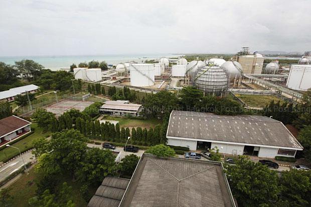

The general view of Map Ta Phut industrial area. (Bangkok Post file photo)
The government has decided to limit the industrial area in Map Ta Phut in Rayong province to 34,000 rai in a bid to secure confidence of existing investors wanting to expand production.
Pasu Loharjun, director-general of the Industrial Works Department, yesterday said the latest meeting between the Industry Ministry and the Interior Ministry’s Public Works and Town and Country Planning Department agreed on the figure, which would still allow room for expansion.
“Maintaining the area at 34,000 rai will instil confidence in investors,” he said after a meeting of the National Industrial Development Committee chaired by Deputy Prime Minister MR Pridiyathorn Devakula.
The committee last month endorsed an Industry Ministry proposal to reduce the present industrial area by 10,000 rai — less than a cut of 20,000 rai proposed by Map Ta Phut municipality.
Map Ta Phut earlier proposed a new city plan halving the industrial area from 40,000 rai and designating 9,475 rai surrounding it as a buffer zone between industries and the community.
Moreover, 15 square kilometres of sea offshore from Map Ta Phut Industrial Estate would be designated as a conservation area. Port construction will be allowed but land reclamation forbidden.
A strip of land about 50 metres wide extending from the boundary fence of the industrial zone would be designated as a protective strip.
The new plan covers Map Ta Phut, Ban Chang, Map Kha Pattana, Pla, Tap Ma and Nern Pra in Rayong. It also proposes that agencies relocate the villages of Huay Pong, Map Cha Lood and Nong Faep, which are now located near the industrial zone.
Industry Minister Chakramon Phasukavanich earlier said many town plans were still deemed obstacles to the country’s industrial development.
Source: http://www.bangkokpost.com/business/news/647240/map-ta-phut-plant-area-set