Why Bangkok has no city centre
Bangkok’s business district has moved four times in seventy years — river to Silom to Sathorn to Sukhumvit. It isn’t a place. It’s a moving average, and the transport network decides where it sits.
By Bangkok Lad at https://bangkoklad.com/
Bangkok’s centre has moved four times
Where the commercial core has been
No strict zoning, so development followed transport rather than a plan.
Chao Phraya river -> Silom &Surawong 1950s -> Sathorn &Wireless 1990s -> Early Sukhumvit post-1999
Ask where the centre of Bangkok is and you’ll get a different answer depending on who you ask and, more revealingly, when they arrived.
Someone who came in the 1980s says Silom. Someone who came in the 2000s says Sathorn or Ploenchit. Someone who arrived last year says Asok, or possibly Thonglor, and looks slightly puzzled by the question.
They’re all correct, which is the interesting bit.
Bangkok’s centre isn’t a place. It’s a moving average — and it has moved roughly every time the transport network has.
Where it’s been
Trace it and the pattern is unmistakable.
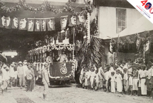
The river. Bangkok began as a river city. The palace, the port, the trade, the wealth — all on or near the Chao Phraya, because the river was the road and everything else was a canal.
Silom and Surawong, 1950s–60s. As modern office and retail formats arrived, the commercial district extended inland into Silom, Surawong and Si Phraya. This was Bangkok’s first recognisable Western-style CBD.
Worth pausing on what Sukhumvit was at this point: an undeveloped field. The address that now signifies central Bangkok to essentially every foreigner in the country was, within living memory, not really part of the city.
Sathorn and Wireless, 1990s. Grade A office development pushed outward from Silom into Sathorn and Wireless Road, while retail and five-star hotels clustered along Ploenchit and Rama I. The CBD didn’t relocate so much as smear.
Early Sukhumvit, post-1999. Then the Skytrain opened, and the field became the centre.
Today the CBD is usually described as three zones — Silom–Sathorn, Wireless–Lumpini, and Early Sukhumvit from Nana to Phrom Phong. Three zones is another way of saying no centre.
Why it kept moving
Two reasons, and the second is the one that explains everything.
One: Bangkok never had strict zoning.
Cities with a single dominant downtown usually have a planning authority that designated one and then enforced it — height limits, use restrictions, commercial zones separated from residential. Bangkok grew with nothing comparable in force.
The result is the thing every visitor notices: a luxury tower next to a tin-roofed workshop next to a five-star hotel next to a noodle stall. There’s no zoning error here. There was very little zoning.
Without a designated centre, the centre goes wherever it’s most convenient to build — and convenience is set by whatever moves people.
Two: transport decided, every time.
The river made the river the centre. Roads pulled it inland to Silom. The BTS pulled it out to Sukhumvit and created a business district in a place that had been a field within living memory.
This is why Bangkok’s mental map is the transit map. Ask someone here where they live and a large share answer with a station rather than a district — a habit that only forms in cities where the network arrived late enough that people remember life without it.
Bangkok before the Skytrain: the 31 years the city chose cars covered the transport history. This is the consequence: the BTS didn’t just move people around Bangkok. It moved Bangkok.
What this does to the city
Property values follow the rail, not the postcode. Distance from a station predicts rent better than distance from any notional centre — which is why a cheap-sounding district four stops out is genuinely cheap, and why the article on ฿30,000 a month turns entirely on that decision.
There’s no single rush hour direction. Polycentric cities have people commuting every way at once, which is part of why Bangkok’s traffic resists the usual fixes.
Neighbourhood identity is unusually strong. Where there’s no centre, districts develop distinct characters rather than existing as suburbs of somewhere more important. Ari, Thonglor, Silom and Chinatown feel like different cities because functionally they are.
And the centre is still moving. Extensions to the rail network keep creating new nodes. The current growth is outward along the lines, and the reasonable prediction is that “central Bangkok” in 2040 includes places currently considered inconveniently far.
If you want to know where Bangkok’s centre will be in fifteen years, don’t look at the property listings. Look at the transit construction map.
Common misconceptions
“Bangkok’s centre is Sukhumvit.” It’s where many foreigners cluster, which is not the same thing. Thai Bangkok’s commercial and administrative weight sits elsewhere, and Silom–Sathorn remains the most established business district.
“It’s badly planned.” It’s lightly planned, which produces different outcomes rather than simply worse ones — including cheap housing next to expensive housing, and food at every price point on every street. Most rigorously zoned cities have neither.
“The old centre died.” Silom didn’t decline; the city grew additional centres around it. Bangkok added rather than replaced.
“Downtown is where the tall buildings are.” Bangkok has tall buildings in a great many places, because there was no rule saying otherwise.
Final thoughts
The question “where is the centre of Bangkok” has no answer, and the absence is the answer.
This is a city that grew along a river, then along roads, then along rail, without a planning authority strong enough to insist it grow anywhere in particular. So it grew wherever movement was easiest, and the definition of easiest kept changing.
What you end up with is a city of several centres, none dominant, all still shifting, where the most reliable predictor of a district’s future is a transit map rather than a plan.
Which sounds chaotic and is actually rather elegant. Bangkok didn’t fail to build a centre. It built four, and it isn’t finished.
Common questions
Where is the centre of Bangkok?
There isn’t one. The CBD is usually described as three zones — Silom–Sathorn, Wireless–Lumpini and Early Sukhumvit — and has moved repeatedly over seventy years.
Where is Bangkok’s business district?
Silom–Sathorn is the most established, with Wireless–Lumpini and Early Sukhumvit forming the other two commercial concentrations.
Why doesn’t Bangkok have one downtown?
It grew without strict zoning, so commercial development followed transport instead of a plan — river, then roads, then rail.
Was Sukhumvit always central?
No. In the 1950s and 60s it was largely undeveloped. Its status as a central district is essentially a post-Skytrain phenomenon.
Where will Bangkok’s centre be next?
Wherever the rail network extends. New nodes have consistently formed around new stations.
Source: https://bangkoklad.com/bangkok-no-city-centre/
Google Translation:
ทำไมกรุงเทพฯ จึงไม่มีศูนย์กลางเมือง
ย่านธุรกิจของกรุงเทพฯ ย้ายไปมาแล้วสี่ครั้งในรอบเจ็ดสิบปี — จากริมแม่น้ำเจ้าพระยาไปสีลม ไปสาทร และไปสุขุมวิท มันไม่ใช่สถานที่ตายตัว มันเป็นเพียงค่าเฉลี่ยเคลื่อนที่ และเครือข่ายการคมนาคมขนส่งเป็นตัวกำหนดว่ามันตั้งอยู่ที่ไหน
โดย Bangkok Lad ที่ https://bangkoklad.com/
ศูนย์กลางของกรุงเทพฯ ย้ายไปมาแล้วสี่ครั้ง
ที่ตั้งของแกนกลางการค้า
ไม่มีการวางผังเมืองที่เข้มงวด ดังนั้นการพัฒนาจึงเป็นไปตามการคมนาคมขนส่งมากกว่าแผนผังเมือง
แม่น้ำเจ้าพระยา -> สีลมและสุรวงศ์ ทศวรรษ 1950 -> สาทรและวิทยุ ทศวรรษ 1990 -> สุขุมวิทตอนต้น หลังปี 1999
ถามว่าศูนย์กลางของกรุงเทพฯ อยู่ที่ไหน คุณจะได้คำตอบที่แตกต่างกันไปขึ้นอยู่กับว่าคุณถามใคร และที่สำคัญกว่านั้นคือ พวกเขามาถึงเมื่อไหร่
คนที่มาในทศวรรษ 1980 บอกว่าสีลม คนที่มาในทศวรรษ 2000 บอกว่าสาทรหรือเพลินจิต คนที่มาเมื่อปีที่แล้วบอกว่าอโศก หรืออาจจะเป็นทองหล่อ และดูงงเล็กน้อยกับคำถามนี้
พวกเขาพูดถูกทั้งหมด ซึ่งเป็นส่วนที่น่าสนใจ
ใจกลางกรุงเทพฯ ไม่ใช่สถานที่ แต่เป็นค่าเฉลี่ยเคลื่อนที่ และมันเคลื่อนที่ไปเกือบทุกครั้งที่เครือข่ายคมนาคมขนส่งเปลี่ยนแปลง
ที่ที่มันเคยอยู่
ลองติดตามดูแล้วจะเห็นรูปแบบที่ชัดเจน
แม่น้ำ กรุงเทพฯ เริ่มต้นจากการเป็นเมืองริมแม่น้ำ พระราชวัง ท่าเรือ การค้า ความมั่งคั่ง ทั้งหมดอยู่บนหรือใกล้แม่น้ำเจ้าพระยา เพราะแม่น้ำเป็นถนน และทุกอย่างอื่นเป็นคลอง
สีลมและสุรวงศ์ ช่วงปี 1950-1960 เมื่อรูปแบบสำนักงานและร้านค้าปลีกสมัยใหม่เข้ามา ย่านธุรกิจจึงขยายเข้าไปในแผ่นดินสู่สีลม สุรวงศ์ และศรีพระยา นี่คือย่านธุรกิจใจกลางเมืองสไตล์ตะวันตกแห่งแรกของกรุงเทพฯ ที่เป็นที่รู้จัก
ควรหยุดคิดสักครู่ว่าสุขุมวิทในเวลานั้นเป็นอย่างไร: เป็นพื้นที่ที่ยังไม่ได้รับการพัฒนา ที่อยู่ซึ่งปัจจุบันบ่งบอกถึงใจกลางกรุงเทพฯ สำหรับชาวต่างชาติแทบทุกคนในประเทศนั้น ในความทรงจำของคนรุ่นปัจจุบัน ไม่ได้เป็นส่วนหนึ่งของเมืองอย่างแท้จริง
สาทรและวิทยุ ช่วงปี 1990 การพัฒนาอาคารสำนักงานเกรดเอขยายตัวออกไปจากสีลมไปยังสาทรและถนนวิทยุ ในขณะที่ร้านค้าปลีกและโรงแรมห้าดาวกระจุกตัวอยู่ตามแนวถนนเพลินจิตและพระราม 1 ย่านศูนย์กลางธุรกิจไม่ได้ย้ายที่ตั้ง แต่กลับกระจายตัวออกไป
สุขุมวิทยุคแรก หลังปี 1999 จากนั้นรถไฟฟ้าเปิดให้บริการ และพื้นที่ว่างก็กลายเป็นศูนย์กลาง
ปัจจุบัน ย่านศูนย์กลางธุรกิจมักถูกอธิบายว่าเป็นสามโซน ได้แก่ สีลม-สาทร วิทยุ-ลุมพินี และสุขุมวิทตอนต้นจากนานาถึงพร้อมพงษ์ สามโซนเป็นอีกวิธีหนึ่งในการบอกว่าไม่มีศูนย์กลาง
ทำไมมันถึงเคลื่อนที่อยู่ตลอด
มีสองเหตุผล และเหตุผลที่สองคือเหตุผลที่อธิบายทุกอย่าง
หนึ่ง: กรุงเทพฯ ไม่เคยมีการวางผังเมืองที่เข้มงวด
เมืองที่มีใจกลางเมืองที่โดดเด่นเพียงแห่งเดียวมักจะมีหน่วยงานวางผังเมืองที่กำหนดและบังคับใช้ เช่น ข้อจำกัดด้านความสูง ข้อจำกัดด้านการใช้ประโยชน์ โซนการค้าแยกจากที่อยู่อาศัย กรุงเทพฯ เติบโตโดยไม่มีการบังคับใช้ที่เทียบเท่ากัน
ผลลัพธ์ก็คือสิ่งที่ผู้มาเยือนทุกคนสังเกตเห็น: ตึกสูงหรูหราอยู่ข้างๆ โรงงานหลังคาสังกะสี ข้างๆ โรงแรมห้าดาว ข้างๆ ร้านขายก๋วยเตี๋ยว ไม่มีข้อผิดพลาดเรื่องการแบ่งเขตพื้นที่ตรงนี้ การแบ่งเขตพื้นที่นั้นน้อยมาก
เมื่อไม่มีศูนย์กลางที่กำหนดไว้ ศูนย์กลางก็จะไปอยู่ที่ใดก็ตามที่สะดวกต่อการก่อสร้าง และความสะดวกสบายนั้นถูกกำหนดโดยสิ่งใดก็ตามที่เคลื่อนย้ายผู้คน
สอง: การขนส่งเป็นตัวกำหนดทุกครั้ง
แม่น้ำทำให้แม่น้ำกลายเป็นศูนย์กลาง ถนนดึงมันเข้ามาด้านในสู่สีลม รถไฟฟ้า BTS ดึงมันออกไปสู่สุขุมวิทและสร้างย่านธุรกิจในสถานที่ที่เคยเป็นทุ่งนาเมื่อนานมาแล้ว
นี่คือเหตุผลที่แผนที่ในใจของกรุงเทพฯ คือแผนที่การขนส่ง ถามใครสักคนที่นี่ว่าพวกเขาอาศัยอยู่ที่ไหน และส่วนใหญ่จะตอบด้วยชื่อสถานีมากกว่าชื่อเขต ซึ่งเป็นนิสัยที่เกิดขึ้นเฉพาะในเมืองที่เครือข่ายมาถึงช้าพอที่ผู้คนจะจำชีวิตก่อนมีรถไฟฟ้าได้
กรุงเทพฯ ก่อนรถไฟฟ้า: 31 ปีที่เมืองเลือกใช้รถยนต์ครอบคลุมประวัติศาสตร์การขนส่ง นี่คือผลที่ตามมา: รถไฟฟ้า BTS ไม่ได้แค่เคลื่อนย้ายผู้คนไปรอบๆ กรุงเทพฯ แต่มันเคลื่อนย้ายกรุงเทพฯ
สิ่งนี้ทำอะไรกับเมือง
มูลค่าทรัพย์สินจะตามเส้นทางรถไฟ ไม่ใช่รหัสไปรษณีย์ ระยะห่างจากสถานีรถไฟสามารถทำนายค่าเช่าได้ดีกว่าระยะห่างจากศูนย์กลางเมืองใดๆ ซึ่งเป็นเหตุผลว่าทำไมย่านที่ฟังดูราคาถูกแต่ห่างออกไปสี่สถานีจึงราคาถูกจริงๆ และทำไมบทความเกี่ยวกับค่าเช่า 30,000 บาทต่อเดือนจึงขึ้นอยู่กับการตัดสินใจนั้นทั้งหมด
ไม่มีทิศทางการจราจรติดขัดเพียงทิศทางเดียวในช่วงชั่วโมงเร่งด่วน เมืองที่มีศูนย์กลางหลายแห่งมีผู้คนเดินทางไปมาทุกทิศทางพร้อมกัน ซึ่งเป็นส่วนหนึ่งที่ทำให้การจราจรในกรุงเทพฯ ไม่สามารถแก้ไขได้ด้วยวิธีเดิมๆ
เอกลักษณ์ของย่านต่างๆ นั้นแข็งแกร่งเป็นพิเศษ ในที่ที่ไม่มีศูนย์กลาง ย่านต่างๆ จะพัฒนาเอกลักษณ์ที่แตกต่างกันออกไป แทนที่จะเป็นเพียงชานเมืองของสถานที่ที่สำคัญกว่า อารี ทองหล่อ สีลม และไชน่าทาวน์ ให้ความรู้สึกเหมือนเป็นเมืองที่แตกต่างกัน เพราะในเชิงการใช้งานแล้วพวกมันก็เป็นเช่นนั้น
และศูนย์กลางเมืองก็ยังคงเคลื่อนที่ การขยายเครือข่ายรถไฟยังคงสร้างจุดเชื่อมต่อใหม่ๆ อย่างต่อเนื่อง การเติบโตในปัจจุบันเป็นการขยายตัวออกไปตามแนวเส้นทางรถไฟ และการคาดการณ์ที่สมเหตุสมผลคือ “ใจกลางกรุงเทพฯ” ในปี 2040 จะรวมถึงสถานที่ที่ปัจจุบันถือว่าอยู่ไกลเกินไปจนไม่สะดวก
หากคุณต้องการทราบว่าใจกลางกรุงเทพฯ จะอยู่ที่ไหนในอีกสิบห้าปีข้างหน้า อย่าดูที่รายการอสังหาริมทรัพย์ ให้ดูที่แผนที่การก่อสร้างระบบขนส่งมวลชน
ความเข้าใจผิดทั่วไป
“ใจกลางเมืองกรุงเทพฯ คือสุขุมวิท” มันเป็นเพียงย่านที่ชาวต่างชาติจำนวนมากอาศัยอยู่ ซึ่งไม่ใช่สิ่งเดียวกัน ศูนย์กลางทางเศรษฐกิจและการบริหารของกรุงเทพฯ อยู่ที่อื่น และสีลม-สาทรยังคงเป็นย่านธุรกิจที่เก่าแก่ที่สุด
“การวางผังเมืองแย่” จริงๆ แล้วเป็นการวางผังเมืองแบบหลวมๆ ซึ่งทำให้เกิดผลลัพธ์ที่แตกต่างออกไป แทนที่จะแย่ลงอย่างเดียว เช่น บ้านราคาถูกอยู่ติดกับบ้านราคาแพง และร้านอาหารทุกระดับราคาในทุกถนน เมืองส่วนใหญ่ที่มีการวางผังเมืองอย่างเข้มงวดมักไม่มีสิ่งเหล่านี้
“ใจกลางเมืองเก่าตายไปแล้ว” สีลมไม่ได้เสื่อมถอยลง แต่เมืองได้สร้างศูนย์กลางอื่นๆ ขึ้นรอบๆ สีลม กรุงเทพฯ ได้เพิ่มสิ่งต่างๆ เข้าไปมากกว่าที่จะมาแทนที่
“ย่านดาวน์ทาวน์คือที่ที่มีตึกสูง” กรุงเทพฯ มีตึกสูงอยู่หลายแห่ง เพราะไม่มีกฎหมายห้ามไว้
ข้อคิดสุดท้าย
คำถามที่ว่า “ใจกลางเมืองกรุงเทพฯ อยู่ที่ไหน” ไม่มีคำตอบ และการไม่มีอยู่ของมันคือคำตอบ
นี่คือเมืองที่เติบโตไปตามแม่น้ำ จากนั้นไปตามถนน จากนั้นไปตามทางรถไฟ โดยไม่มีหน่วยงานวางผังเมืองที่เข้มแข็งพอที่จะบังคับให้เมืองเติบโตไปที่ใดที่หนึ่งโดยเฉพาะ ดังนั้นเมืองจึงเติบโตไปในที่ที่การเคลื่อนย้ายสะดวกที่สุด และนิยามของคำว่า “สะดวกที่สุด” ก็เปลี่ยนแปลงไปเรื่อยๆ
ผลที่ได้คือเมืองที่มีศูนย์กลางหลายแห่ง ไม่มีแห่งใดโดดเด่น ทุกแห่งยังคงเปลี่ยนแปลงอยู่ตลอดเวลา โดยที่ตัวบ่งชี้ที่น่าเชื่อถือที่สุดเกี่ยวกับอนาคตของเขตต่างๆ คือแผนที่การขนส่งมากกว่าแผนผังเมือง
ซึ่งฟังดูวุ่นวาย แต่จริงๆ แล้วค่อนข้างสง่างาม กรุงเทพฯ ไม่ได้ล้มเหลวในการสร้างศูนย์กลาง แต่สร้างถึงสี่แห่ง และยังไม่เสร็จสมบูรณ์
คำถามทั่วไป
ศูนย์กลางของกรุงเทพฯ อยู่ที่ไหน?
ไม่มีศูนย์กลางเดียว ย่านธุรกิจใจกลางเมืองมักถูกอธิบายว่าเป็นสามโซน ได้แก่ สีลม-สาทร วิทยุ-ลุมพินี และสุขุมวิทตอนต้น และมีการเปลี่ยนแปลงซ้ำแล้วซ้ำเล่าตลอดเจ็ดสิบปีที่ผ่านมา
ย่านธุรกิจของกรุงเทพฯ อยู่ที่ไหน?
สีลม-สาทรเป็นโซนที่พัฒนามากที่สุด โดยมีวิทยุ-ลุมพินีและสุขุมวิทตอนต้นเป็นอีกสองย่านธุรกิจที่สำคัญ
ทำไมกรุงเทพฯ จึงไม่มีใจกลางเมืองเพียงแห่งเดียว?
เมืองเติบโตโดยไม่มีการวางผังเมืองที่เข้มงวด ดังนั้นการพัฒนาเชิงพาณิชย์จึงเป็นไปตามการขนส่งแทนที่จะเป็นแผนผังเมือง คือ แม่น้ำ ถนน และทางรถไฟ
สุขุมวิทเคยเป็นศูนย์กลางเสมอมาหรือไม่?
ไม่ ในช่วงทศวรรษ 1950 และ 1960 พื้นที่นี้ยังไม่ได้รับการพัฒนามากนัก สถานะของมันในฐานะย่านใจกลางเมืองนั้นเป็นปรากฏการณ์ที่เกิดขึ้นหลังจากการสร้างรถไฟฟ้าบีทีเอสเป็นหลัก
ศูนย์กลางของกรุงเทพฯ ต่อไปจะเป็นอย่างไร?
ไม่ว่าเครือข่ายรถไฟจะขยายไปที่ไหนก็ตาม ศูนย์กลางใหม่ๆ ได้ก่อตัวขึ้นอย่างต่อเนื่องรอบๆ สถานีใหม่ๆ