
 Driving East from Bangkok? Beware the Bang Pakong Roadworks
Where Can Drivers Find Reliable Traffic Information in Thailand?
Last week, following the 12 August national holiday, I travelled down to the seaside town of Sri Racha with my family for a short holiday. The drive should have been straightforward. Instead, it became a reminder of how bad traffic in Thailand can be, and how difficult it is to obtain reliable information about major roadworks in Thailand before setting off.
From my home in Samut Prakan, there are three main routes when travelling to the provinces east of Bangkok. The first is the Bangkok–Ban Chang Motorway (Route 7); the road with the motorway services. The second is the ground-level section of Bang Na–Trat Road (Highway 34), while the third is the elevated highway running above it.
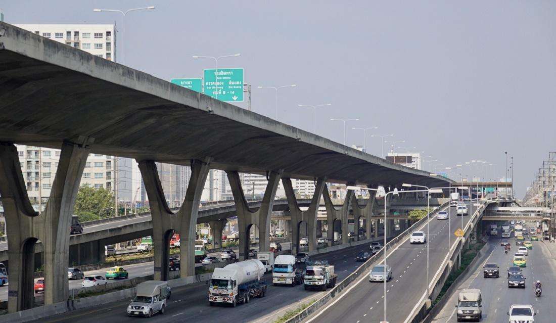
I chose the third option, the elevated highway route. As we approached Bang Pakong, however, electronic signs began warning of severe congestion ahead. At the same time, Google Maps suggested leaving the elevated highway and dropping down to ground level before reaching the toll plaza and the end of the elevated highway.
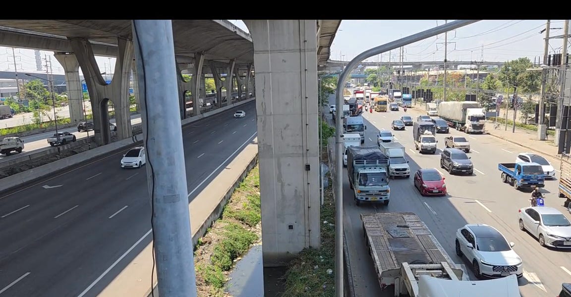
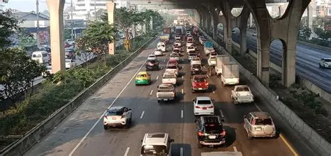
Following Google’s advice, I exited near Bang Pakong Hospital and immediately discovered the reason. I could see above me traffic on the elevated road was backed up for kilometres as vehicles queued for the toll booths and the descent to ground level. Unfortunately, the frontage road at ground level was only slightly better. For almost six kilometres, traffic crawled along at a snail’s pace before finally reaching the point where the route splits towards either Chonburi or the Chonburi Bypass and then the traffic returned back to normal.
The cause of all of this built-up traffic was extensive resurfacing work on the Chonburi-bound side of the road, starting from around the Bang Pakong Hospital to the Bang Pakong Bridge, and extending towards the EGAT Bang Pakong Power Plant entrance.
If you happen to be on the elevated road, then drop down at exit 4-01 just before Bang Pakong hospital and stay on the frontage road as this is the quicker traffic currently.
Had I known before leaving home about these roadworks, I would simply have chosen Route 7 and avoided the delays altogether.
On the return journey home two days later on the Saturday afternoon, the scale of the disruption became even clearer. Travelling westbound towards Bangkok, there are no traffic issues, but I could look across at the eastbound traffic and see long queues stretching across both the elevated and ground-level roads. The congestion appeared to be affecting thousands of motorists.
The experience left me wondering why it is still so difficult to find advance information about major roadworks in Thailand.
Where Can Drivers Find Reliable Traffic Information in Thailand?
For years I have wondered whether Thailand has a single, easy-to-use source providing advance notice of roadworks, accidents, lane closures and other events likely to affect journeys and I simply didn’t know about it.
After returning home, I decided to investigate. A quick search revealed that such information does exist, but isn’t very useful, and is spread across a number of different agencies and platforms rather than being available through one central service.
Here’s what AI informed:
Thailand apparently has several useful sources, although they are not as well known or as centralized.
For Bangkok (best source for roadworks, closures and incidents)
The Bangkok Metropolitan Administration (BMA) operates a real-time traffic system called BMA Traffic. It shows:
- Roadworks and construction sites
- Road closures
- Lane closures
- Accidents
- Vehicle breakdowns
- Flooding and rain-related incidents
- CCTV traffic cameras
- Traffic congestion levels on major roads
You can access it here:
The system specifically includes event layers for “road repairs”, “road closures”, “construction works” and other traffic incidents.
Bangkok Traffic Department
The Bangkok Traffic and Transportation Department also publishes traffic information, statistics and links to real-time monitoring services:
Bangkok Traffic and Transportation Department
Traffic Police
For current incidents, accidents and emergency traffic problems:
- Traffic Police Hotline: 1197
- Emergency: 191
The Traffic Police also report incidents through social media and radio networks.
Expressways and Motorways
For expressways around Bangkok:
This provides expressway traffic conditions and traffic updates.
For highways and motorways throughout Thailand:
Department of Highways Traffic Information
The Department of Highways also provides traffic-monitoring apps with CCTV feeds, traffic incidents and motorway conditions.
What most Bangkok residents actually use
In practice, many Bangkok drivers rely on:
These often provide quicker warnings of accidents, lane closures and congestion than the official sources because they combine GPS data from thousands of users.
For someone living in Bangkok, I would suggest:
- Google Maps or Waze for day-to-day driving.
- BMA Traffic when you want to know why traffic is bad (roadworks, closures, construction, flooding, etc.).
- EXAT if your route regularly uses the Bang Na Expressway, Burapha Withi, Chalerm Maha Nakhon Expressway or other Bangkok expressways.
Summary
My experience at Bang Pakong demonstrated that major traffic disruptions can still catch motorists by surprise, even in an era of smartphones, GPS navigation and real-time mapping.
Some information is available, but it isn’t so good. The Bangkok Metropolitan Administration, the Department of Highways and the Expressway Authority all provide some traffic updates, while Google Maps and Waze remain the tools most drivers rely upon for real-time navigation.
The challenge is that these sources are fragmented, not always widely publicised and, in some cases, difficult to find—particularly for English-speaking residents and visitors.
Until Thailand develops a more centralised and user-friendly traffic information service, motorists will probably continue to depend on a combination of Google Maps, Waze and a little local knowledge. Nevertheless, knowing that these official resources exist may help readers avoid the sort of frustrating delay that turned my simple holiday journey into an unexpected lesson in Thailand’s traffic information system.
In summary,
- Travelling in Bangkok and around Thailand continues to be hit-and-miss in the 2020s even with all the modern technology available.
- basically Google Maps is your best bet, particularly for those using English-language.
If anyone is more knowledgeable, knows where there is decent information to be had (in Thai or English language) and can offer that advice, do let us know please, we’ll all be very grateful to you.
Google Translation:
ขับรถจากกรุงเทพฯ ไปทางตะวันออก? ระวังงานก่อสร้างถนนบางปะกง!
ผู้ขับขี่สามารถหาข้อมูลการจราจรที่น่าเชื่อถือในประเทศไทยได้จากที่ไหน?
สัปดาห์ที่แล้ว หลังวันหยุดยาว 12 สิงหาคม ผมและครอบครัวเดินทางไปพักผ่อนที่เมืองชายทะเลศรีราชา การเดินทางควรจะราบรื่น แต่กลับกลายเป็นเครื่องเตือนใจว่าการจราจรในประเทศไทยนั้นติดขัดมากแค่ไหน และการหาข้อมูลที่น่าเชื่อถือเกี่ยวกับงานก่อสร้างถนนสายหลักในประเทศไทยก่อนออกเดินทางนั้นยากลำบากเพียงใด
จากบ้านของผมในสมุทรปราการ มีเส้นทางหลักสามเส้นทางเมื่อเดินทางไปยังจังหวัดทางตะวันออกของกรุงเทพฯ เส้นทางแรกคือมอเตอร์เวย์กรุงเทพฯ-บ้านช้าง (ทางหลวงหมายเลข 7) ซึ่งเป็นถนนที่มีสถานีบริการมอเตอร์เวย์ เส้นทางที่สองคือถนนบางนา-ตราด (ทางหลวงหมายเลข 34) ซึ่งเป็นถนนระดับพื้นดิน และเส้นทางที่สามคือทางด่วนยกระดับ
ผมเลือกเส้นทางที่สาม คือทางด่วนยกระดับ อย่างไรก็ตาม เมื่อเราใกล้ถึงบางปะกง ป้ายอิเล็กทรอนิกส์เริ่มเตือนถึงการจราจรติดขัดอย่างรุนแรงข้างหน้า ในขณะเดียวกัน Google Maps แนะนำให้ลงจากทางด่วนและลงไปที่พื้นดินก่อนถึงด่านเก็บค่าผ่านทางและปลายทางด่วน
ผมทำตามคำแนะนำของ Google โดยลงจากทางด่วนใกล้โรงพยาบาลบางปะกง และก็พบสาเหตุทันที ผมมองเห็นการจราจรบนทางด่วนติดขัดเป็นระยะทางหลายกิโลเมตร เนื่องจากรถยนต์ต่อแถวรอผ่านด่านเก็บค่าผ่านทางและลงไปยังพื้นดิน น่าเสียดายที่ถนนด้านข้างทางด่วนที่พื้นดินก็ดีขึ้นเพียงเล็กน้อย การจราจรเคลื่อนตัวช้ามากเกือบหกกิโลเมตรก่อนจะถึงจุดที่ทางแยกไปชลบุรีหรือทางเลี่ยงเมืองชลบุรี จากนั้นการจราจรก็กลับสู่ภาวะปกติ
สาเหตุของการจราจรติดขัดทั้งหมดนี้เกิดจากงานซ่อมแซมผิวถนนครั้งใหญ่ทางฝั่งที่มุ่งหน้าไปชลบุรี เริ่มจากบริเวณโรงพยาบาลบางปะกงไปจนถึงสะพานบางปะกง และขยายไปจนถึงทางเข้าโรงไฟฟ้าบางปะกง การไฟฟ้าฝ่ายผลิต
ถ้าคุณอยู่บนทางยกระดับ ให้ลงที่ทางออก 4-01 ก่อนถึงโรงพยาบาลบางปะกง แล้วใช้ถนนด้านข้าง เพราะตอนนี้การจราจรบนถนนเส้นนี้จะเร็วกว่า
ถ้าฉันรู้เรื่องการก่อสร้างถนนก่อนออกจากบ้าน ฉันคงเลือกใช้เส้นทาง 7 และหลีกเลี่ยงการจราจรติดขัดไปเลย
ในการเดินทางกลับบ้านสองวันต่อมาในบ่ายวันเสาร์ ความรุนแรงของการจราจรติดขัดยิ่งชัดเจนขึ้น การเดินทางไปทางทิศตะวันตกมุ่งหน้าสู่กรุงเทพฯ ไม่มีปัญหาการจราจร แต่ฉันมองไปที่การจราจรทางทิศตะวันออกและเห็นรถติดยาวเหยียดทั้งบนทางยกระดับและทางพื้นดิน การจราจรติดขัดดูเหมือนจะส่งผลกระทบต่อผู้ขับขี่หลายพันคน
ประสบการณ์นี้ทำให้ฉันสงสัยว่าทำไมการหาข้อมูลล่วงหน้าเกี่ยวกับการก่อสร้างถนนครั้งใหญ่ในประเทศไทยจึงยังยากอยู่
ผู้ขับขี่สามารถหาข้อมูลการจราจรที่น่าเชื่อถือในประเทศไทยได้จากที่ไหน?
เป็นเวลาหลายปีที่ฉันสงสัยว่าประเทศไทยมีแหล่งข้อมูลเดียวที่ใช้งานง่ายซึ่งให้ข้อมูลล่วงหน้าเกี่ยวกับการก่อสร้างถนน อุบัติเหตุ การปิดช่องทางจราจร และเหตุการณ์อื่นๆ ที่อาจส่งผลกระทบต่อการเดินทางหรือไม่ และฉันก็ไม่รู้เรื่องนี้มาก่อน
หลังจากกลับบ้าน ฉันจึงตัดสินใจค้นหาข้อมูล การค้นหาอย่างรวดเร็วพบว่าข้อมูลดังกล่าวมีอยู่จริง แต่ไม่ค่อยมีประโยชน์ และกระจัดกระจายอยู่ตามหน่วยงานและแพลตฟอร์มต่างๆ แทนที่จะมีให้บริการผ่านบริการส่วนกลางเพียงแห่งเดียว
นี่คือสิ่งที่ AI แจ้งให้ทราบ:
ดูเหมือนว่าประเทศไทยจะมีแหล่งข้อมูลที่มีประโยชน์หลายแหล่ง แม้ว่าจะไม่เป็นที่รู้จักหรือรวมศูนย์ไว้ด้วยกันก็ตาม
สำหรับกรุงเทพฯ (แหล่งข้อมูลที่ดีที่สุดสำหรับการก่อสร้างถนน การปิดช่องทางจราจร และเหตุการณ์ต่างๆ)
กรุงเทพมหานคร (BMA) ดำเนินการระบบจราจรแบบเรียลไทม์ที่เรียกว่า BMA Traffic แผนที่แสดงข้อมูล:
งานก่อสร้างและซ่อมแซมถนน
การปิดถนน
การปิดช่องจราจร
อุบัติเหตุ
รถเสีย
เหตุการณ์น้ำท่วมและเหตุการณ์ที่เกี่ยวข้องกับฝน
กล้องวงจรปิดจราจร
ระดับความแออัดของการจราจรบนถนนสายหลัก
คุณสามารถเข้าถึงได้ที่นี่:
แผนที่จราจรแบบเรียลไทม์ของกรุงเทพมหานคร
ระบบนี้มีเลเยอร์เหตุการณ์เฉพาะสำหรับ “การซ่อมแซมถนน”, “การปิดถนน”, “งานก่อสร้าง” และเหตุการณ์จราจรอื่นๆ
กรมการขนส่งกรุงเทพมหานคร
กรมการขนส่งกรุงเทพมหานครยังเผยแพร่ข้อมูลจราจร สถิติ และลิงก์ไปยังบริการตรวจสอบแบบเรียลไทม์:
กรมการขนส่งกรุงเทพมหานคร
ตำรวจจราจร
สำหรับเหตุการณ์ปัจจุบัน อุบัติเหตุ และปัญหาจราจรฉุกเฉิน:
สายด่วนตำรวจจราจร: 1197
ฉุกเฉิน: 191
ตำรวจจราจรยังรายงานเหตุการณ์ผ่านเครือข่ายโซเชียลมีเดียและวิทยุ
ทางด่วนและมอเตอร์เวย์
สำหรับทางด่วนรอบกรุงเทพฯ:
สำหรับทางด่วนรอบกรุงเทพฯ:
แอปพลิเคชัน EXAT Portal
แอปพลิเคชันนี้ให้ข้อมูลสภาพการจราจรและการอัปเดตสภาพการจราจรบนทางด่วน
สำหรับทางหลวงและมอเตอร์เวย์ทั่วประเทศไทย:
ข้อมูลการจราจรกรมทางหลวง
กรมทางหลวงยังมีแอปพลิเคชันตรวจสอบการจราจรพร้อมภาพจากกล้องวงจรปิด เหตุการณ์จราจร และสภาพมอเตอร์เวย์
สิ่งที่ชาวกรุงเทพฯ ส่วนใหญ่ใช้จริง
ในทางปฏิบัติ ผู้ขับขี่ในกรุงเทพฯ หลายคนใช้:
Google Maps
Waze
แอปพลิเคชันเหล่านี้มักให้คำเตือนเกี่ยวกับอุบัติเหตุ การปิดเลน และการจราจรติดขัดได้เร็วกว่าแหล่งข้อมูลอย่างเป็นทางการ เนื่องจากรวมข้อมูล GPS จากผู้ใช้หลายพันคน
สำหรับคนที่อาศัยอยู่ในกรุงเทพฯ ผมขอแนะนำ:
Google Maps หรือ Waze สำหรับการขับขี่ในชีวิตประจำวัน
BMA Traffic เมื่อคุณต้องการทราบว่าทำไมการจราจรถึงติดขัด (งานก่อสร้าง การปิดถนน น้ำท่วม ฯลฯ)
EXAT หากเส้นทางของคุณใช้ทางด่วนบางนา ทางด่วนบูรพาวิถี ทางด่วนเฉลิมมหานคร หรือทางด่วนอื่นๆ ในกรุงเทพฯ เป็นประจำ
สรุป
ประสบการณ์ของผมที่บางปะกงแสดงให้เห็นว่า การจราจรติดขัดอย่างหนักยังคงทำให้ผู้ขับขี่รถยนต์ตกใจได้ แม้ในยุคของสมาร์ทโฟน ระบบนำทาง GPS และแผนที่แบบเรียลไทม์ก็ตาม
ข้อมูลบางส่วนมีให้ แต่ก็ไม่ดีเท่าที่ควร กรุงเทพมหานคร กรมทางหลวง และการทางด่วน ต่างก็ให้ข้อมูลการจราจรบ้าง ในขณะที่ Google Maps และ Waze ยังคงเป็นเครื่องมือที่ผู้ขับขี่ส่วนใหญ่ใช้สำหรับการนำทางแบบเรียลไทม์
ความท้าทายคือ แหล่งข้อมูลเหล่านี้กระจัดกระจาย ไม่ได้เผยแพร่อย่างกว้างขวางเสมอไป และในบางกรณีก็หาได้ยาก โดยเฉพาะอย่างยิ่งสำหรับผู้พักอาศัยและนักท่องเที่ยวที่พูดภาษาอังกฤษ
จนกว่าประเทศไทยจะพัฒนาระบบข้อมูลการจราจรที่เป็นศูนย์กลางและใช้งานง่ายกว่านี้ ผู้ขับขี่รถยนต์อาจยังคงต้องพึ่งพา Google Maps, Waze และความรู้ในท้องถิ่นเล็กน้อยต่อไป อย่างไรก็ตาม การรู้ว่ามีแหล่งข้อมูลอย่างเป็นทางการเหล่านี้อยู่ อาจช่วยให้ผู้อ่านหลีกเลี่ยงความล่าช้าที่น่าหงุดหงิดซึ่งเปลี่ยนการเดินทางท่องเที่ยวธรรมดาๆ ของผมให้กลายเป็นบทเรียนที่ไม่คาดคิดเกี่ยวกับระบบข้อมูลการจราจรของประเทศไทยได้
โดยสรุปแล้ว
การเดินทางในกรุงเทพฯ และทั่วประเทศไทยในช่วงปี 2020 ยังคงเป็นเรื่องที่คาดเดาได้ยาก แม้จะมีเทคโนโลยีทันสมัยมากมายก็ตาม
โดยพื้นฐานแล้ว Google Maps คือตัวเลือกที่ดีที่สุด โดยเฉพาะอย่างยิ่งสำหรับผู้ที่ใช้ภาษาอังกฤษ
หากใครมีความรู้มากกว่านี้ รู้ว่ามีแหล่งข้อมูลที่ดี (ทั้งภาษาไทยหรือภาษาอังกฤษ) และสามารถให้คำแนะนำได้ โปรดแจ้งให้เราทราบด้วย เราจะขอบคุณเป็นอย่างยิ่ง
.JPG)